Skip to content
Plan & Tour
DestinationsItinerariesTravel BlogAboutContact
0Sign inPlan a trip
Plan & TourPlan & Tour

Travel guides, destination inspiration and curated itineraries for Canada, the USA and beyond, plus a free tool to plan your own day-by-day trip.

Get travel inspiration

Explore

  • All Destinations
  • Curated Itineraries
  • Travel Blog
  • Plan a Trip

Topics

  • Hiking & Nature
  • Food & Drink
  • City Breaks
  • Budget Travel

Company

  • About Us
  • Contact
  • Privacy Policy
  • Terms of Service

© 2026 Plan & Tour. Built for travellers.

Discover the world, one trip at a time.

The Geeste River: Scenic Walks and Nature Escapes in Bremen
  1. Home
  2. Destinations
  3. Bremen
  4. The Geeste River: Scenic Walks and Nature Escapes in Bremen
River

The Geeste River: Scenic Walks and Nature Escapes in Bremen

Follow the gentle Geeste through Bremen's green corridors for peaceful riverside trails and easy access to the Weser estuary.

BremenUpdated 14 October 2026

Discovering the Geeste River

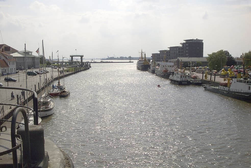
The Geeste River rises in Lower Saxony and flows into the Weser near Bremerhaven, carving a quiet corridor of meadows, reeds and small woodlands that contrasts with Bremen’s urban core. Its banks remain largely undeveloped, offering visitors a linear green space ideal for walking and cycling without crowds.

What to See and Do

Follow the well-marked riverside paths that run from the mouth of the Geeste upstream toward the village of Geestemünde. Birdwatchers often spot herons, kingfishers and migratory waterfowl in the reed beds. Photographers appreciate the soft light reflecting off the water at dawn and the occasional historic sluice gates that hint at the river’s role in regional drainage. Cyclists can combine a Geeste ride with the Weser Cycle Path for a longer loop back into central Bremen.

Practical Routes

  • Start at the confluence with the Weser and walk or cycle 8 km upstream to the first lock.
  • Connect via local paths to the Luneplate nature reserve for extended wetland exploration.
  • Look for interpretive signs explaining the river’s importance to flood control and local agriculture.

Getting There

Bremen Hauptbahnhof lies roughly 60 km south of the lower Geeste; regional trains reach Bremerhaven in under an hour, followed by a short bus or bike ride to the riverbank. Cyclists from central Bremen can follow the Weser downstream on dedicated paths that link directly to the Geeste trailhead. Drivers find free parking at several small lots near the estuary.

Best Time to Visit

Late spring through early autumn brings the mildest weather and longest daylight for outdoor activity. Migratory birds peak in April–May and September–October, while summer offers calm water for quiet paddling where permitted. Winter visits reward those seeking solitude, though paths may be muddy after rain.

Nearby Attractions

Combine a Geeste outing with a visit to Bremerhaven’s harbor museums or the historic Schnoor quarter in Bremen. The river also serves as a gateway to the Wadden Sea World Heritage coastline, reachable by short ferry hops from nearby ports.

Visitor tips

  • Wear sturdy shoes; riverside paths can be soft after rain even in summer.
  • Carry water and snacksu2014facilities are sparse along the lower reaches.
  • Check tide tables if planning to walk near the estuary mouth, as mudflats can appear quickly.
  • Bring binoculars for birdwatching and a small backpack for litter; there are few bins along the trail.

Frequently asked questions

Is the Geeste suitable for swimming?+

The river is generally too shallow and cool for comfortable swimming; most visitors enjoy it from the banks or by kayak.

Are dogs allowed on the trails?+

Dogs are welcome but must remain on a leash in protected sections to avoid disturbing nesting birds.

Can I rent bikes near the Geeste?+

Bike rentals are available in Bremerhaven and central Bremen; several operators offer one-way options along the Weser-Geeste route.

How long does a typical visit take?+

A relaxed out-and-back walk from the Weser confluence covers 10u201312 km and takes three to four hours including stops.

Is the path accessible for wheelchairs or strollers?+

The first few kilometers from the estuary are paved and relatively flat; further upstream the surface becomes gravel and may be uneven.

Share
Google Maps Apple Maps Directions

Image: Uwe H. Friese (Vulkan) · CC BY-SA 3.0 · via Wikimedia Commons

Keep reading

Nearby & related

All stories
Krietes Wald (Im Holze): A Protected Forest Sanctuary Near Bremen
Osterholz

Krietes Wald (Im Holze): A Protected Forest Sanctuary Near Bremen

This quiet woodland reserve in Osterholz offers peaceful trails through ancient trees and habitats for native wildlife…

15 October 2026
Hochwasserschutzpolder zwischen Senator-Apelt-Straße und Neustädter Hafen: A Quiet Nature Retreat in Bremen’s Port District
Häfen

Hochwasserschutzpolder zwischen Senator-Apelt-Straße und Neustädter Hafen: A Quiet Nature Retreat in Bremen’s Port District

This protected flood-control polder offers peaceful walking paths, harbor views, and wildlife habitat right in the heart…

15 October 2026
Vogelschutzgehölz Sodenmatt: A Quiet Bird Sanctuary in Bremen’s Huchting District
Huchting

Vogelschutzgehölz Sodenmatt: A Quiet Bird Sanctuary in Bremen’s Huchting District

This protected woodland in western Bremen offers excellent birdwatching and gentle walks amid native trees and wetlands.

15 October 2026