Skip to content
Plan & Tour
DestinationsItinerariesTravel BlogAboutContact
0Sign inPlan a trip
Plan & TourPlan & Tour

Travel guides, destination inspiration and curated itineraries for Canada, the USA and beyond, plus a free tool to plan your own day-by-day trip.

Get travel inspiration

Explore

  • All Destinations
  • Curated Itineraries
  • Travel Blog
  • Plan a Trip

Topics

  • Hiking & Nature
  • Food & Drink
  • City Breaks
  • Budget Travel

Company

  • About Us
  • Contact
  • Privacy Policy
  • Terms of Service

© 2026 Plan & Tour. Built for travellers.

Discover the world, one trip at a time.

Savary Island: Pristine Beaches and Quiet Trails on British Columbia’s Sunshine Coast
  1. Home
  2. Destinations
  3. British Columbia
  4. Savary Island: Pristine Beaches and Quiet Trails on British Columbia’s Sunshine Coast
Island

Savary Island: Pristine Beaches and Quiet Trails on British Columbia’s Sunshine Coast

Savary Island offers long sandy shores, clear shallow waters, and a car-free atmosphere that rewards slow exploration.

British ColumbiaUpdated 1 August 2026

Why Savary Island Draws Visitors

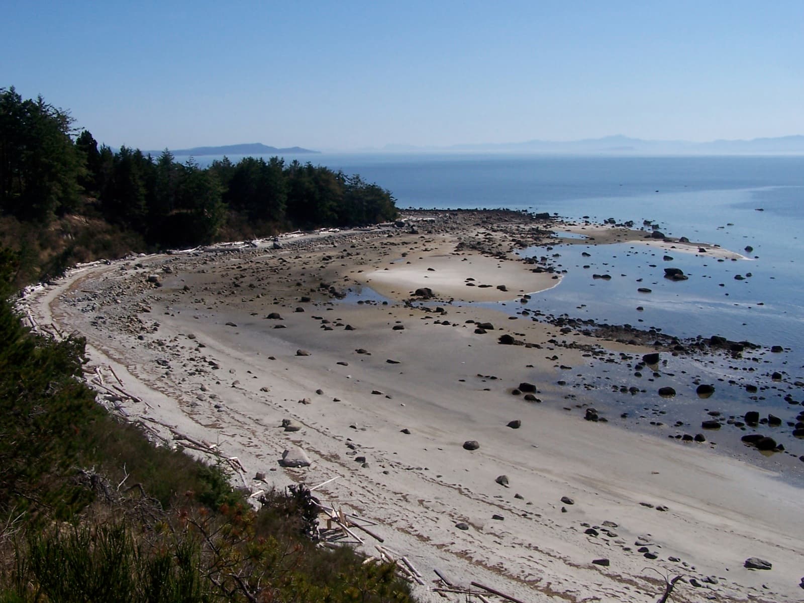
Savary Island sits in the Strait of Georgia, a narrow crescent of land known for one of the longest continuous sand beaches on Canada’s Pacific coast. The island’s south-facing shoreline warms quickly in summer, creating swimming conditions rare in British Columbia. Behind the beach, low dunes give way to mixed forest and open meadows where deer graze at dawn. The absence of cars keeps noise low and the pace relaxed, so visitors move by foot, bicycle, or water taxi along the shoreline.

Getting There

Most travelers reach Savary from Lund on the mainland. Passenger ferries and water taxis depart from the government dock; the crossing takes roughly twenty minutes. Once on the island, a single gravel road runs its length, but the majority of movement happens along the hard-packed sand at low tide. Those arriving by kayak or small boat can launch from Desolation Sound and paddle across the short channel, stopping at the protected cove on the north shore.

Practical Arrival Notes

  • Pack light: supplies are limited and everything must be carried from the dock.
  • Check tide tables before walking the full beach length; sections become impassable at high water.
  • Bring cash for water-taxi fares and any small vendors near the main landing.

Things to Do

Swimming and beachcombing occupy most days. At low tide, shallow pools reveal sea stars, crabs, and occasional sand dollars. The western tip offers a short loop trail through second-growth forest that ends at a viewpoint overlooking the Copeland Islands. Kayakers launch from the south beach to explore nearby islets or paddle into Desolation Sound Marine Park. Birders watch for oystercatchers and bald eagles along the shoreline. In the evening, the open sky above the meadows provides clear stargazing once lights are dimmed.

Best Time to Visit

July and August bring the warmest water and longest daylight. Spring and early fall offer fewer visitors and mild temperatures, though rain is more frequent. Winter visits are possible for hardy travelers, but ferry service is reduced and many seasonal businesses close.

Nearby Attractions

From Savary, day trips easily reach Desolation Sound for deeper kayaking routes and Malaspina Inlet’s waterfalls. Powell River’s historic townsite lies a short drive south of Lund, offering galleries and a working harbor. The nearby Sunshine Coast Trail provides longer hikes through coastal rainforest if visitors want to extend their stay on the mainland.

Visitor tips

  • Carry all food, water, and waste out; there are no public garbage facilities on the island.
  • Respect private propertyu2014much of the island is residential and only the beach below the high-tide line is public.
  • Book water-taxi return times in advance during peak summer weekends, as capacity is limited.

Frequently asked questions

How do I get to Savary Island from Vancouver?+

Drive or bus to Lund via Highway 101, then take a passenger ferry or water taxi across the short strait; total travel time from Vancouver is four to five hours.

Is Savary Island car-free?+

Yes. Private vehicles are not permitted on the island; visitors walk, cycle, or use water taxis to move around.

Can I camp on Savary Island?+

Camping is allowed only on designated private or leased sites; there is no public campground. Many visitors stay in cabins or return to the mainland each night.

What should I bring for a day trip?+

Bring plenty of water, food, sunscreen, a tide table, and layers for changing weather. Insect repellent is useful in forested areas.

Are there restaurants or stores on the island?+

Options are very limited. A small seasonal cafu00e9 operates near the main dock; otherwise, bring everything needed for the day.

Share
Google Maps Apple Maps Directions

Image: (WT-shared) Shaund · CC BY-SA 4.0 · via Wikimedia Commons

Keep reading

Nearby & related

All stories
Vedder River: Salmon Fishing, Paddling and Riverside Trails in British Columbia
British Columbia

Vedder River: Salmon Fishing, Paddling and Riverside Trails in British Columbia

A clear, productive river in the Fraser Valley offering consistent chinook and coho runs, easy paddling and quiet hiking…

1 August 2026
E
British Columbia

Englishman River: Waterfalls, Forests and Salmon Runs on Vancouver Island

Hike to dramatic waterfalls, swim in clear pools, and watch salmon spawn along this Vancouver Island river.

1 August 2026
B
British Columbia

Bella Coola River: Wilderness Fishing and Grizzly Viewing in British Columbia’s Great Bear Rainforest

This remote river in the Bella Coola Valley offers world-class steelhead and salmon fishing, abundant wildlife, and…

1 August 2026


