Skip to content
Plan & Tour
DestinationsItinerariesTravel BlogAboutContact
0Sign inPlan a trip
Plan & TourPlan & Tour

Travel guides, destination inspiration and curated itineraries for Canada, the USA and beyond, plus a free tool to plan your own day-by-day trip.

Get travel inspiration

Explore

  • All Destinations
  • Curated Itineraries
  • Travel Blog
  • Plan a Trip

Topics

  • Hiking & Nature
  • Food & Drink
  • City Breaks
  • Budget Travel

Company

  • About Us
  • Contact
  • Privacy Policy
  • Terms of Service

© 2026 Plan & Tour. Built for travellers.

Discover the world, one trip at a time.

Roques de Anaga: Tenerife’s Dramatic Volcanic Sea Stacks
  1. Home
  2. Destinations
  3. Santa Cruz de Tenerife Province
  4. Roques de Anaga: Tenerife’s Dramatic Volcanic Sea Stacks
Protected area

Roques de Anaga: Tenerife’s Dramatic Volcanic Sea Stacks

Hike Tenerife’s protected Anaga coastline to reach these striking basalt formations and sweeping Atlantic views.

Santa Cruz de Tenerife ProvinceUpdated 12 November 2026

Why Roques de Anaga Stands Out

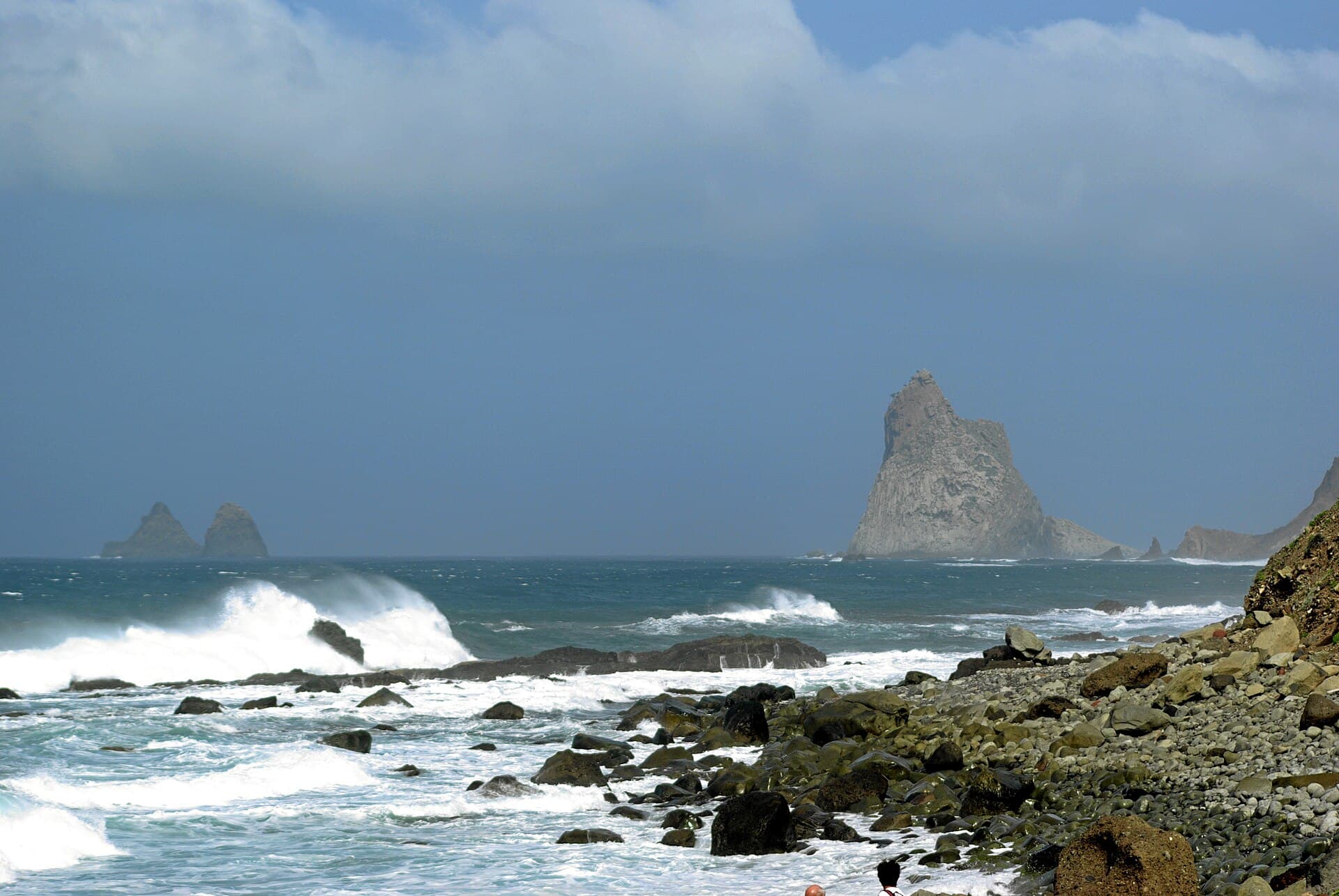
Roques de Anaga rise sharply from the Atlantic as dark, weathered basalt towers on Tenerife’s northeastern shore. Part of the larger Anaga Rural Park, this protected area preserves ancient volcanic rock shaped by erosion into dramatic sea stacks and cliffs. The site rewards visitors with raw coastal scenery that contrasts sharply with the island’s busier southern resorts.

What to See and Do

Walk the coastal path that links the hamlet of El Draguillo to the main roques. The route follows narrow ridges with constant ocean vistas and passes through pockets of laurel forest and coastal scrub. Look for nesting seabirds and the occasional whale spouting offshore. Photographers favor the late-afternoon light when the rocks glow against the sea.

Shorter Options

  • Drive to the Mirador de Anaga viewpoint for a quick look at the stacks without a long hike.
  • Combine the visit with a stop at nearby Taganana village and its black-sand coves.

Getting There

From Santa Cruz de Tenerife, take the TF-2 highway north then follow the winding TF-12 through the Anaga mountains. The final stretch requires a narrow paved road to El Draguillo; a 4×4 is not essential but helpful after rain. Public buses run as far as Taganana, after which a taxi or organized tour is the practical option. Parking at trailheads is limited, so arrive early.

Best Time to Visit

The mild Canary climate allows year-round access, yet spring and autumn bring the most comfortable temperatures and clearer trails. Summer can be hot on exposed ridges, while winter storms occasionally close paths. Weekdays see far fewer visitors than weekends.

Nearby Attractions

Combine a visit with the laurel forests of Monte de las Mercedes, the historic center of La Laguna, or the golden sands of Playa de las Teresitas. Many travelers continue along the coastal road to the fishing village of San Andrés for fresh seafood before returning to Santa Cruz.

Visitor tips

  • Wear sturdy shoes with good grip; the coastal path includes steep, uneven sections and occasional loose rock.
  • Carry at least two liters of water per personu2014shade is scarce once you leave the laurel patches.
  • Check the local weather and park notices before setting out; strong winds can make the ridges unsafe.

Frequently asked questions

Do I need a guide to visit Roques de Anaga?+

No permit or guide is required for the main coastal path, but hiring a local guide is worthwhile if you want deeper insight into the geology and endemic plants.

Is the hike to the roques suitable for children?+

The route has steep drop-offs and narrow sections; it is best for older children with hiking experience and proper footwear.

Are there facilities like toilets or cafu00e9s at the trailhead?+

El Draguillo has very limited services; plan to bring everything you need and use facilities in Taganana or Santa Cruz beforehand.

Can I swim near the Roques de Anaga?+

The coastline is rocky with strong currents; swimming is not recommended. Safer beaches lie a short drive away in Taganana or San Andru00e9s.

How long does the walk from El Draguillo to the roques take?+

Allow two to three hours round-trip for the main out-and-back route, plus extra time for photos and rest stops.

Share
Google Maps Apple Maps Directions

Image: Berthold Werner · Public domain · via Wikimedia Commons

Keep reading

Nearby & related

All stories
P
Santa Cruz de Tenerife Province

Playa de Bajamar: Tenerife’s Rugged Black-Sand Beach and Natural Pools

Find calm volcanic shores, dramatic cliffs, and tide-fed rock pools on Tenerife’s wild northern coast.

12 November 2026
Playa de Benijo: Tenerife’s Rugged Black-Sand Beach in the Anaga Mountains
Santa Cruz de Tenerife Province

Playa de Benijo: Tenerife’s Rugged Black-Sand Beach in the Anaga Mountains

A dramatic pebble cove backed by steep cliffs and Atlantic waves, offering hikers and photographers an untamed slice of…

12 November 2026
Playa de las Vistas: Tenerife’s Golden-Sand Family Beach in Los Cristianos
Santa Cruz de Tenerife Province

Playa de las Vistas: Tenerife’s Golden-Sand Family Beach in Los Cristianos

A calm, accessible stretch of imported golden sand with a lively promenade, ideal for swimming and relaxed days on…

12 November 2026