Skip to content
Plan & Tour
DestinationsItinerariesTravel BlogAboutContact
0Sign inPlan a trip
Plan & TourPlan & Tour

Travel guides, destination inspiration and curated itineraries for Canada, the USA and beyond, plus a free tool to plan your own day-by-day trip.

Get travel inspiration

Explore

  • All Destinations
  • Curated Itineraries
  • Travel Blog
  • Plan a Trip

Topics

  • Hiking & Nature
  • Food & Drink
  • City Breaks
  • Budget Travel

Company

  • About Us
  • Contact
  • Privacy Policy
  • Terms of Service

© 2026 Plan & Tour. Built for travellers.

Discover the world, one trip at a time.

Roque de la Grieta: Hiking Tenerife’s Striking Volcanic Rock Spire
  1. Home
  2. Destinations
  3. Santa Cruz de Tenerife Province
  4. Roque de la Grieta: Hiking Tenerife’s Striking Volcanic Rock Spire
Mountain

Roque de la Grieta: Hiking Tenerife’s Striking Volcanic Rock Spire

Ascend to this dramatic basalt pinnacle in Tenerife’s highland volcanic terrain for sweeping views of Teide and the Orotava Valley.

Santa Cruz de Tenerife ProvinceUpdated 12 November 2026

Why Roque de la Grieta Stands Out

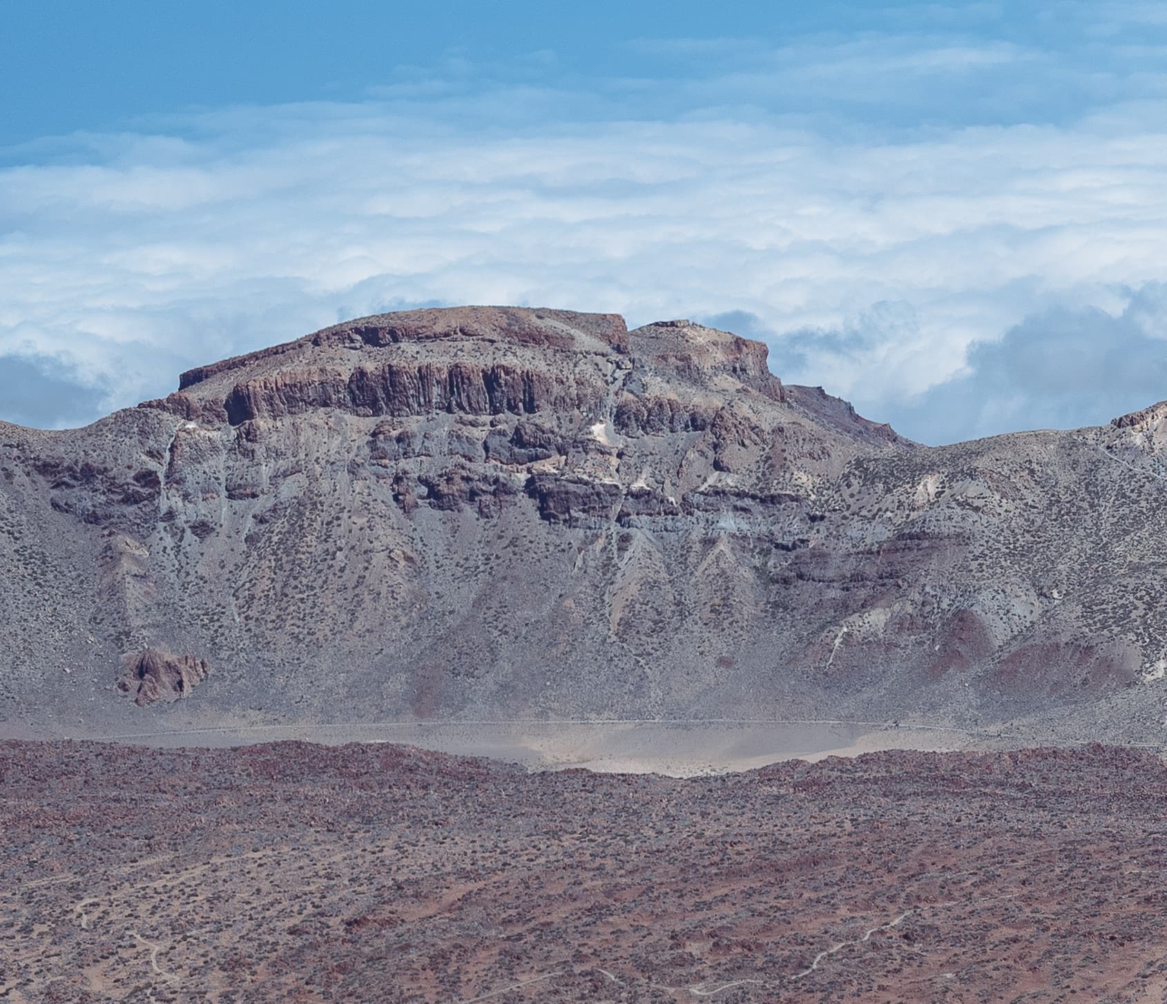
Roque de la Grieta rises as a slender basalt tower amid the arid, moon-like slopes of Tenerife’s central highlands. Its sharp profile against the sky draws hikers seeking a quieter alternative to the crowds at Mount Teide. The formation offers unobstructed panoramas across the Las Cañadas caldera and down into the fertile Orotava Valley, where terraced vineyards and banana plantations contrast with the dark volcanic rock.

How to Reach the Trailhead

Most visitors drive the TF-21 road that crosses Teide National Park. Park at the La Ruleta or nearby mirador lay-bys and follow the well-marked PR-TF 1 or connecting paths that lead southeast toward the roque. Those without a car can take the 348 bus from Puerto de la Cruz or Los Cristianos to the Teide cable-car base, then continue on foot or by park shuttle. The final approach is a moderate hike of roughly two hours each way on loose volcanic gravel and occasional rock steps.

Best Time to Visit and What to Expect

April through June and September through October bring mild daytime temperatures and lower wind speeds. Summer afternoons can exceed 30 °C on the exposed slopes, while winter nights drop below freezing; carry layers and check the park’s weather alerts. The route passes through high-mountain shrubland dotted with Teide broom and the occasional blue chaffinch, offering changing light on the rock face at sunrise and sunset.

Activities and Photography

The main draw is the out-and-back hike culminating at the base of the spire, where careful scrambling reveals 360-degree vistas. Photographers favor the golden-hour light that turns the basalt warm orange and highlights distant snow patches on Teide. Birdwatchers may spot the endemic Tenerife goldcrest in the scattered pines lower on the trail. No technical climbing gear is required for the standard viewpoint, but sure-footedness is essential on the final rocky sections.

Nearby Highlights

Combine the outing with a stop at the nearby Roque Cinchado, only a short detour along the same road, or continue to the Teide cable-car for higher elevation views. The historic Parador hotel inside the caldera provides a convenient lunch stop with regional Canarian cuisine. For a longer day, link trails toward the Roques de García for additional rock formations and interpretive panels on the island’s volcanic geology.

Visitor tips

  • Wear sturdy hiking boots with good grip; the path crosses loose scoria that becomes slippery after rain.
  • Carry at least two liters of water per person and sun protection, as there is no shade or water on the upper trail.
  • Start early to avoid afternoon winds that frequently funnel through the caldera and to secure parking at popular viewpoints.

Frequently asked questions

How difficult is the hike to Roque de la Grieta?+

It is rated moderate for fit walkers; the main challenge is loose gravel and steady elevation gain rather than technical climbing.

Do I need a permit to visit Roque de la Grieta?+

No special permit is required for the standard trail, but Teide National Park entry is free and the area is open year-round.

Can children or older adults complete the route?+

The hike suits older children and active seniors with good balance; those with mobility concerns may prefer shorter viewpoint stops along the road.

Is there mobile phone coverage on the trail?+

Signal is patchy above 2,000 m; download an offline map before leaving the TF-21 road.

What wildlife might I see near Roque de la Grieta?+

Look for the blue chaffinch in the pines and the occasional Berthelotu2019s pipit on the open slopes; both are endemic to the Canary Islands.

Share
Google Maps Apple Maps Directions

Image: Flocci Nivis · CC BY-SA 4.0 · via Wikimedia Commons

Keep reading

Nearby & related

All stories
P
Santa Cruz de Tenerife Province

Playa de Bajamar: Tenerife’s Rugged Black-Sand Beach and Natural Pools

Find calm volcanic shores, dramatic cliffs, and tide-fed rock pools on Tenerife’s wild northern coast.

12 November 2026
Playa de Benijo: Tenerife’s Rugged Black-Sand Beach in the Anaga Mountains
Santa Cruz de Tenerife Province

Playa de Benijo: Tenerife’s Rugged Black-Sand Beach in the Anaga Mountains

A dramatic pebble cove backed by steep cliffs and Atlantic waves, offering hikers and photographers an untamed slice of…

12 November 2026
Playa de las Vistas: Tenerife’s Golden-Sand Family Beach in Los Cristianos
Santa Cruz de Tenerife Province

Playa de las Vistas: Tenerife’s Golden-Sand Family Beach in Los Cristianos

A calm, accessible stretch of imported golden sand with a lively promenade, ideal for swimming and relaxed days on…

12 November 2026