Skip to content
Plan & Tour
DestinationsItinerariesTravel BlogAboutContact
0Sign inPlan a trip
Plan & TourPlan & Tour

Travel guides, destination inspiration and curated itineraries for Canada, the USA and beyond, plus a free tool to plan your own day-by-day trip.

Get travel inspiration

Explore

  • All Destinations
  • Curated Itineraries
  • Travel Blog
  • Plan a Trip

Topics

  • Hiking & Nature
  • Food & Drink
  • City Breaks
  • Budget Travel

Company

  • About Us
  • Contact
  • Privacy Policy
  • Terms of Service

© 2026 Plan & Tour. Built for travellers.

Discover the world, one trip at a time.

Roque de Garachico: Tenerife’s Dramatic Protected Volcanic Islet
  1. Home
  2. Destinations
  3. Santa Cruz de Tenerife Province
  4. Roque de Garachico: Tenerife’s Dramatic Protected Volcanic Islet
Protected area

Roque de Garachico: Tenerife’s Dramatic Protected Volcanic Islet

Rising from the Atlantic near Garachico, this basalt sea stack reveals the Canary Islands' volcanic heritage and supports unique coastal ecosystems.

Santa Cruz de Tenerife ProvinceUpdated 12 November 2026

Geological Origins and Protected Status

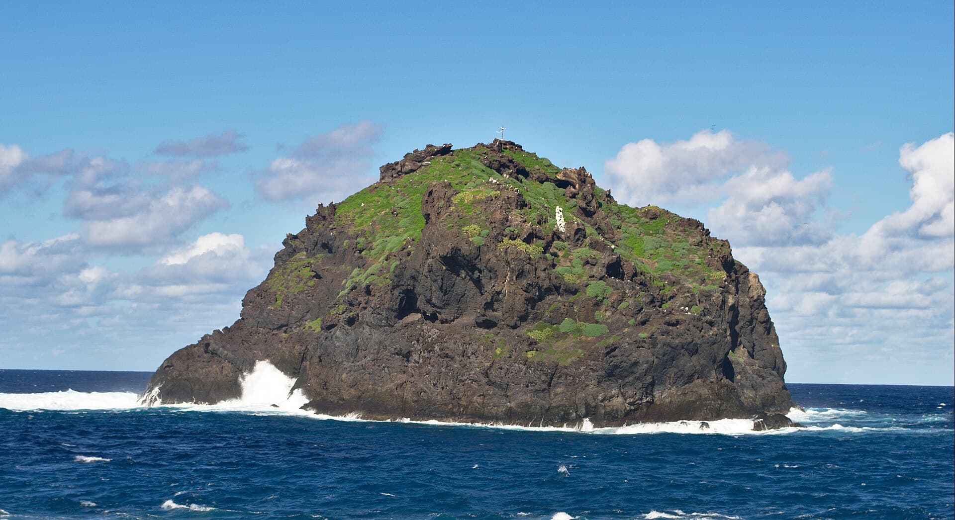
Roque de Garachico formed through ancient volcanic eruptions that created a resistant basalt column standing offshore from Tenerife’s northwest coast. Designated a protected natural monument, the islet preserves rare coastal flora and serves as an important nesting site for seabirds. Its stark silhouette against the ocean highlights the raw geology that defines the Canary Islands.

What to See and Do

From shore viewpoints in Garachico, visitors can observe the rock’s columnar basalt formations and the surrounding tidal zones teeming with marine life. Boat excursions allow closer inspection of underwater caves and the chance to spot dolphins or schools of fish in the clear waters. Birdwatchers should bring binoculars to watch species such as Cory’s shearwaters and yellow-legged gulls that use the islet for breeding. Snorkeling and diving trips reveal colorful reefs protected from heavy coastal development.

Access and Practical Considerations

The site is reached by traveling to the historic town of Garachico, where coastal paths and miradors provide unobstructed views. Organized boat tours depart from the local harbor and circle the rock without landing, preserving its protected status. Strong currents and rocky landings make swimming directly at the islet inadvisable; instead, enjoy the natural seawater pools along Garachico’s shoreline.

Best Time to Visit

The mild subtropical climate supports year-round visits, though spring and autumn offer calmer seas and fewer crowds. Winter brings occasional Atlantic swells that enhance the dramatic seascape but can limit boat departures. Early morning light provides the best conditions for photography and wildlife observation before afternoon winds pick up.

Nearby Attractions

Combine a visit with Garachico’s lava-formed natural pools and its well-preserved 16th-century architecture. Short drives lead to the laurel forests of the Monte del Agua or the coastal cliffs of the Teno Rural Park, offering contrasting landscapes within the same region of Tenerife.

Visitor tips

  • Wear sturdy shoes for coastal paths and bring binoculars for seabird viewing from shore.
  • Check sea conditions the day before booking a boat tour, as Atlantic swells can cancel departures.
  • Pack reef-safe sunscreen and water shoes for exploring Garachico's natural tidal pools after viewing the islet.

Frequently asked questions

Can visitors land on Roque de Garachico?+

No, the islet is a protected natural monument where landing is prohibited to safeguard nesting birds and fragile vegetation.

What is the best way to view Roque de Garachico?+

Coastal viewpoints in Garachico offer excellent free views, while local boat tours provide closer perspectives of the rock and surrounding waters.

Is Roque de Garachico suitable for swimming or diving?+

Direct access is restricted, but nearby Garachico pools and organized diving trips around the islet allow safe enjoyment of the marine environment.

How long should I plan to spend at the site?+

Two to three hours covers viewpoints, a short boat circuit, and time to explore Garachico's adjacent natural pools and historic center.

Are there facilities like restrooms or cafes near the viewpoints?+

Garachico town, a short walk from the main coastal paths, provides cafes, restrooms, and parking for visitors.

Share
Google Maps Apple Maps Directions

Image: Paweł 'pbm' Szubert (talk) · CC BY-SA 3.0 · via Wikimedia Commons

Keep reading

Nearby & related

All stories
P
Santa Cruz de Tenerife Province

Playa de Bajamar: Tenerife’s Rugged Black-Sand Beach and Natural Pools

Find calm volcanic shores, dramatic cliffs, and tide-fed rock pools on Tenerife’s wild northern coast.

12 November 2026
Playa de Benijo: Tenerife’s Rugged Black-Sand Beach in the Anaga Mountains
Santa Cruz de Tenerife Province

Playa de Benijo: Tenerife’s Rugged Black-Sand Beach in the Anaga Mountains

A dramatic pebble cove backed by steep cliffs and Atlantic waves, offering hikers and photographers an untamed slice of…

12 November 2026
Playa de las Vistas: Tenerife’s Golden-Sand Family Beach in Los Cristianos
Santa Cruz de Tenerife Province

Playa de las Vistas: Tenerife’s Golden-Sand Family Beach in Los Cristianos

A calm, accessible stretch of imported golden sand with a lively promenade, ideal for swimming and relaxed days on…

12 November 2026