Skip to content
Plan & Tour
DestinationsItinerariesTravel BlogAboutContact
0Sign inPlan a trip
Plan & TourPlan & Tour

Travel guides, destination inspiration and curated itineraries for Canada, the USA and beyond, plus a free tool to plan your own day-by-day trip.

Get travel inspiration

Explore

  • All Destinations
  • Curated Itineraries
  • Travel Blog
  • Plan a Trip

Topics

  • Hiking & Nature
  • Food & Drink
  • City Breaks
  • Budget Travel

Company

  • About Us
  • Contact
  • Privacy Policy
  • Terms of Service

© 2026 Plan & Tour. Built for travellers.

Discover the world, one trip at a time.

Puig de sa Selleta: Hiking Mallorca’s Quiet Tramuntana Peak
  1. Home
  2. Destinations
  3. Balearic Islands
  4. Puig de sa Selleta: Hiking Mallorca’s Quiet Tramuntana Peak
Mountain

Puig de sa Selleta: Hiking Mallorca’s Quiet Tramuntana Peak

A rewarding, low-crowd ascent through olive terraces and pine forest to sweeping views over western Mallorca.

Balearic IslandsUpdated 21 September 2026

Why Puig de sa Selleta Stands Out

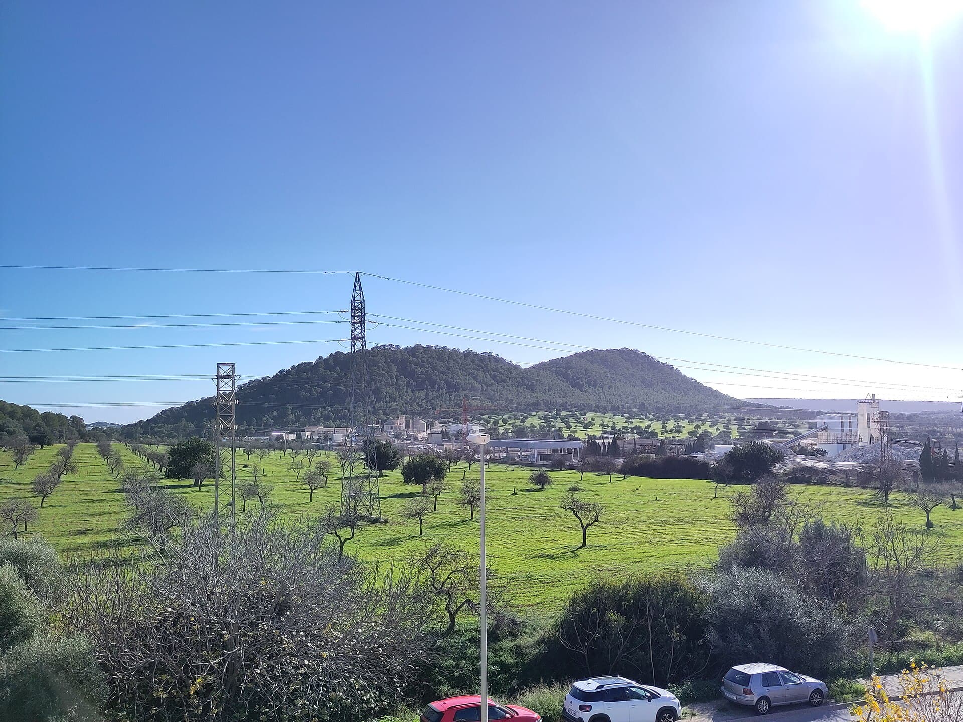
At 492 metres, Puig de sa Selleta rises gently above the western foothills of the Serra de Tramuntana. Unlike the crowded summits of Puig Major or Es Teix, this peak offers solitude, terraced olive groves, and unobstructed panoramas of the Mediterranean and the distant Formentor peninsula. The route passes through classic Mallorcan landscape: dry-stone walls, carob trees, and Aleppo pines that shelter endemic birds such as the Balearic warbler.

Planning Your Visit

The best months are April–June and September–October, when temperatures stay comfortable for walking and wildflowers or autumn light enhance the scenery. Summer brings intense heat and occasional thunderstorms; winter trails can be muddy after rain. Allow three to four hours for the round trip, including time at the summit.

Getting There and Trail Access

Drive from Palma via the Ma-1101 to the village of Puigpunyent, then continue toward Es Capdellà. Park in the signed lay-by at Coll de sa Creu (limited spaces). The trail begins on a wide track that narrows into a marked footpath (PR-Mallorca 5 variant). No permit is required, but the route is unsigned beyond the first kilometre, so a good map or GPS track is essential. Public buses reach Puigpunyent; from there a taxi or 45-minute walk gets you to the trailhead.

What to Expect on the Hike

The path climbs steadily through terraced farmland before entering pine woodland. After 45 minutes you reach a saddle with views toward Andratx. The final rocky section to the summit trig point is short but requires sure footing. At the top, the 360-degree vista takes in the Bay of Palma, the dramatic cliffs of Na Burguesa, and on clear days the island of Cabrera. Return by the same route or extend the walk along the ridge toward neighbouring Puig des Cairells.

Nearby Attractions Worth Combining

  • The historic village of Puigpunyent with its weekly market and cafés.
  • Finca Es Rafal, open for olive-oil tastings.
  • Coastal walks at nearby Port d’Andratx, 20 minutes by car.
  • The larger but busier Puig de Galatzó, reached from the same valley.

Combine the hike with a relaxed lunch in Andratx or a swim at Cala d’Egos for a full day exploring the southwest corner of the island.

Visitor tips

  • Carry at least 1.5 litres of water per person; there are no springs on the route.
  • Wear sturdy shoes with good gripu2014limestone sections become slippery when wet.
  • Download an offline map; mobile coverage drops after the first kilometre.
  • Start early to avoid midday heat and secure one of the few parking spaces at Coll de sa Creu.

Frequently asked questions

How difficult is the hike to Puig de sa Selleta?+

The route is moderate: 7 km round trip with 350 m of ascent. Good fitness is needed for the final rocky scramble, but no technical climbing is involved.

Can I reach Puig de sa Selleta without a car?+

Yes. Take the bus to Puigpunyent, then walk or taxi the remaining 3 km to the trailhead. Allow extra time for the approach.

Is the summit marked or has a viewpoint?+

A small trig point and stone windbreak mark the top; the open rocky area provides excellent 360-degree views without any structures.

Are dogs allowed on the trail?+

Dogs are permitted but must stay on leads to protect livestock and ground-nesting birds.

What should I do if the weather turns bad?+

The exposed summit and limestone can become hazardous in wind or rain. Descend immediately via the same path if thunder or strong gusts appear.

Share
Google Maps Apple Maps Directions

Image: Joan Gené · CC BY-SA 4.0 · via Wikimedia Commons

Keep reading

Nearby & related

All stories
T
Balearic Islands

The Statue of James I of Aragon in Palma de Mallorca

Stand before the bronze monument to the king who conquered Mallorca and shaped the island’s medieval identity.

26 September 2026
M
Balearic Islands

Mirador del Centenari del Foment: Panoramic Views Over Mallorca’s Tramuntana Mountains

This secluded viewpoint delivers sweeping vistas of rugged peaks, olive terraces, and the Mediterranean from the heart…

26 September 2026
M
Balearic Islands

Mirador des Salt de la Bella Dona: Dramatic Cliffside Views in Mallorca’s Tramuntana

This secluded viewpoint reveals plunging gorges, terraced valleys, and distant sea horizons in the heart of the Serra de…

26 September 2026