Skip to content
Plan & Tour
DestinationsItinerariesTravel BlogAboutContact
0Sign inPlan a trip
Plan & TourPlan & Tour

Travel guides, destination inspiration and curated itineraries for Canada, the USA and beyond, plus a free tool to plan your own day-by-day trip.

Get travel inspiration

Explore

  • All Destinations
  • Curated Itineraries
  • Travel Blog
  • Plan a Trip

Topics

  • Hiking & Nature
  • Food & Drink
  • City Breaks
  • Budget Travel

Company

  • About Us
  • Contact
  • Privacy Policy
  • Terms of Service

© 2026 Plan & Tour. Built for travellers.

Discover the world, one trip at a time.

Pouce Coupé River: Wilderness Paddling and Fishing in Northern British Columbia
  1. Home
  2. Destinations
  3. British Columbia
  4. Pouce Coupé River: Wilderness Paddling and Fishing in Northern British Columbia
River

Pouce Coupé River: Wilderness Paddling and Fishing in Northern British Columbia

A clear tributary of the Peace River offering quiet angling, boreal scenery, and easy access from the Alaska Highway.

British ColumbiaUpdated 1 August 2026

Why Visit the Pouce Coupé River

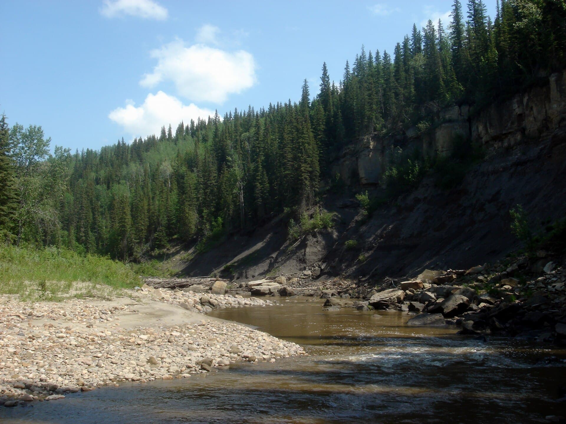
The Pouce Coupé River winds through the aspen parkland and spruce forests of British Columbia’s Peace Country, delivering clear water and modest current ideal for day trips. Its valley remains largely undeveloped, giving visitors a genuine sense of northern wilderness without long drives or expensive logistics.

Activities on the Water and Banks

Fishing

Arctic grayling and bull trout thrive in the deeper runs and undercut banks. Fly anglers wade the gravel bars below Highway 2, while spin fishers launch small boats at informal put-ins near the community of Pouce Coupe. Catch-and-release is encouraged for larger bull trout to protect the population.

Paddling

The 25-kilometre stretch from the town to the confluence with the Peace River is gentle enough for open canoes yet interesting for kayakers. Expect occasional sweepers and one short Class I rapid; most paddlers finish the trip in six to eight hours. Side channels host beaver and moose, especially at dawn.

Wildlife and Shoreline Walks

Short trails along the north bank near the old ferry crossing reveal songbirds, black bears, and abundant berry patches in late summer. The river corridor forms part of a larger wildlife movement route between the Rocky Mountain foothills and the boreal plain.

Getting There

Reach the river from Dawson Creek by driving 15 minutes south on Highway 2, then turning onto secondary roads that parallel the valley. Gravel access points are marked on provincial recreation maps. Travelers coming from Fort St. John use the same highway northbound and turn west at the Pouce Coupe exit.

Best Time to Visit

June through early September offers the most reliable water levels for paddling and the longest daylight. Late August and September bring quieter water, fewer insects, and the first hints of fall color. Winter visitors can snowshoe the frozen river corridor when ice is thick, though local knowledge of safe crossings is essential.

Nearby Attractions

Combine a river day with a visit to the Kiskatinaw River trestle bridge or the rolling hills of the Tumbler Ridge UNESCO Global Geopark, both less than an hour away. Dawson Creek’s art gallery and agricultural museum provide indoor options on rainy afternoons.

Visitor tips

  • Check river levels on the Water Survey of Canada gauge before launching; sudden rain can raise the river quickly.
  • Carry bear spray and make noise along wooded banks; the valley supports a healthy black-bear population.
  • Park only in established pullouts to avoid blocking active ranch and forestry roads.

Frequently asked questions

Can beginners safely paddle the Pouce Coupu00e9 River?+

Yes, the main reach from Pouce Coupe to the Peace River is suitable for novice paddlers in stable canoes or kayaks when water levels are moderate.

Are there developed campgrounds along the river?+

No formal campgrounds exist on the immediate banks, but several provincial recreation sites and private RV parks lie within a 20-minute drive.

What is the fishing season and regulations?+

The river falls under Region 7B Peace regulations; check the current BC Freshwater Fishing Regulations synopsis for open dates and catch limits.

Is the water safe to drink?+

Treat all river water; upstream agricultural and residential use means bacteria and sediment can be present even when the water looks clear.

Are there any dangerous rapids or hazards?+

The river is mostly flat with occasional log jams and one short riffle; scout from shore before committing and portage if unsure.

Share
Google Maps Apple Maps Directions

Image: Qyd · CC BY 3.0 · via Wikimedia Commons

Keep reading

Nearby & related

All stories
Vedder River: Salmon Fishing, Paddling and Riverside Trails in British Columbia
British Columbia

Vedder River: Salmon Fishing, Paddling and Riverside Trails in British Columbia

A clear, productive river in the Fraser Valley offering consistent chinook and coho runs, easy paddling and quiet hiking…

1 August 2026
E
British Columbia

Englishman River: Waterfalls, Forests and Salmon Runs on Vancouver Island

Hike to dramatic waterfalls, swim in clear pools, and watch salmon spawn along this Vancouver Island river.

1 August 2026
B
British Columbia

Bella Coola River: Wilderness Fishing and Grizzly Viewing in British Columbia’s Great Bear Rainforest

This remote river in the Bella Coola Valley offers world-class steelhead and salmon fishing, abundant wildlife, and…

1 August 2026


