Why Peña Ranero Stands Out
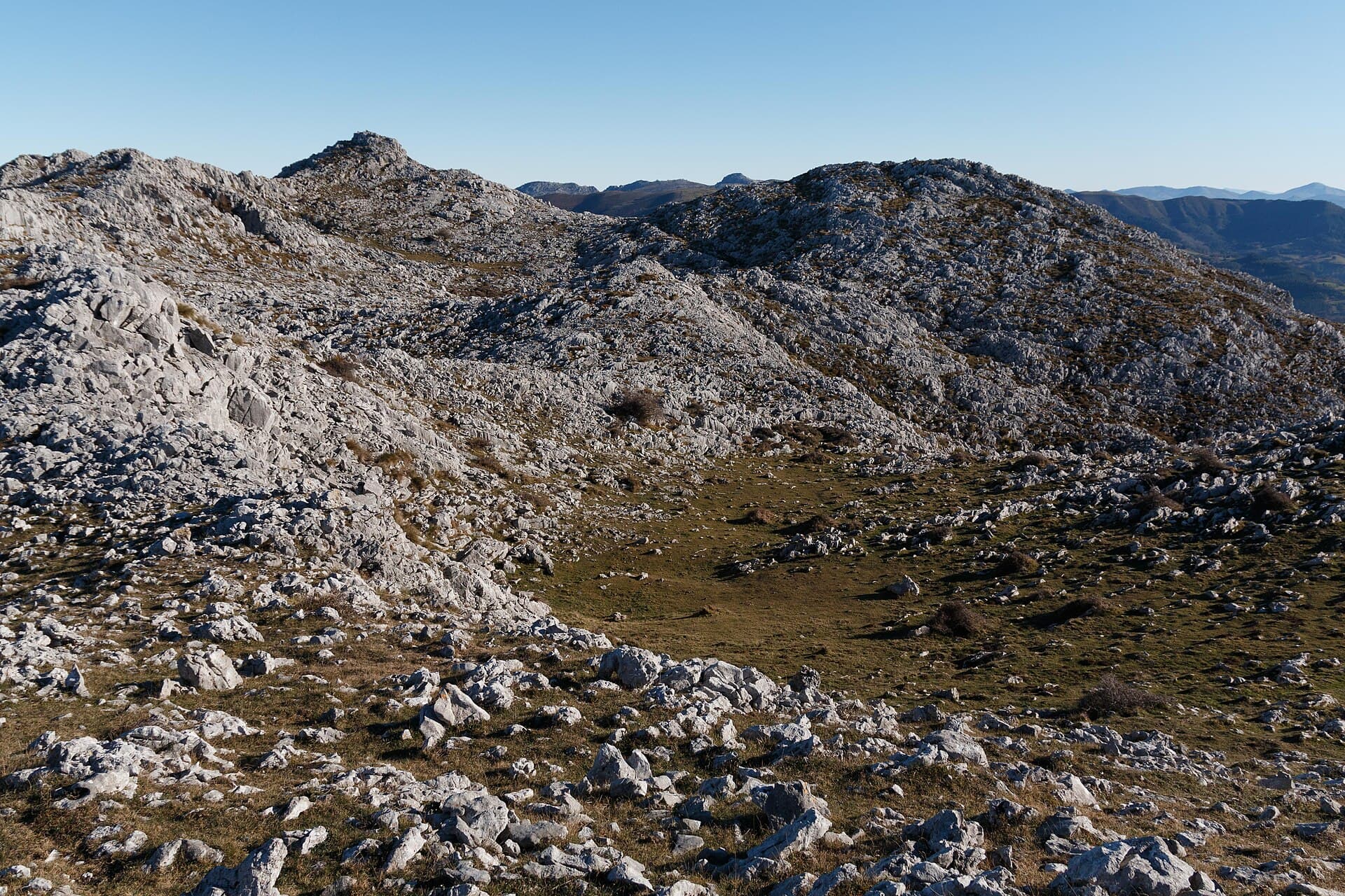
Peña Ranero rises as a distinctive limestone massif in Cantabria, its sheer cliffs and jagged pinnacles shaped by karst erosion over millennia. The mountain offers hikers and climbers a raw, uncrowded experience with sweeping views across the Asón valley toward the Bay of Biscay and the inland peaks of the Cordillera Cantábrica. Its geology creates a distinctive landscape of sinkholes, caves, and exposed rock that feels both rugged and accessible.
Getting There
The mountain lies near the village of Ranero in the municipality of Ruesga. Most visitors arrive by car via the A-8 motorway, exiting at Ampuero or Colindres and following local roads through the valley. Parking is available at trailheads near the village or along forest tracks. Public transport is limited, so a rental car or taxi from nearby towns like Ramales de la Victoria provides the most practical access. The nearest major airport is Bilbao, roughly an hour’s drive away.
Best Time to Visit
Spring and early autumn deliver the clearest weather and comfortable temperatures for hiking. Summer brings lush greenery but can be humid; winter offers solitude yet requires caution due to ice on exposed rock. Avoid periods of heavy rain, as limestone surfaces become slippery and some paths cross seasonal streams.
Trails and Activities
The standard route begins at the edge of Ranero village and ascends steadily through beech forest before emerging onto open rock. The path reaches the main summit area after a moderate climb, rewarding visitors with 360-degree vistas. More experienced hikers can continue along the ridge or explore side trails leading to smaller crags. Rock climbers find bolted routes on the south and west faces, while the surrounding caves attract experienced speleologists. Photographers favor the golden hour when the limestone glows against the green valleys below.
Flora and Fauna
Beech and oak woodlands cloak the lower slopes, giving way to alpine grasses and hardy shrubs near the summit. Griffon vultures and peregrine falcons often soar overhead, while chamois occasionally appear on distant ridges. Spring wildflowers brighten the meadows in May and June.
Nearby Attractions
Combine a visit with the dramatic caves of Cullalvera or the historic town of Ramales de la Victoria. The nearby Asón River offers gentle walks and trout fishing, while the coastal towns of Santoña and Laredo provide beaches and seafood restaurants just 30 minutes away.