
Keep reading
Nearby & related
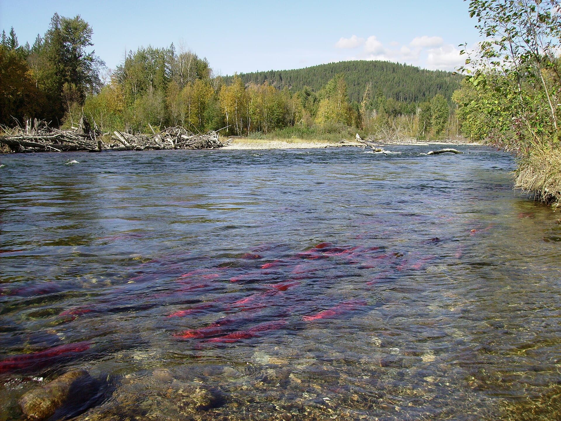
Chilkat River: Bald Eagle Capital Along the BC-Alaska Border
Float through salmon-rich waters teeming with eagles and bears in one of North America’s premier wildlife corridors.
1 July 2026
A rewarding scramble in the Canadian Rockies offering sweeping views of the Vermilion and Ottertail ranges.
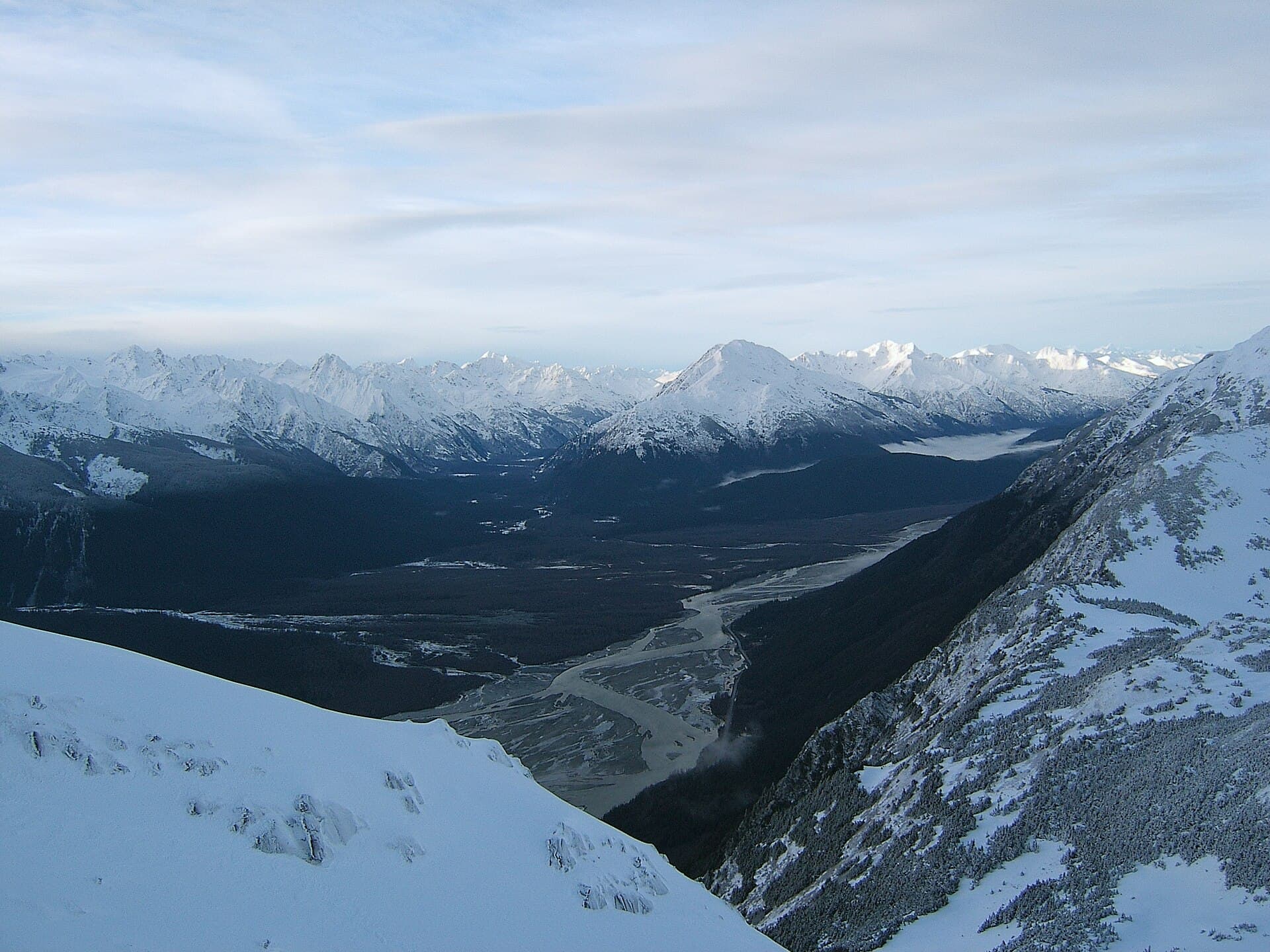
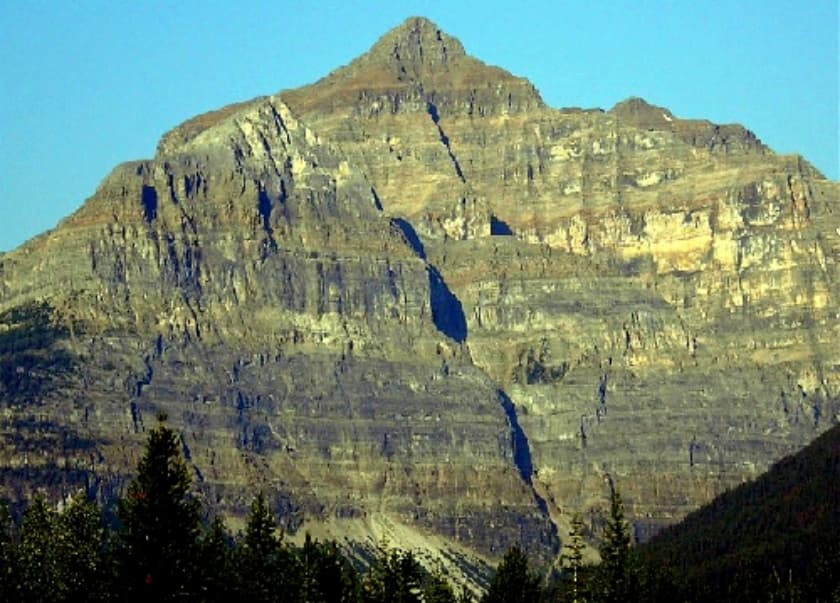
Mount Whymper rises prominently above Highway 93 in Kootenay National Park, British Columbia, providing a classic Rockies ascent with minimal approach time. Its position near Vermilion Pass delivers expansive sightlines across the Kootenay and Banff backcountry, including glimpses of the Rockwall and the distinctive peaks of the Ottertail Range. The mountain appeals to hikers seeking a full-day challenge without multi-day logistics.
The standard route begins at the parking area for the Stanley Glacier trailhead on Highway 93, roughly midway between the park’s west gate and Radium Hot Springs. From there, a well-defined trail leads through forest before ascending steep scree slopes and a final rocky ridge. The approach follows established park paths, with the final summit block requiring careful route-finding over loose rock. No permits are required for day use, though park entry fees apply at the gate.
July through early September offers the most reliable snow-free conditions on the upper slopes. Early summer can leave lingering snow patches that demand ice axes, while September brings cooler temperatures and fewer bugs. Afternoon thunderstorms are common in July and August; start early to avoid lightning exposure on the exposed ridge.
Beyond the summit scramble, the area supports excellent day hikes such as the short but dramatic Marble Canyon loop and the Paint Pots mineral springs. Photographers favor the roadside pullouts along Highway 93 for golden-hour images of the mountain’s north face reflected in the Vermilion River. Wildlife viewing opportunities include mountain goats on the higher ledges and occasional grizzly sightings in the valley bottoms. For a longer itinerary, combine the climb with an overnight at one of the backcountry campgrounds along the Rockwall trail.
The route involves roughly 900 metres of elevation gain over mostly unmaintained terrain above treeline. Sturdy boots, trekking poles, and a helmet are standard for the loose upper slopes. Navigation is straightforward in clear weather using the obvious ridge crest, yet whiteout conditions can occur rapidly. Carry sufficient water, as sources are limited once above the forest.
Keep reading
Float through salmon-rich waters teeming with eagles and bears in one of North America’s premier wildlife corridors.
It is rated a moderate-to-difficult day scramble requiring good fitness, route-finding skills, and comfort on loose rock; it is not a maintained trail to the summit.
The upper slopes involve steep scree and exposure, so it is generally not recommended for young children or first-time scramblers without an experienced guide.
No formal campground exists at the trailhead, but backcountry camping is available at nearby sites such as Helmet Creek or Tumbling Creek within Kootenay National Park.
Mountain goats frequent the ridges, while black bears and grizzlies inhabit the lower valleys; marmots and pikas are common on the rocky slopes.
The standard approach follows the Stanley Glacier trailhead; a longer eastern ridge option exists but requires more navigation and is rarely used by day hikers.
Follow the Similkameen River through dramatic canyons, fertile orchards, and quiet parks in the heart of the Similkameen…
Discover the dramatic sockeye salmon runs, clear waters, and surrounding forests of Adams River in British Columbia’s…
