
Keep reading
Nearby & related
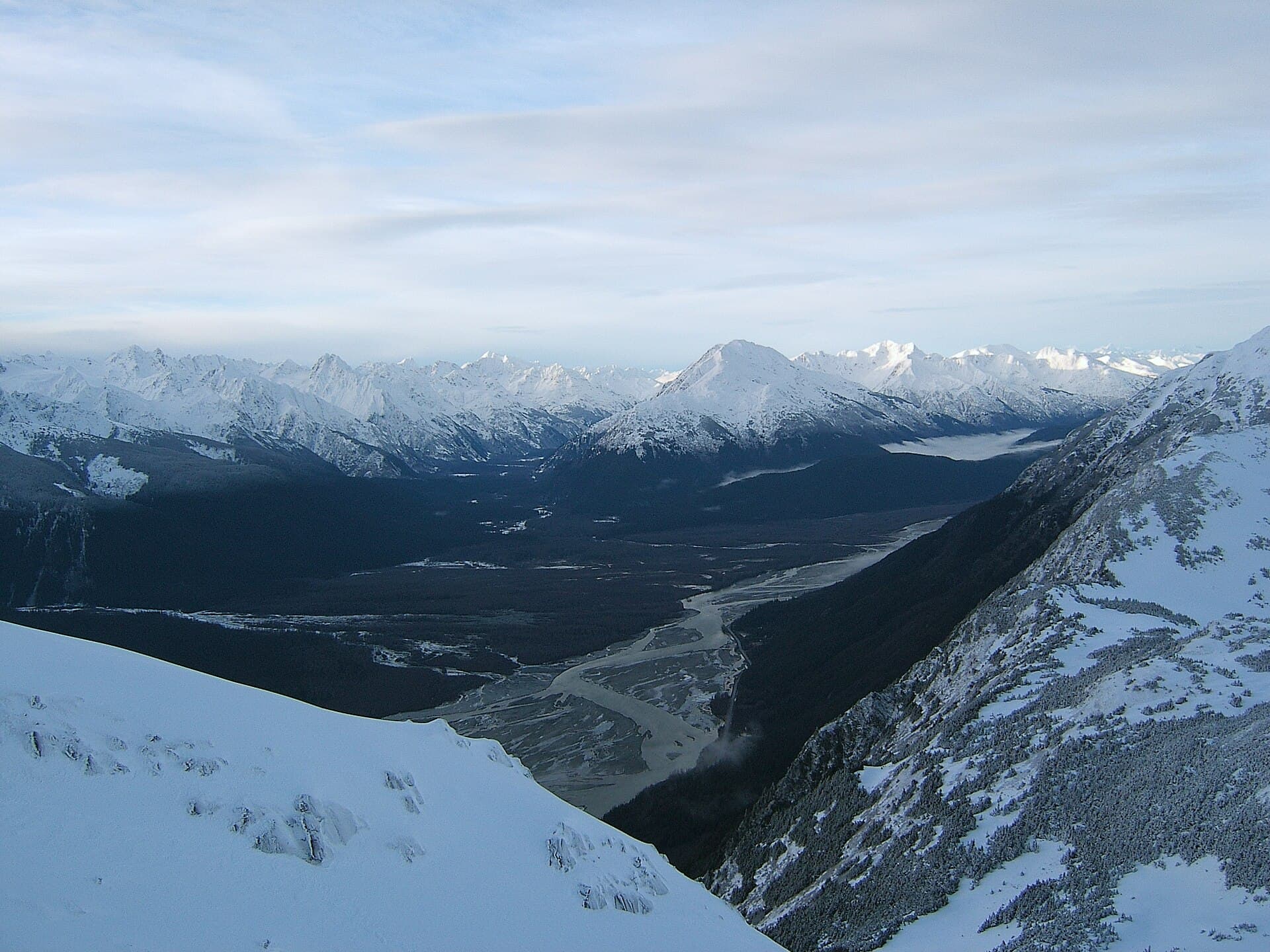
Chilkat River: Bald Eagle Capital Along the BC-Alaska Border
Float through salmon-rich waters teeming with eagles and bears in one of North America’s premier wildlife corridors.
1 July 2026
A rugged, glaciated summit offering serious climbers pristine wilderness in the Waddington Range.
Mount Queen Bess rises as a striking, ice-clad peak in the remote Waddington Range of British Columbia’s Coast Mountains. Its isolation, extensive glaciers, and technical routes draw experienced mountaineers seeking genuine wilderness rather than crowded trails. The mountain rewards those who value self-reliance and dramatic alpine scenery over easy access.
Access begins with travel to the Chilcotin region, typically via Williams Lake or Bella Coola. From there, floatplane or helicopter charters from bases such as Tatla Lake provide the only practical approach to the surrounding valleys and glaciers. No maintained roads or trails reach the peak itself, so all visitors must arrange air support and plan for self-sufficient travel once on the ground.
Most ascents follow glacier travel and moderate snow or ice slopes, though steeper rock and ice sections appear on several faces. The surrounding icefields create a high-alpine environment where route-finding, crevasse awareness, and weather assessment are essential skills. Parties usually establish base camps on moraines or snowfields below the peak.
The optimal window runs from late June through early September when snow bridges stabilize and daylight hours are longest. Even then, sudden storms can arrive quickly, so climbers must monitor forecasts and carry extra supplies. Winter and shoulder seasons increase avalanche risk and complicate logistics.
Within the same range lie other notable summits and icefields that can extend a multi-peak expedition. The broader Homathko and Kliniklini areas offer additional glacier travel opportunities for those already equipped for remote travel. Coastal fjords to the west provide a striking contrast once the mountain phase ends.
Visitors should possess glacier travel and crevasse rescue experience. Groups typically carry skis or snowshoes for efficient movement across ice and carry satellite communication devices. Leave detailed itineraries with a reliable contact and factor in extra days for weather delays during both arrival and departure.
Keep reading
Float through salmon-rich waters teeming with eagles and bears in one of North America’s premier wildlife corridors.
No. The mountain requires prior glacier and mountaineering experience; novices should gain skills on less remote peaks first.
Most parties spend four to seven days round-trip from the nearest air-access point, depending on weather and route choice.
No facilities exist. All camping is wilderness-style on snow or moraine; visitors must pack out all waste.
No special climbing permits are required, but commercial air operators need appropriate licenses; always confirm current park or provincial regulations.
The approach is too long and rugged for practical foot access; virtually all visitors arrive by floatplane or helicopter.
Follow the Similkameen River through dramatic canyons, fertile orchards, and quiet parks in the heart of the Similkameen…
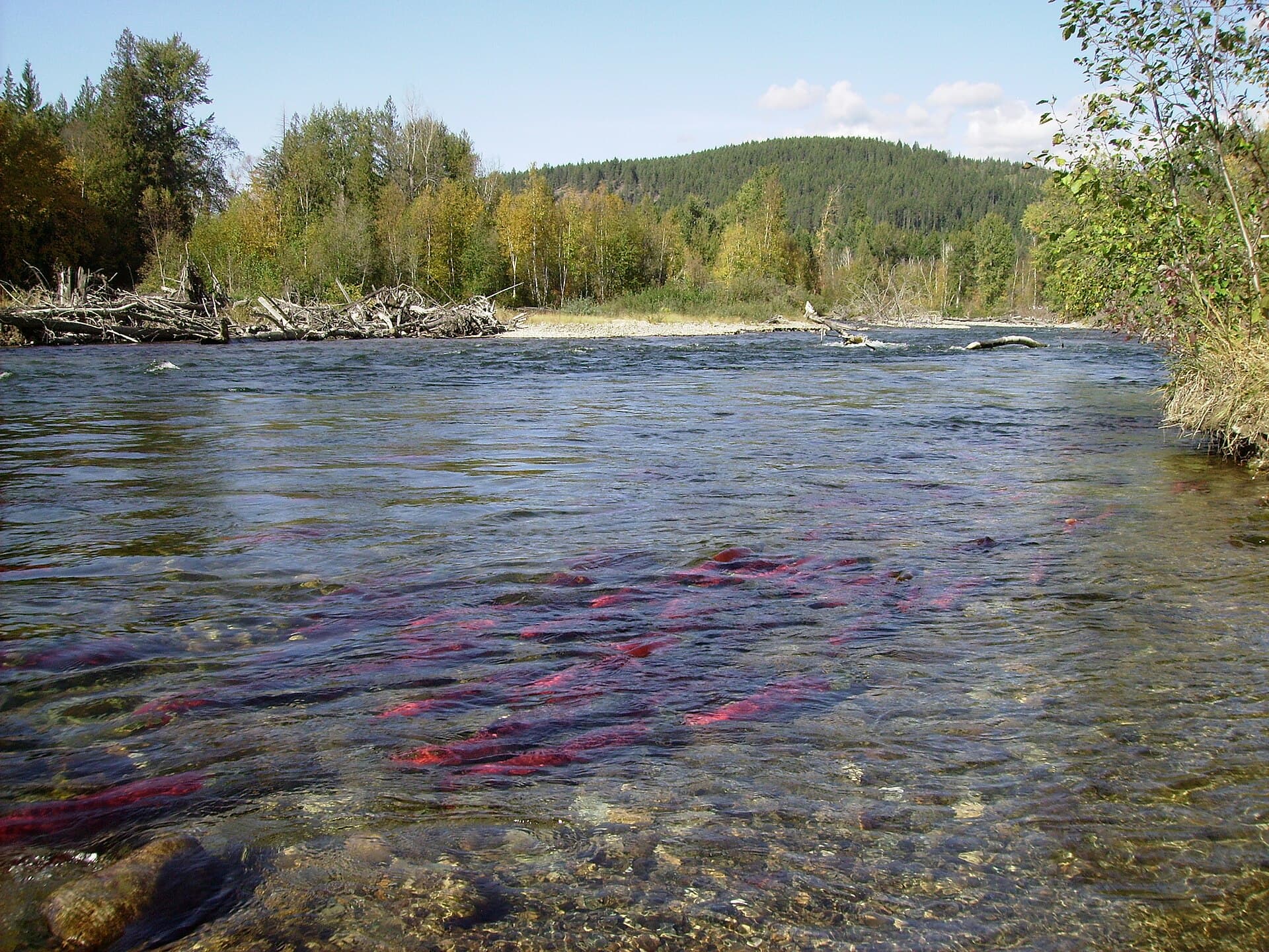
Discover the dramatic sockeye salmon runs, clear waters, and surrounding forests of Adams River in British Columbia’s…
