Skip to content
Plan & Tour
DestinationsItinerariesTravel BlogAboutContact
0Sign inPlan a trip
Plan & TourPlan & Tour

Travel guides, destination inspiration and curated itineraries for Canada, the USA and beyond, plus a free tool to plan your own day-by-day trip.

Get travel inspiration

Explore

  • All Destinations
  • Curated Itineraries
  • Travel Blog
  • Plan a Trip

Topics

  • Hiking & Nature
  • Food & Drink
  • City Breaks
  • Budget Travel

Company

  • About Us
  • Contact
  • Privacy Policy
  • Terms of Service

© 2026 Plan & Tour. Built for travellers.

Discover the world, one trip at a time.

Mount Ginini: Summit Hikes and Alpine Views in Namadgi National Park
  1. Home
  2. Destinations
  3. Australian Capital Territory
  4. Mount Ginini: Summit Hikes and Alpine Views in Namadgi National Park
Mountain

Mount Ginini: Summit Hikes and Alpine Views in Namadgi National Park

Climb to the highest accessible point in the ACT for sweeping Brindabella Range vistas and quiet subalpine wilderness just outside Canberra.

Australian Capital TerritoryUpdated 17 September 2026

Why Mount Ginini Rewards Visitors

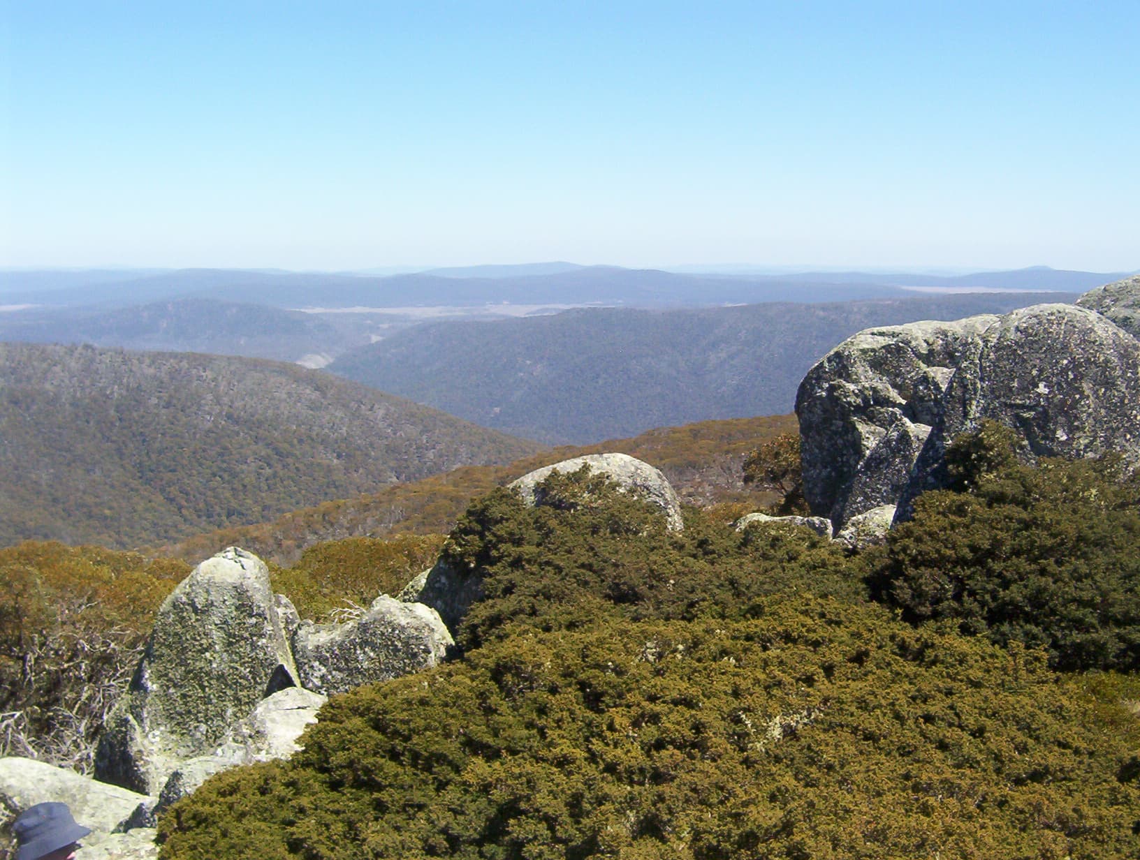
Mount Ginini rises to 1762 metres in the northern Brindabella Range, offering one of the most accessible high-country experiences in the Australian Capital Territory. Its open summit and former fire tower site deliver uninterrupted views across the forested ridges of Namadgi National Park and, on clear days, toward the distant peaks of Kosciuszko National Park. The mountain sits within a landscape shaped by granite tors, snow-gum woodlands and seasonal wildflower meadows, creating a compact yet dramatic slice of the Australian Alps.

How to Reach the Summit

Access begins from Canberra via the sealed Cotter Road, turning onto the gravel Mount Franklin Road inside Namadgi National Park. The final approach follows a well-maintained management track that climbs steadily through eucalypt forest to a small parking area below the summit. From the car park a short but steep walking track leads to the top in 20 to 30 minutes. Four-wheel-drive vehicles are not essential outside winter, yet drivers should expect corrugations and occasional fallen timber after storms.

Best Time to Visit

October through April provides the most reliable conditions for hiking, with mild days and reduced chance of sudden snow. Spring brings wildflowers along the verges, while autumn offers cooler temperatures and fewer insects. Winter visits are possible for experienced walkers carrying snow chains and emergency gear, but the road is frequently closed by ice or fallen trees. Summer afternoons can bring thunderstorms, so early starts are advisable.

Things to See and Do

The primary activity is the summit walk itself, which rewards photographers with 360-degree panoramas. Longer options include linking tracks toward Mount Gingera or following the ridgeline south toward the Cotter Valley. Birdwatchers may spot flame robins and wedge-tailed eagles, while wildflower enthusiasts can find orchids and alpine daisies in season. The area is also popular for quiet stargazing on clear nights, far from Canberra’s light pollution.

Nearby Attractions

Combine a visit with Corin Dam for lake views or the historic homesteads and wetlands of Tidbinbilla Nature Reserve. The Cotter River picnic areas provide easy riverside walks, and the Mount Franklin ski area offers further high-country exploration when snow is present. All lie within a 45-minute drive of the Ginini trailhead.

Visitor tips

  • Carry at least two litres of water per person; there are no reliable sources on the mountain.
  • Check the ACT Parks website or visitor centre for road closures before leaving Canberra, especially after heavy rain or snow.
  • Pack windproof layers and sun protection; conditions change rapidly above the treeline even on warm days.

Frequently asked questions

How high is Mount Ginini?+

The summit reaches 1762 metres, making it one of the highest points in the Australian Capital Territory accessible by public road and short walk.

Is the hike suitable for beginners?+

The final track is short but steep; fit walkers with moderate fitness manage it comfortably, though children and those with mobility limitations may find the gradient demanding.

Can I drive all the way to the top?+

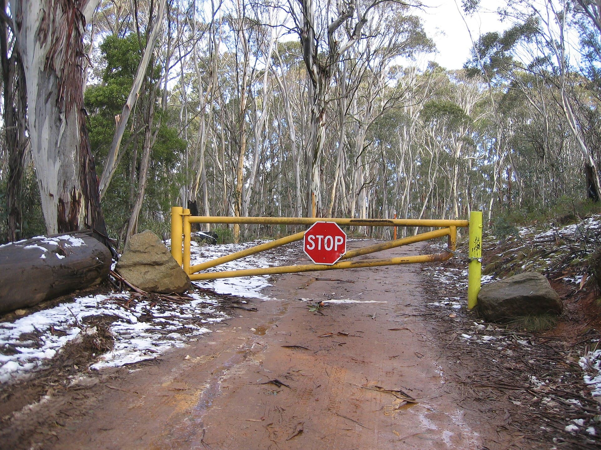
A locked gate prevents vehicle access to the final section; the summit must be reached on foot from the parking area.

Are there toilets or facilities at Mount Ginini?+

No facilities exist at the summit or trailhead; plan to use amenities at the Cotter Campground or Tidbinbilla before entering the park.

Is camping permitted on Mount Ginini?+

Overnight camping is not allowed on the summit; the nearest designated sites are at the Cotter River or along the Mount Franklin Road.

Share
Google Maps Apple Maps Directions

Image: Dfrg.msc at English Wikipedia · Public domain · via Wikimedia Commons

Keep reading

Nearby & related

All stories
A
Australian Capital Territory

Australians of the Year Walk: Canberra’s Lakeside Tribute to National Achievers

A peaceful foreshore path in Canberra honouring every Australian of the Year with permanent plaques and stories.

17 September 2026
Cotter River: Canberra’s Wild Waterway for Hiking, Fishing and Picnics
Australian Capital Territory

Cotter River: Canberra’s Wild Waterway for Hiking, Fishing and Picnics

Flowing through Namadgi National Park, the Cotter River offers clear trout streams, riverside campsites and easy day…

17 September 2026
Mount Franklin: Summit Hikes in the Brindabella Ranges
Australian Capital Territory

Mount Franklin: Summit Hikes in the Brindabella Ranges

Tackle the rugged trails and sweeping alpine views at this prominent peak in the Australian Capital Territory.

17 September 2026