
Skip to content
Plan & Tour
DestinationsItinerariesTravel BlogAboutContact
0Sign inPlan a trip
Plan & TourPlan & Tour

Travel guides, destination inspiration and curated itineraries for Canada, the USA and beyond, plus a free tool to plan your own day-by-day trip.

Get travel inspiration

Explore

  • All Destinations
  • Curated Itineraries
  • Travel Blog
  • Plan a Trip

Topics

  • Hiking & Nature
  • Food & Drink
  • City Breaks
  • Budget Travel

Company

  • About Us
  • Contact
  • Privacy Policy
  • Terms of Service

© 2026 Plan & Tour. Built for travellers.

Discover the world, one trip at a time.

Mount Fay: Scaling One of Banff’s Iconic Ten Peaks
  1. Home
  2. Destinations
  3. British Columbia
  4. Mount Fay: Scaling One of Banff’s Iconic Ten Peaks
Mountain

Mount Fay: Scaling One of Banff’s Iconic Ten Peaks

Explore the dramatic granite spire of Mount Fay in British Columbia's Banff National Park, where alpine lakes and towering ridges define the Canadian Rockies.

British ColumbiaUpdated 31 July 2026

Why Mount Fay Stands Out

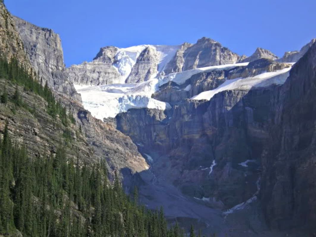
Mount Fay rises prominently among the Valley of the Ten Peaks, offering visitors sweeping views across turquoise Moraine Lake and the surrounding glaciated landscape. Its distinctive pyramid shape and sheer rock faces make it a focal point for photographers and hikers seeking the classic Canadian Rockies experience without extreme technical climbing.

Getting There

Access begins in Calgary with a drive west along the Trans-Canada Highway to Lake Louise, then south on Moraine Lake Road. The final approach follows well-marked trails from the Moraine Lake parking area into the valley. Public shuttle options operate seasonally from Lake Louise to reduce vehicle traffic in the park.

Best Time to Visit

July through September provides the most reliable trail conditions and wildflower displays at lower elevations. Early summer brings lingering snow patches that add dramatic contrast, while fall offers fewer crowds and golden larch trees. Winter visits require avalanche awareness and specialized equipment for backcountry travel.

Activities and What to See

Moderate hiking trails lead to viewpoints overlooking the peak and adjacent Wenkchemna Glacier. Strong hikers can tackle the ascent via the southeast ridge for panoramic summit views. Wildlife spotting includes marmots, pikas, and occasional mountain goats along the slopes. Photography opportunities peak at sunrise when alpenglow illuminates the granite.

  • Combine a visit with paddling on nearby Moraine Lake for a full-day itinerary.
  • Watch for interpretive signs explaining the area’s glacial history and ecology.

Nearby Attractions

Lake Louise and its famous teahouse trails lie just north, while the Icefields Parkway offers additional high-alpine scenery to the north. The town of Banff provides lodging and supplies roughly an hour away by road.

Visitor tips

  • Pack layers and rain gear, as mountain weather changes rapidly even on clear days.
  • Check current park conditions and trail reports before setting out, especially for snow or rockfall risks.
  • Start hikes early to secure parking at Moraine Lake and avoid afternoon thunderstorms.

Frequently asked questions

How difficult is hiking around Mount Fay?+

Trails to viewpoints are moderate with steady elevation gain; the full summit route involves exposed scrambling suitable for experienced hikers only.

Do I need a permit to visit Mount Fay?+

A Parks Canada pass is required for entry to Banff National Park; no additional summit permit is needed for standard hiking routes.

Can beginners visit Mount Fay?+

Novice visitors can enjoy the lakeside trails and lower viewpoints, but summit attempts require strong fitness and route-finding skills.

What wildlife might I encounter near Mount Fay?+

Marmots, pikas, and mountain goats are common; always maintain distance and store food properly to avoid attracting bears.

Is Mount Fay accessible in winter?+

Winter access is possible with snowshoes or skis, but requires avalanche training, proper gear, and checking current bulletins.

Share
Google Maps Apple Maps Directions

Image: CC BY-SA 4.0 · via Wikimedia Commons

Keep reading

Nearby & related

All stories
Wedgemount Lake: Hiking to a Turquoise Alpine Gem Near Whistler
British Columbia

Wedgemount Lake: Hiking to a Turquoise Alpine Gem Near Whistler

A rewarding backcountry trek leads to glacial waters and sweeping mountain views in British Columbia’s Coast Range.

8 August 2026

Yellowhead Lake: Turquoise Waters and Mountain Backdrops in Mount Robson Provincial Park
British Columbia

Yellowhead Lake: Turquoise Waters and Mountain Backdrops in Mount Robson Provincial Park

This serene lake in British Columbia’s Rockies delivers quiet paddling, trout fishing, and easy access to dramatic peaks…

8 August 2026

Swindle Island: Remote Wilderness on British Columbia’s Central Coast
British Columbia

Swindle Island: Remote Wilderness on British Columbia’s Central Coast

Discover pristine rainforest, marine wildlife, and quiet anchorages on this secluded island in the Inside Passage.

8 August 2026