
Keep reading
Nearby & related
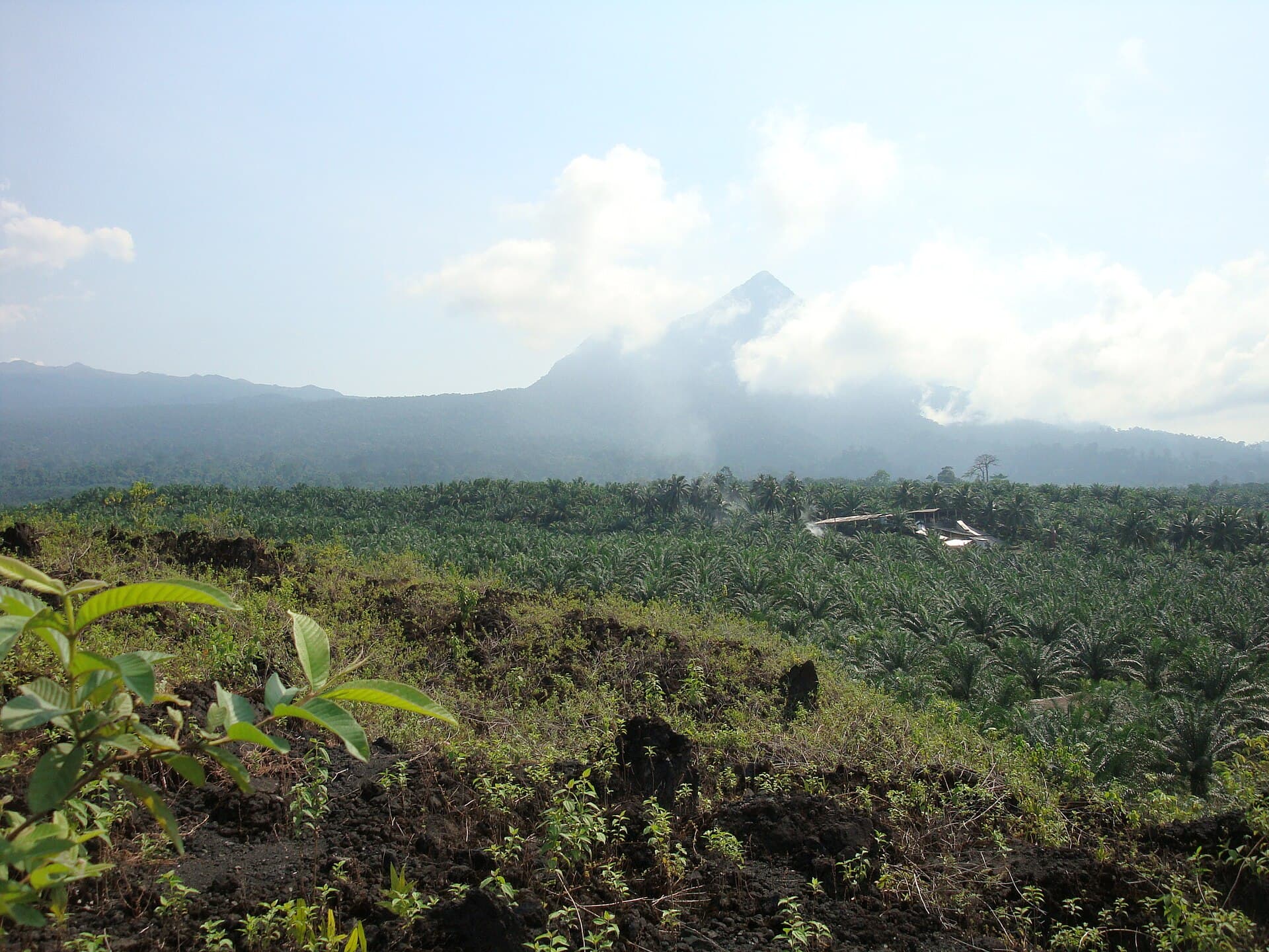
Little Mount Cameroon: Hiking the Volcanic Slopes Near Buea
Tackle the accessible trails of this smaller volcanic peak for sweeping views of the Atlantic and the main Cameroon…
28 October 2026
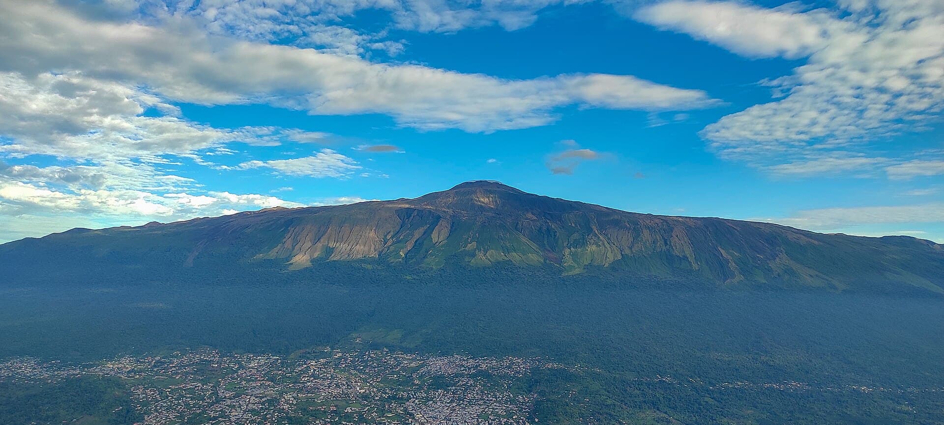
Hike the dramatic volcanic slopes of Mount Cameroon through rainforests and grasslands to the summit of this active West African giant.
Mount Cameroon rises dramatically from the coastal plains near the Gulf of Guinea as an active volcano and the highest peak in West Africa. Its slopes support distinct ecological zones from lowland rainforest to alpine grasslands, offering hikers rare biodiversity and sweeping views across the Atlantic and surrounding countryside. The mountain’s volcanic history remains visible in lava fields and crater formations, while local Bakweri communities maintain cultural ties to the peak that add depth to any visit.
Most travelers reach the mountain via Douala International Airport, followed by a road journey of roughly one hour to the town of Buea at the mountain’s base. From Buea, established trails begin near the university or the nearby village of Molyko. Public minibuses and shared taxis connect Douala with Buea, while private transfers or organized tours provide direct access to trailheads. The mountain lies within Fako Division, making Buea the practical gateway for supplies and permits.
The clearest weather and most reliable trail conditions occur during the dry season from November through February. These months minimize mud and reduce the risk of sudden downpours that can obscure views or make steep sections hazardous. The rainy season from March to October brings lush vegetation but also frequent cloud cover and slippery paths, limiting summit chances. Early morning starts remain advisable year-round to avoid afternoon cloud buildup on the upper slopes.
The most popular route starts from Buea and ascends through forest to the summit at 4,040 meters, typically requiring two days with an overnight camp. A longer traverse continues across the mountain to the village of Bomana on the northern side. Shorter day hikes reach viewpoints or lava flow areas for those not attempting the full summit. Guides are strongly recommended to navigate unmarked sections and interpret the terrain. The mountain also attracts birdwatchers seeking species such as the Mount Cameroon francolin and plant enthusiasts exploring endemic orchids and giant lobelias.
After descending, many visitors combine the climb with time in Limbe, a short drive away, where black-sand beaches and botanical gardens provide coastal contrast. The nearby Limbe Wildlife Centre offers rehabilitation programs for primates rescued from the region. Further afield, the coastal road leads to the fishing town of Tiko and the fertile plantations that surround the mountain’s lower slopes. Cultural tours in Buea introduce visitors to Bakweri traditions tied to the volcano.
Preparation includes sturdy boots, layered clothing for temperature swings, and sufficient water. Altitude effects become noticeable above 3,000 meters, so pacing remains essential. Local porters can carry equipment on multi-day trips, supporting community economies around the park.
The ascent is strenuous due to steep gradients and high altitude but does not require technical climbing skills; most fit hikers complete it with proper preparation and a guide.
Yes, entry to the protected area requires a permit obtained in Buea, usually arranged through a licensed guide or tour operator.
Visitors often spot monkeys, duikers, and a variety of birds including the endemic Mount Cameroon francolin, though larger animals remain elusive.
Solo hiking is discouraged because of the remote terrain and need for local knowledge; joining a guided group or hiring porters is the standard and safer approach.
Designated campsites exist along the main routes, and overnight stays with a guide are common for those attempting the summit.
Keep reading
Tackle the accessible trails of this smaller volcanic peak for sweeping views of the Atlantic and the main Cameroon…