Skip to content
Plan & Tour
DestinationsItinerariesTravel BlogAboutContact
0Sign inPlan a trip
Plan & TourPlan & Tour

Travel guides, destination inspiration and curated itineraries for Canada, the USA and beyond, plus a free tool to plan your own day-by-day trip.

Get travel inspiration

Explore

  • All Destinations
  • Curated Itineraries
  • Travel Blog
  • Plan a Trip

Topics

  • Hiking & Nature
  • Food & Drink
  • City Breaks
  • Budget Travel

Company

  • About Us
  • Contact
  • Privacy Policy
  • Terms of Service

© 2026 Plan & Tour. Built for travellers.

Discover the world, one trip at a time.

Mount Ball: Hiking and Scrambling the Canadian Rockies’ Striking Summit
  1. Home
  2. Destinations
  3. British Columbia
  4. Mount Ball: Hiking and Scrambling the Canadian Rockies’ Striking Summit
Mountain

Mount Ball: Hiking and Scrambling the Canadian Rockies’ Striking Summit

Mount Ball offers dramatic alpine views and accessible scrambling in British Columbia's Kootenay and Banff national parks.

British ColumbiaUpdated 31 July 2026

Why Visit Mount Ball

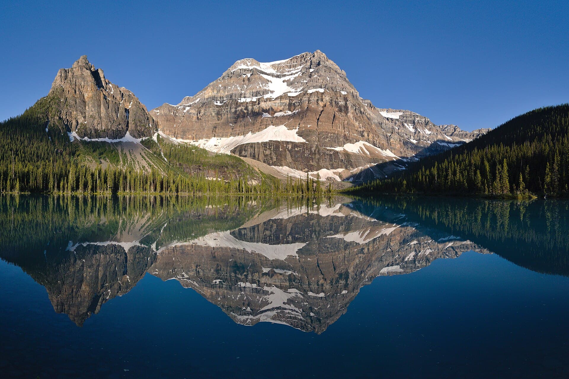
Mount Ball rises to 3,311 metres in the Ball Range of the Canadian Rockies, straddling the boundary between Kootenay and Banff national parks. Its prominent north face and sweeping views of the Vermilion and Bow valleys make it a standout objective for hikers and scramblers seeking a rewarding alpine experience without extreme technical difficulty.

Getting There

Access begins from the Trans-Canada Highway near Castle Junction or Highway 93 through Kootenay National Park. The most common trailhead is at the Stanley Glacier parking area or the Marble Canyon lot, both reached by a straightforward drive from Banff or Radium Hot Springs. A vehicle is essential; no public transit serves the remote trailheads directly.

Best Time to Visit

July through September offers the most reliable snow-free conditions on the upper slopes and meadows. Early summer can bring lingering snow and higher avalanche risk, while October often brings early storms. Plan for long daylight hours in midsummer to complete the full ascent and descent safely.

Activities and Routes

The standard route follows the Stanley Glacier trail before branching onto a well-defined scrambling path that gains the ridge leading to the summit. Expect a long day of 12–16 kilometres with significant elevation gain. Highlights include wildflower meadows in July, larch groves in September, and panoramic views of Mounts Whymper, Verendrye, and the surrounding limestone peaks. Experienced scramblers may explore variations along the south ridge for added challenge.

Nearby Attractions

Combine a Mount Ball trip with visits to the Paint Pots, Marble Canyon, or the Kootenay Hot Springs in nearby Radium. The Icefields Parkway and Lake Louise are within an hour’s drive, offering easy extensions for those based in Banff or Canmore.

Visitor tips

  • Carry bear spray and know how to use itu2014both black and grizzly bears frequent the lower valleys.
  • Start early to avoid afternoon thunderstorms common in the Rockies and to secure parking at popular trailheads.
  • Bring layers and navigation tools; weather changes rapidly above treeline and the upper route requires route-finding.

Frequently asked questions

How difficult is the scramble up Mount Ball?+

It is a moderate-to-difficult scramble requiring good fitness, some exposure tolerance, and basic route-finding skills above the treeline.

Do I need a permit to hike Mount Ball?+

A national parks pass is required for entry to Banff or Kootenay; no additional hiking permit is needed for the standard route.

Is Mount Ball suitable for beginners?+

Novices should join a guided trip or gain experience on easier peaks first, as the upper sections involve loose rock and steep terrain.

What wildlife might I encounter?+

Expect possible sightings of mountain goats near the summit, plus bears, elk, and marmots at lower elevations.

Can I camp near Mount Ball?+

Backcountry camping is available at designated sites such as those near Stanley Glacier; reservations are recommended in peak season.

Share
Google Maps Apple Maps Directions

Image: Lindsey Harper · CC BY-SA 2.0 · via Wikimedia Commons

Keep reading

Nearby & related

All stories
Wedgemount Lake: Hiking to a Turquoise Alpine Gem Near Whistler
British Columbia

Wedgemount Lake: Hiking to a Turquoise Alpine Gem Near Whistler

A rewarding backcountry trek leads to glacial waters and sweeping mountain views in British Columbia’s Coast Range.

8 August 2026
Yellowhead Lake: Turquoise Waters and Mountain Backdrops in Mount Robson Provincial Park
British Columbia

Yellowhead Lake: Turquoise Waters and Mountain Backdrops in Mount Robson Provincial Park

This serene lake in British Columbia’s Rockies delivers quiet paddling, trout fishing, and easy access to dramatic peaks…

8 August 2026
Swindle Island: Remote Wilderness on British Columbia’s Central Coast
British Columbia

Swindle Island: Remote Wilderness on British Columbia’s Central Coast

Discover pristine rainforest, marine wildlife, and quiet anchorages on this secluded island in the Inside Passage.

8 August 2026


