Skip to content
Plan & Tour
DestinationsItinerariesTravel BlogAboutContact
0Sign inPlan a trip
Plan & TourPlan & Tour

Travel guides, destination inspiration and curated itineraries for Canada, the USA and beyond, plus a free tool to plan your own day-by-day trip.

Get travel inspiration

Explore

  • All Destinations
  • Curated Itineraries
  • Travel Blog
  • Plan a Trip

Topics

  • Hiking & Nature
  • Food & Drink
  • City Breaks
  • Budget Travel

Company

  • About Us
  • Contact
  • Privacy Policy
  • Terms of Service

© 2026 Plan & Tour. Built for travellers.

Discover the world, one trip at a time.

Montaña del Cuervo: Hiking Lanzarote’s Striking Volcanic Cone
  1. Home
  2. Destinations
  3. Tinajo
  4. Montaña del Cuervo: Hiking Lanzarote’s Striking Volcanic Cone
Mountain

Montaña del Cuervo: Hiking Lanzarote’s Striking Volcanic Cone

Explore the dramatic crater and sweeping lava-field views at this accessible peak near Tinajo in Lanzarote.

TinajoUpdated 12 November 2026

Why Visit Montaña del Cuervo

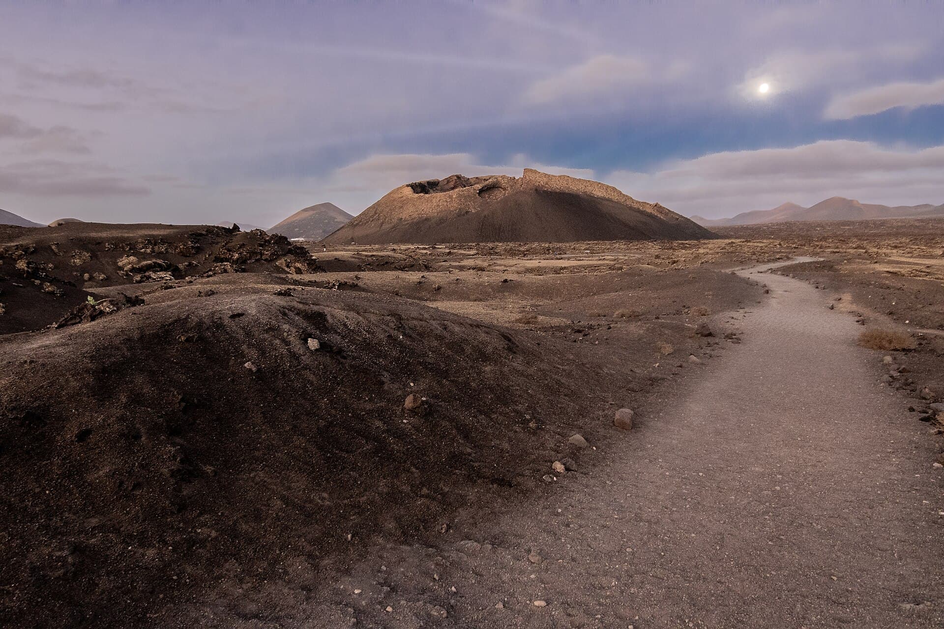
Montaña del Cuervo rises as a classic volcanic cone within Lanzarote’s protected volcanic landscape. Its dark slopes and open crater offer an immediate sense of the island’s fiery origins while providing wide views across the malpaís toward the Timanfaya volcanoes and the Atlantic. The short ascent rewards visitors with an intimate encounter with Lanzarote’s geology without requiring technical climbing skills.

Geology and Landscape

The mountain formed during the 1730–1736 eruptions that reshaped much of central Lanzarote. Its symmetrical cone and wide, bowl-shaped crater illustrate the explosive phase of those events. From the rim, visitors see layered lava flows, scattered volcanic bombs, and the contrasting green of surviving palm groves in the distance. The stark black-and-red palette changes subtly with the angle of sunlight, creating striking photographic opportunities at dawn and dusk.

Hiking the Cone

A well-defined path circles the outer slopes and climbs to the crater rim. The route is short yet steep in places, crossing loose volcanic gravel that demands steady footing. Once on top, a short loop around the crater edge reveals different vantage points over the surrounding lava fields. Most walkers complete the round trip in under two hours, making the mountain an ideal half-day outing that pairs easily with nearby sites.

Getting There

From Tinajo town, follow the LZ-56 road toward the volcanic park area and watch for the signed parking area at the base of the cone. The trailhead is reached by a short unpaved track suitable for ordinary cars. Those staying in Puerto del Carmen or Arrecife can drive the coastal route via the LZ-2 and LZ-67 in roughly 25 minutes. Public buses serve Tinajo, after which a taxi completes the journey.

Best Time to Visit

Early morning or late afternoon visits avoid the strongest sun and offer softer light for photography. Winter and spring months bring cooler temperatures and occasional wildflowers on the lower slopes. Summer hikers should start at first light and carry ample water, as the dark rock retains heat throughout the day.

Nearby Attractions

Combine the hike with the Timanfaya National Park visitor route, the Mancha Blanca visitor center, or the coastal viewpoints at El Golfo. The small village of Tinajo itself offers traditional Canarian restaurants and the Iglesia de San Roque for a cultural contrast to the volcanic terrain.

Visitor tips

  • Wear sturdy closed-toe shoes with good grip; the volcanic gravel is loose on the steeper sections.
  • Carry at least one liter of water per person and apply high-factor sunscreen, as shade is nonexistent on the cone.
  • Start the hike early in the morning to enjoy cooler temperatures and fewer visitors on the narrow crater rim path.

Frequently asked questions

How difficult is the hike to the crater rim?+

The trail is short but steep and involves loose volcanic material; most reasonably fit walkers manage it in 45u201360 minutes each way.

Is Montau00f1a del Cuervo inside Timanfaya National Park?+

It lies within the wider Parque Natural de Los Volcanes that surrounds the national park, so the same volcanic landscape rules apply.

Can children or older visitors manage the ascent?+

The path is manageable for fit children and active seniors, but the loose surface and lack of shade require caution and adequate preparation.

Are there facilities at the trailhead?+

A small parking area exists but no toilets, shops, or water points; plan accordingly before leaving Tinajo or the main road.

What is the best season for clear views?+

Winter through spring generally offers the clearest skies and mildest temperatures, though any season works if you avoid midday heat.

Share
Google Maps Apple Maps Directions

Image: GelitoAM · CC BY-SA 4.0 · via Wikimedia Commons

Keep reading

Nearby & related

All stories
Hermitage of Los Dolores: Lanzarote’s Quiet Pilgrimage Chapel in Tinajo
Tinajo

Hermitage of Los Dolores: Lanzarote’s Quiet Pilgrimage Chapel in Tinajo

A modest 18th-century shrine set among lava fields that draws locals and travelers seeking the island’s patron saint and…

12 November 2026
Pico Partido: Hiking Lanzarote’s Dramatic Volcanic Summit in Tinajo
Tinajo

Pico Partido: Hiking Lanzarote’s Dramatic Volcanic Summit in Tinajo

Discover the stark beauty of Pico Partido, a volcanic peak offering hikers sweeping views across Lanzarote’s lava fields…

12 November 2026