Skip to content
Plan & Tour
DestinationsItinerariesTravel BlogAboutContact
0Sign inPlan a trip
Plan & TourPlan & Tour

Travel guides, destination inspiration and curated itineraries for Canada, the USA and beyond, plus a free tool to plan your own day-by-day trip.

Get travel inspiration

Explore

  • All Destinations
  • Curated Itineraries
  • Travel Blog
  • Plan a Trip

Topics

  • Hiking & Nature
  • Food & Drink
  • City Breaks
  • Budget Travel

Company

  • About Us
  • Contact
  • Privacy Policy
  • Terms of Service

© 2026 Plan & Tour. Built for travellers.

Discover the world, one trip at a time.

Márquez River: Exploring Bolivia’s Remote Highland Waterway
  1. Home
  2. Destinations
  3. Bolivia
  4. Márquez River: Exploring Bolivia’s Remote Highland Waterway
River

Márquez River: Exploring Bolivia’s Remote Highland Waterway

The Márquez River carves through Bolivia’s Altiplano, providing a quiet corridor of water, wildlife, and dramatic volcanic scenery for travelers venturing beyond the salt flats.

BoliviaUpdated 13 October 2026

Why Visit the Márquez River

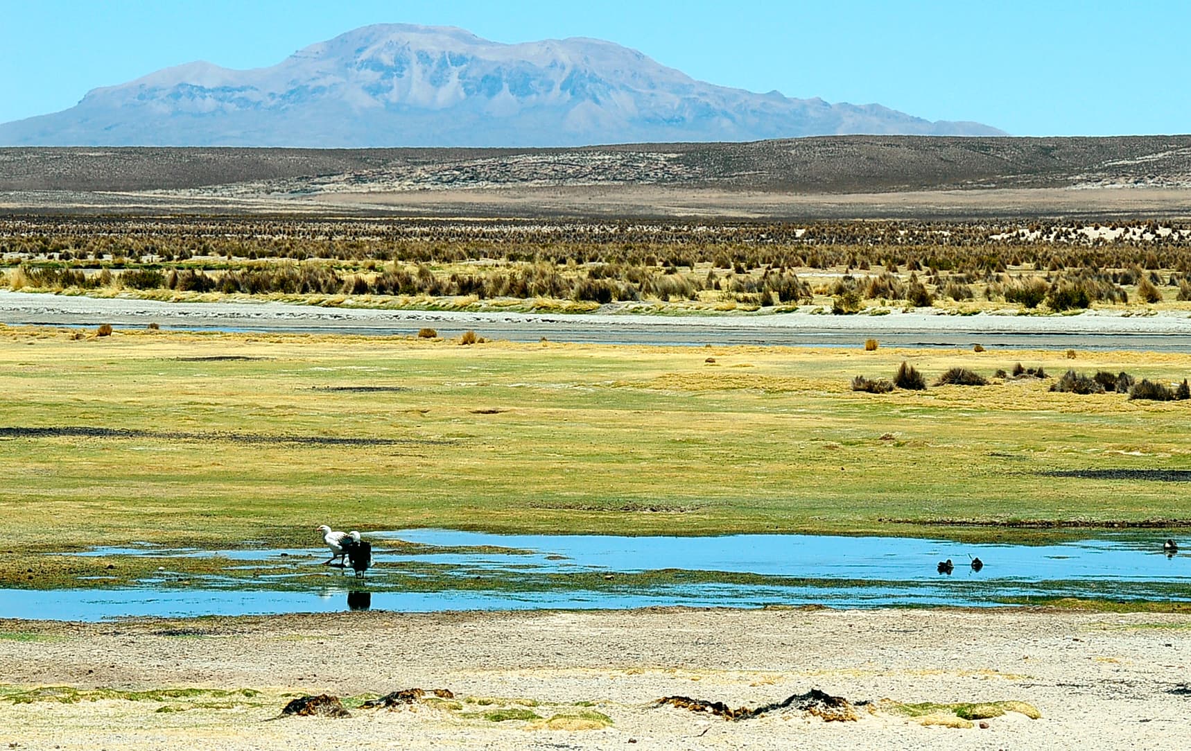
Flowing across the southern Altiplano in Bolivia’s Potosí Department, the Márquez River offers a rare ribbon of fresh water amid vast, arid plains and scattered volcanic peaks. Its clear, shallow stretches attract birdlife including flamingos and Andean geese, while the surrounding terrain features dramatic rock formations and distant views of snow-capped summits. Travelers seeking solitude find the river a peaceful counterpoint to the crowded Salar de Uyuni.

Activities Along the River

Short hikes follow the riverbanks on relatively flat terrain, allowing visitors to observe changing water levels and local vegetation. Photographers capture reflections of the sky and distant mountains, especially at sunrise. Birdwatching is rewarding near slower pools; bring binoculars and move quietly. Some sections permit careful wading or picnics on smooth river stones, though currents can rise quickly after rain.

Practical Considerations for Exploration

The river’s remote setting means no facilities exist on site. Visitors should carry all supplies, respect private land boundaries, and avoid disturbing livestock that graze nearby. Four-wheel-drive vehicles handle the unpaved access routes best, and local drivers familiar with seasonal flooding are recommended.

Getting There

Most travelers reach the Márquez River from Uyuni, roughly two hours northwest by road. The route passes through small villages and open pampa; a 4×4 and experienced driver are essential. Those coming from Potosí face a longer journey via unpaved roads that may close during heavy rains. No public transport serves the river directly.

Best Time to Visit

The dry season from May to October brings stable weather, lower river levels, and clearer skies for photography and hiking. January through March sees occasional flash floods that can block tracks and raise water levels, making access unreliable. Early morning visits minimize wind and maximize wildlife sightings.

Nearby Attractions

Combine a river visit with the vast Salar de Uyuni to the south or the volcanic landscapes of the Eduardo Avaroa Reserve further southwest. The colonial mining town of Potosí lies several hours east, offering historic streets and markets as a cultural contrast to the open highland scenery.

Visitor tips

  • Hire a local driver with a 4x4 vehicle familiar with seasonal road conditions.
  • Carry ample water, sun protection, and a first-aid kit, as no services exist on site.
  • Travel during the Mayu2013October dry season to avoid flash floods and closed tracks.

Frequently asked questions

Is the Mu00e1rquez River safe for swimming?+

The river is shallow in many places but currents can strengthen after rain; wading is possible with caution, but swimming is not advised due to cold temperatures and lack of rescue services.

Do I need a guide to visit the Mu00e1rquez River?+

A local driver is strongly recommended for navigation and safety on remote roads; independent travel is possible only with prior experience in the Altiplano and proper vehicle preparation.

What wildlife might I see along the river?+

Flamingos, Andean geese, and various shorebirds frequent the banks, especially near slower pools; early morning offers the best viewing opportunities.

Can I combine a visit with the Salar de Uyuni?+

Yes; most travelers pair the river with the salt flats, allowing a full-day loop from Uyuni that includes both landscapes.

Are there any cultural sites near the Mu00e1rquez River?+

Small Aymara communities nearby maintain traditional practices; respectful observation from a distance is welcomed, though formal tours are not organized.

Share
Google Maps Apple Maps Directions

Image: LBM1948 · CC BY-SA 4.0 · via Wikimedia Commons

Keep reading

Nearby & related

All stories
La Paz River: Rafting and Canyon Adventures in Bolivia
La Paz Department

La Paz River: Rafting and Canyon Adventures in Bolivia

Follow the La Paz River through Andean canyons from the highlands into the Yungas for rafting, scenery, and cultural…

13 October 2026
L
La Paz Department

Leque River: Bolivia’s Andean Waterway in La Paz Department

Follow the clear waters of the Leque River through rugged valleys and quiet Aymara communities in Bolivia’s La Paz…

13 October 2026
Tahuamanu River: Bolivia’s Remote Amazonian Waterway in Pando
Pando Department

Tahuamanu River: Bolivia’s Remote Amazonian Waterway in Pando

Venture deep into the Pando rainforest along the Tahuamanu River for wildlife-rich boat journeys and authentic jungle…

13 October 2026