
Skip to content
Plan & Tour
DestinationsItinerariesTravel BlogAboutContact
0Sign inPlan a trip
Plan & TourPlan & Tour

Travel guides, destination inspiration and curated itineraries for Canada, the USA and beyond, plus a free tool to plan your own day-by-day trip.

Get travel inspiration

Explore

  • All Destinations
  • Curated Itineraries
  • Travel Blog
  • Plan a Trip

Topics

  • Hiking & Nature
  • Food & Drink
  • City Breaks
  • Budget Travel

Company

  • About Us
  • Contact
  • Privacy Policy
  • Terms of Service

© 2026 Plan & Tour. Built for travellers.

Discover the world, one trip at a time.

Howson Peak: Hiking British Columbia’s Remote Coast Mountain Summit
  1. Home
  2. Destinations
  3. British Columbia
  4. Howson Peak: Hiking British Columbia’s Remote Coast Mountain Summit
Mountain

Howson Peak: Hiking British Columbia’s Remote Coast Mountain Summit

A remote northern BC peak offering sweeping alpine views, challenging routes, and pristine wilderness for experienced hikers.

British ColumbiaUpdated 31 July 2026

Why Visit Howson Peak

Howson Peak rises prominently in the Howson Range of British Columbia’s Coast Mountains, delivering dramatic ridgeline hiking and 360-degree vistas of glaciated peaks and deep valleys. Its isolation keeps crowds away, making it ideal for those seeking genuine backcountry solitude rather than crowded tourist trails.

Getting There

Access begins near Telkwa or Smithers along Highway 16. From there, forestry service roads lead toward the Howson Range trailheads; high-clearance vehicles are essential as surfaces turn rough and seasonal. The final approach often involves a multi-hour drive followed by a hike starting at lower elevations and climbing steadily through subalpine forest into open meadows.

Best Time to Visit

July through early September offers the most reliable snow-free conditions on the upper slopes. Wildflowers peak in late July, while September brings cooler temperatures and fewer insects. Winter visits require full mountaineering gear and avalanche awareness due to heavy snowfall.

What to See and Do

The standard route follows a long ridge with moderate scrambling sections and occasional exposure. Summit views encompass neighboring peaks in the Telkwa and Babine ranges plus distant coastal ranges on clear days. Photographers favor the golden-hour light on the surrounding tarns and heather meadows. Strong hikers can combine the ascent with overnight camping at high-elevation lakes for multi-day exploration.

Nearby Attractions

  • Babine Mountains Provincial Park offers additional trail networks and wildlife viewing.
  • Smithers provides resupply options and serves as a base for other Coast Mountain objectives.
  • Telkwa River valley features fishing and easy riverside walks for rest days.

Wildlife encounters are common; expect grizzly bears, mountain goats, and marmots in the alpine zone. Always practice leave-no-trace principles on this fragile terrain.

Visitor tips

  • Carry bear spray and know how to use it; the area has active grizzly populations.
  • Check current forestry road conditions with local resource offices before departure, as washouts can block access.
  • Pack layers and navigation tools; weather changes rapidly above treeline and cell service is nonexistent.

Frequently asked questions

How difficult is the hike to Howson Peak?+

It is a strenuous full-day outing for fit hikers with route-finding skills; expect 8-12 hours round trip including scrambling sections.

Do I need a guide or permit?+

No permits are required for day hikes, but guided trips are recommended for those new to remote alpine travel.

Is Howson Peak suitable for beginners?+

No; the route involves off-trail travel, exposure, and long distances best suited to experienced backcountry hikers.

What wildlife might I encounter?+

Grizzly bears, black bears, mountain goats, and hoary marmots are frequently seen; proper food storage is mandatory.

Are there camping options near the peak?+

Yes, several small alpine lakes offer scenic but exposed campsites; bring all water and practice strict leave-no-trace camping.

Share
Google Maps Apple Maps Directions

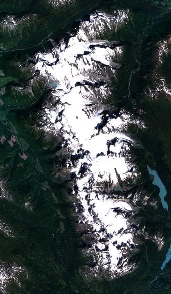
Image: NASA · Public domain · via Wikimedia Commons

Keep reading

Nearby & related

All stories
Vedder River: Salmon Fishing, Paddling and Riverside Trails in British Columbia
British Columbia

Vedder River: Salmon Fishing, Paddling and Riverside Trails in British Columbia

A clear, productive river in the Fraser Valley offering consistent chinook and coho runs, easy paddling and quiet hiking…

1 August 2026
E
British Columbia

Englishman River: Waterfalls, Forests and Salmon Runs on Vancouver Island

Hike to dramatic waterfalls, swim in clear pools, and watch salmon spawn along this Vancouver Island river.

1 August 2026
B
British Columbia

Bella Coola River: Wilderness Fishing and Grizzly Viewing in British Columbia’s Great Bear Rainforest

This remote river in the Bella Coola Valley offers world-class steelhead and salmon fishing, abundant wildlife, and…

1 August 2026

