
Keep reading
Nearby & related
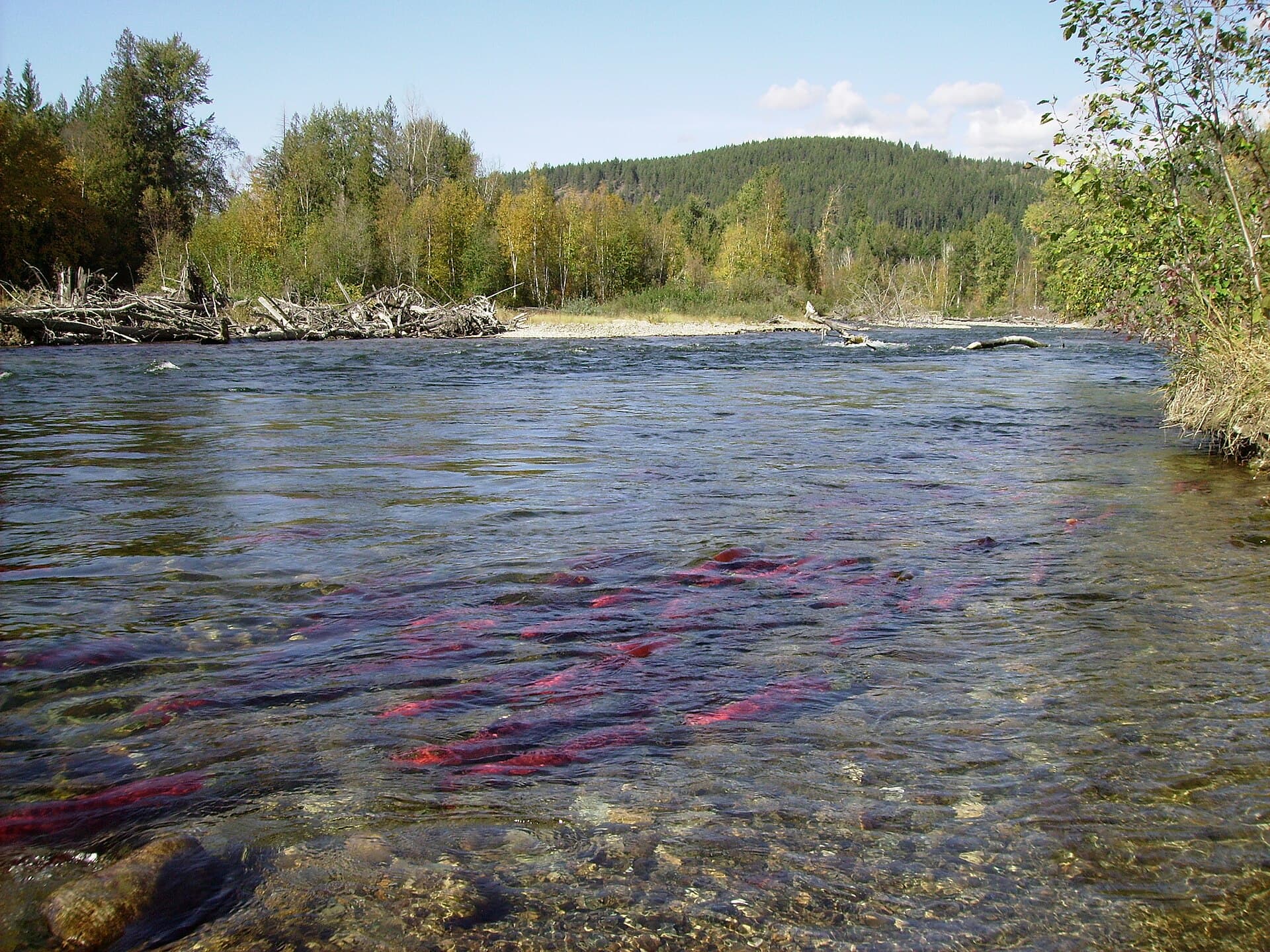
Chilkat River: Bald Eagle Capital Along the BC-Alaska Border
Float through salmon-rich waters teeming with eagles and bears in one of North America’s premier wildlife corridors.
1 July 2026
Howse Peak rises dramatically above the Icefields Parkway, offering serious climbers one of the Rockies’ most committing faces amid pristine subalpine wilderness.
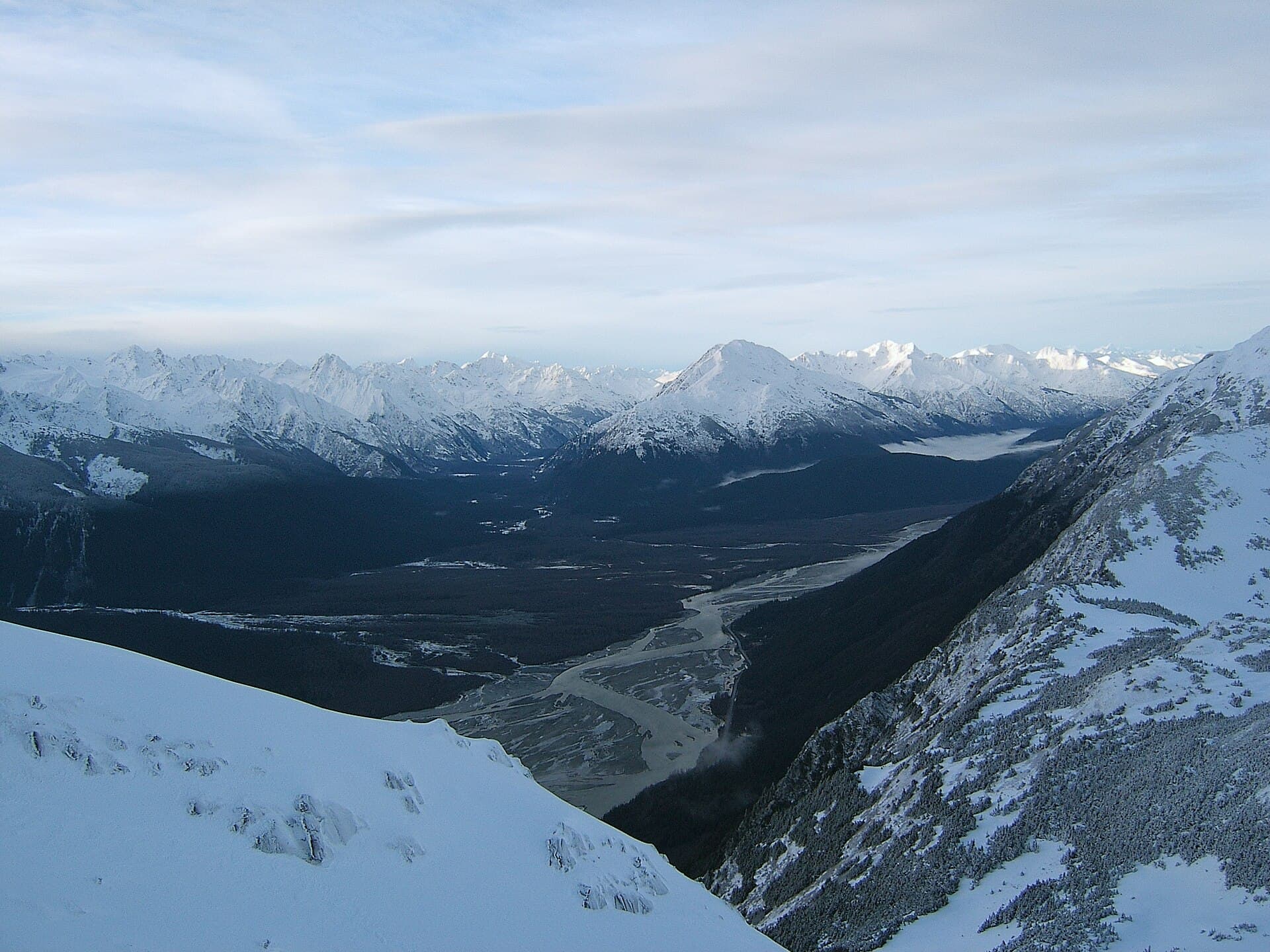
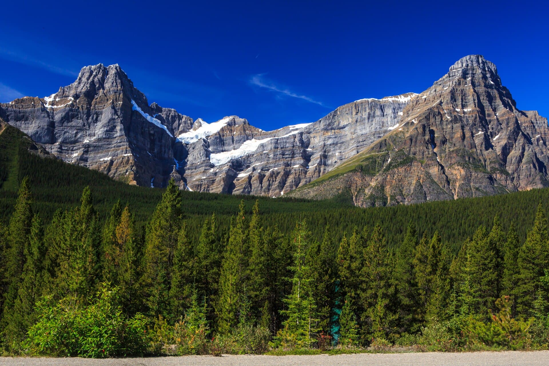
Howse Peak (3,290 m) anchors the northern end of the Waputik Range in Banff National Park. Its 1,200-metre north face ranks among the longest and most technically demanding alpine walls in the Canadian Rockies, drawing experienced mountaineers from around the world. Even for non-climbers the peak’s sheer profile and hanging glaciers create one of the most photographed roadside spectacles on the Icefields Parkway.
The mountain is reached via Highway 93, the Icefields Parkway, roughly 80 km north of Lake Louise. Pullouts near the Howse River bridge and the start of the Glacier Lake trail provide unobstructed views of the north face. No formal trail ascends the peak itself; visitors wanting closer contact hike or mountain-bike the 9 km Glacier Lake trail, then continue on informal paths toward the base of the east face. Four-wheel-drive roads to the Howse Pass area exist south of the peak but require high-clearance vehicles and are often washed out.
July through early September offers the longest daylight and most stable snow-free approaches for climbers. Road access is reliable then, wildflowers carpet the valley, and the north face is usually in condition. Shoulder seasons bring fewer people but higher avalanche risk and lingering snow on approach routes. Winter visits are limited to ski touring or snowshoeing from the highway; the face itself is rarely attempted outside summer.
Most visitors stop for photographs at the roadside pullouts. Those with more time can walk the flat Glacier Lake trail through old-growth forest to a turquoise lake directly beneath the east face. Photographers favor early-morning light on the north face or golden-hour reflections in the lake. Serious parties tackle multi-day routes on the north face or the technically easier but still committing east ridge; these require glacier travel skills, rock and ice protection, and strong route-finding ability. No facilities exist at the mountain; every visitor must be self-sufficient.
Keep reading
Float through salmon-rich waters teeming with eagles and bears in one of North America’s premier wildlife corridors.
No. Casual visitors enjoy roadside views and the Glacier Lake hike without any technical skills. Only those attempting the faces require advanced mountaineering experience.
There is no maintained summit trail. The peak is reached only by committing alpine routes suitable for experienced parties.
Waterfowl Lakes campground lies 10 km south; backcountry camping is permitted at designated sites along the Glacier Lake trail with a Parks Canada permit.
Grizzly and black bears, mountain goats, and hoary marmots are regularly seen. Stay alert on the trail and store food properly.
Yes. The north face is visible from the Icefields Parkway year-round, though snow-covered roads and avalanche closures can limit access between November and May.
Follow the Similkameen River through dramatic canyons, fertile orchards, and quiet parks in the heart of the Similkameen…
Discover the dramatic sockeye salmon runs, clear waters, and surrounding forests of Adams River in British Columbia’s…
