Skip to content
Plan & Tour
DestinationsItinerariesTravel BlogAboutContact
0Sign inPlan a trip
Plan & TourPlan & Tour

Travel guides, destination inspiration and curated itineraries for Canada, the USA and beyond, plus a free tool to plan your own day-by-day trip.

Get travel inspiration

Explore

  • All Destinations
  • Curated Itineraries
  • Travel Blog
  • Plan a Trip

Topics

  • Hiking & Nature
  • Food & Drink
  • City Breaks
  • Budget Travel

Company

  • About Us
  • Contact
  • Privacy Policy
  • Terms of Service

© 2026 Plan & Tour. Built for travellers.

Discover the world, one trip at a time.

Della Falls: Canada’s Tallest Waterfall on Vancouver Island
  1. Home
  2. Destinations
  3. British Columbia
  4. Della Falls: Canada’s Tallest Waterfall on Vancouver Island
Waterfall

Della Falls: Canada’s Tallest Waterfall on Vancouver Island

A remote trek through Strathcona Provincial Park leads to British Columbia's highest cascade and pristine alpine scenery.

British ColumbiaUpdated 1 July 2026

Why Della Falls Stands Out

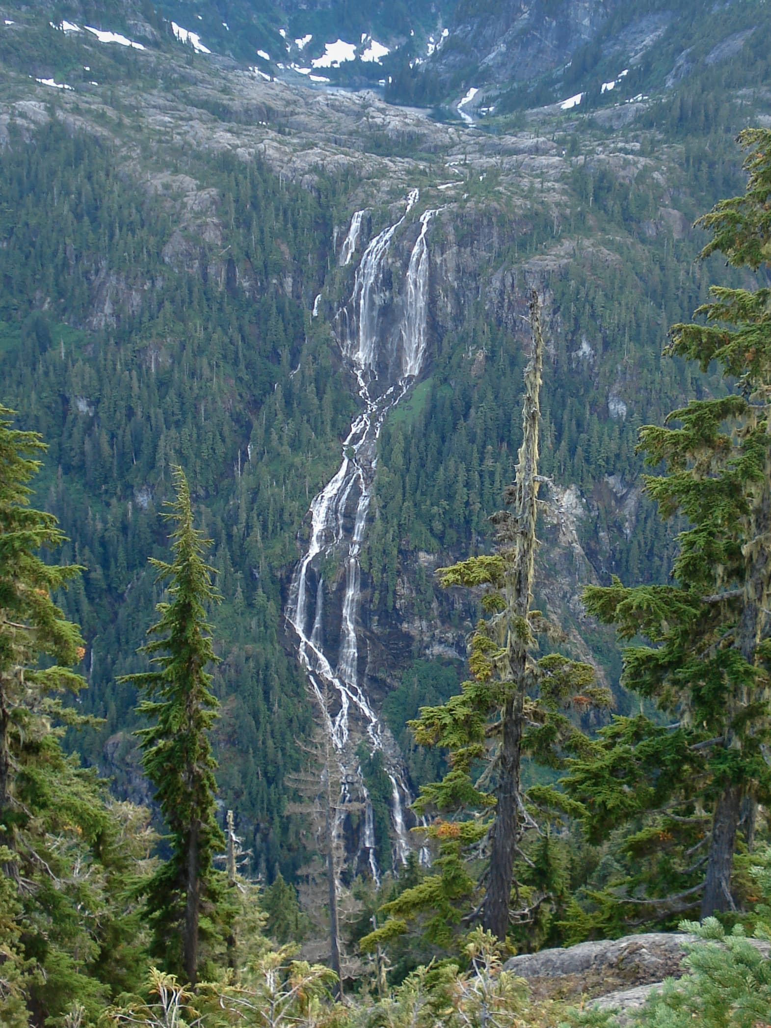
Della Falls drops in a series of powerful tiers from a hanging valley on Vancouver Island, creating one of the most dramatic vertical landscapes in Canada. The waterfall plunges from the slopes of Mount Septimus into Della Lake, surrounded by old-growth forest and rugged peaks that remain largely untouched. Visitors who make the journey experience the scale of coastal mountain wilderness rather than a quick roadside viewpoint.

Planning Your Journey

Access begins at the town of Port Alberni. From there, travelers take a water taxi across Great Central Lake to the trailhead at the lake’s western end. The subsequent hike follows the Della Falls Trail for roughly 16 kilometres one way, gaining elevation steadily through temperate rainforest before reaching subalpine meadows and the base of the falls. Most visitors allow two full days for the round trip, camping at designated sites along the route.

Trail Highlights

The path crosses several bridged creeks and passes through stands of cedar and hemlock. Near the end, the trail climbs beside the lower cascades before opening to views of the main drop. Della Lake itself offers a reflective foreground for photographs when weather cooperates.

Best Time to Visit

Late spring through early autumn provides the most reliable conditions. Snow lingers on higher sections into June in some years, while July and August bring longer days and lower water levels that make creek crossings easier. September often delivers clear skies and fewer insects, though nights grow cooler.

Nearby Destinations

After the falls, many extend their trip within Strathcona Provincial Park to Buttle Lake or the Forbidden Plateau area. The coastal communities of Tofino and Ucluelet lie a few hours west, offering ocean beaches and rainforest boardwalks as a contrast to the inland peaks.

Visitor tips

  • Book water-taxi transport in advance during peak summer months, as capacity is limited.
  • Carry bear spray and know how to use it; black bears frequent the valley.
  • Pack layers and waterproof gearu2014the trail receives frequent rain even in summer.

Frequently asked questions

How tall is Della Falls?+

It is recognized as the tallest waterfall in Canada, with a total drop exceeding 440 metres across multiple tiers.

Do I need a permit to hike to Della Falls?+

No special permit is required for day hiking, but backcountry camping in Strathcona Provincial Park requires a valid park use permit obtained in advance.

Is the trail suitable for beginners?+

The route is long and moderately strenuous with elevation gain; it is best suited to experienced hikers comfortable with multi-day trips and variable weather.

Can I see the falls without hiking the full trail?+

Limited views are possible from the water taxi on Great Central Lake, but the full height and setting are only visible after completing the hike to Della Lake.

Are there facilities at the trailhead or along the route?+

There are no services beyond basic pit toilets at the trailhead and designated campsites; visitors must be fully self-sufficient with food, water, and shelter.

Share
Google Maps Apple Maps Directions

Image: Rob Dabal · CC BY-SA 3.0 · via Wikimedia Commons

Keep reading

Nearby & related

All stories
Chilkat River: Bald Eagle Capital Along the BC-Alaska Border
British Columbia

Chilkat River: Bald Eagle Capital Along the BC-Alaska Border

Float through salmon-rich waters teeming with eagles and bears in one of North America’s premier wildlife corridors.

1 July 2026
Similkameen River: A Scenic Waterway Through British Columbia’s Southern Valleys
British Columbia

Similkameen River: A Scenic Waterway Through British Columbia’s Southern Valleys

Follow the Similkameen River through dramatic canyons, fertile orchards, and quiet parks in the heart of the Similkameen…

1 July 2026
Adams River: Witnessing British Columbia’s Legendary Sockeye Salmon Migration
British Columbia

Adams River: Witnessing British Columbia’s Legendary Sockeye Salmon Migration

Discover the dramatic sockeye salmon runs, clear waters, and surrounding forests of Adams River in British Columbia’s…

1 July 2026


