Skip to content
Plan & Tour
DestinationsItinerariesTravel BlogAboutContact
0Sign inPlan a trip
Plan & TourPlan & Tour

Travel guides, destination inspiration and curated itineraries for Canada, the USA and beyond, plus a free tool to plan your own day-by-day trip.

Get travel inspiration

Explore

  • All Destinations
  • Curated Itineraries
  • Travel Blog
  • Plan a Trip

Topics

  • Hiking & Nature
  • Food & Drink
  • City Breaks
  • Budget Travel

Company

  • About Us
  • Contact
  • Privacy Policy
  • Terms of Service

© 2026 Plan & Tour. Built for travellers.

Discover the world, one trip at a time.

Cumbre Vieja Natural Park: Hiking La Palma’s Volcanic Ridges and Lava Fields
  1. Home
  2. Destinations
  3. Santa Cruz de Tenerife Province
  4. Cumbre Vieja Natural Park: Hiking La Palma’s Volcanic Ridges and Lava Fields
Park

Cumbre Vieja Natural Park: Hiking La Palma’s Volcanic Ridges and Lava Fields

Explore dramatic volcanic trails, pine forests, and panoramic views in this rugged natural park on La Palma.

Santa Cruz de Tenerife ProvinceUpdated 12 November 2026

Why Visit Cumbre Vieja Natural Park

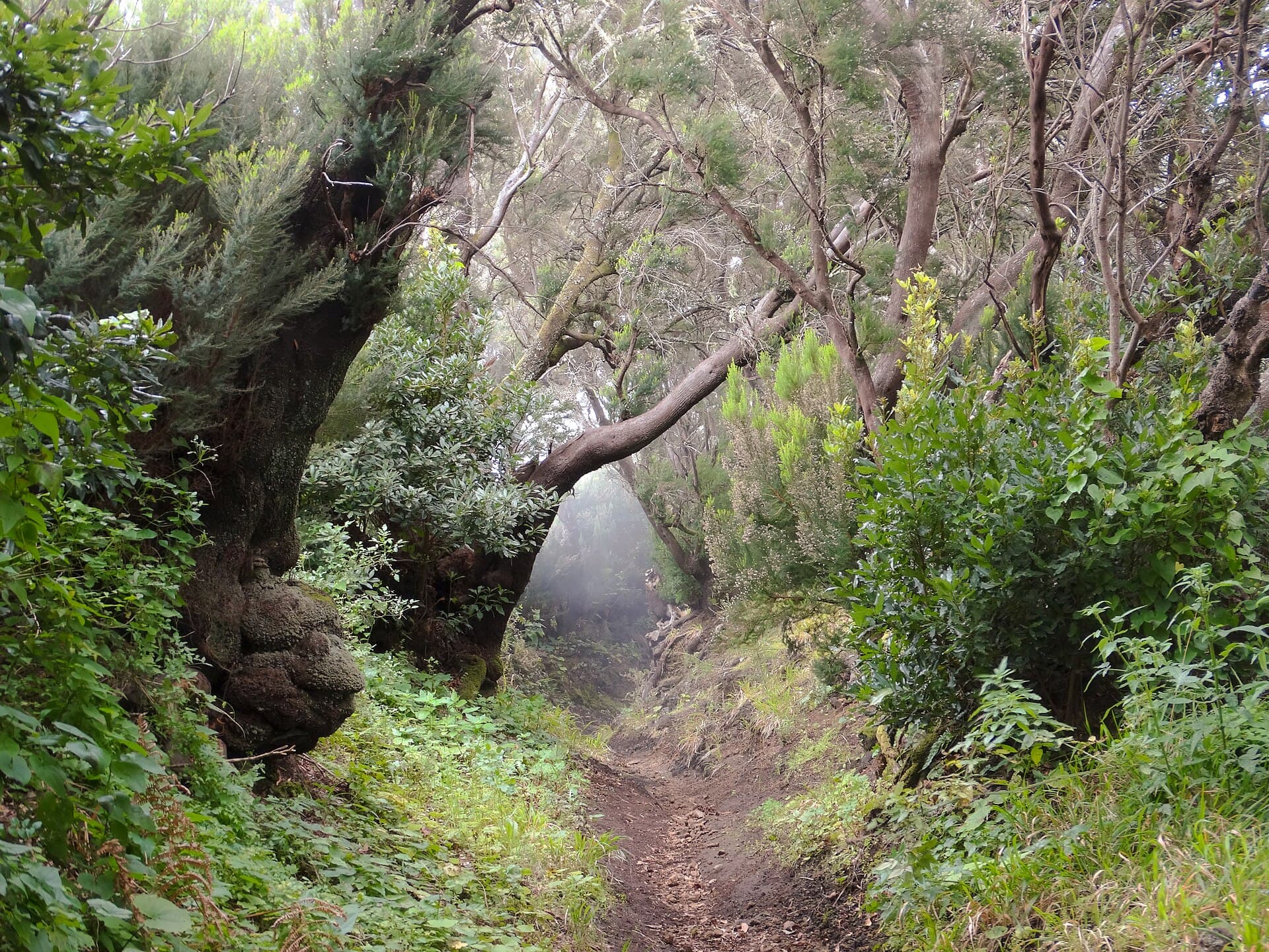
Cumbre Vieja Natural Park covers the southern half of La Palma in the Canary Islands, showcasing stark volcanic ridges, recent lava flows, and dense Canary pine forests. The park’s landscape formed over thousands of years of eruptions, creating a stark contrast between black lava fields and green highland vegetation that draws hikers seeking dramatic scenery without crowds.

Key Attractions and Activities

Visitors come primarily for the network of well-marked hiking trails that traverse the park’s central ridge. The GR-131 long-distance path runs the length of the park, offering continuous ridge-top views of both coasts. Shorter options include the circular route around the 1949 San Juan volcano crater and paths leading to the Fuencaliente lighthouse, where old lava flows meet the Atlantic. Birdwatchers often spot laurel forest species and raptors along the higher elevations.

Scattered viewpoints such as Mirador de los Llanos and Mirador de las Hoyas provide sweeping vistas over the island’s volcanic spine and distant Tenerife on clear days. The park also preserves stands of endemic flora like the Canary pine and various orchids that thrive in the volcanic soil.

Planning Your Visit

The best months to explore are spring and autumn when temperatures remain mild and rainfall is lower. Summer brings stronger sun exposure on the exposed ridges, while winter can deliver sudden showers and reduced visibility. Wear layered clothing and sturdy footwear, as many trails cross loose volcanic gravel.

Getting There and Getting Around

Most travelers reach the park by rental car from Santa Cruz de La Palma or Los Llanos de Aridane, with main access roads climbing from the LP-2 and LP-3 highways. Limited bus services connect larger villages on the park’s edges, but a car offers the flexibility needed to reach trailheads and viewpoints. Several parking areas sit near popular starting points such as the Refugio de El Pilar.

Nearby Destinations

Combine a park visit with the Caldera de Taburiente National Park to the north or the coastal wine region around Fuencaliente. The small towns of El Paso and Los Canarios provide simple restaurants serving local goat cheese and wrinkled potatoes.

Visitor tips

  • Carry at least two liters of water per person, as few trails have reliable water sources.
  • Download offline maps before setting out, since mobile coverage drops in many remote sections of the ridge.
  • Start hikes early to avoid afternoon clouds that often obscure viewpoints along the crest.

Frequently asked questions

How difficult are the hiking trails in Cumbre Vieja Natural Park?+

Trails range from moderate ridge walks on the GR-131 to more strenuous ascents over loose volcanic terrain. Beginners can enjoy shorter loops near El Pilar while experienced hikers tackle longer sections of the ridge.

Is Cumbre Vieja safe to visit after recent volcanic activity?+

The park remains open and monitored. Official trails avoid active or unstable zones, but always check current access notices at visitor centers before heading out.

Do I need a guide for hiking in the park?+

Most trails are clearly signed and suitable for independent hikers with basic navigation skills. Guided walks are available from local operators if you prefer company or deeper geological insights.

What wildlife might I see in Cumbre Vieja Natural Park?+

Look for laurel forest birds, buzzards, and the occasional endemic lizard. Mammals are scarce, though goats sometimes graze the higher slopes.

Are there facilities like toilets or cafu00e9s inside the park?+

Only basic shelters and occasional picnic areas exist. Plan to bring all supplies and use facilities in nearby villages before entering trail sections.

Share
Google Maps Apple Maps Directions

Image: Fährtenleser · CC BY-SA 4.0 · via Wikimedia Commons

Keep reading

Nearby & related

All stories
P
Santa Cruz de Tenerife Province

Playa de Bajamar: Tenerife’s Rugged Black-Sand Beach and Natural Pools

Find calm volcanic shores, dramatic cliffs, and tide-fed rock pools on Tenerife’s wild northern coast.

12 November 2026
Playa de Benijo: Tenerife’s Rugged Black-Sand Beach in the Anaga Mountains
Santa Cruz de Tenerife Province

Playa de Benijo: Tenerife’s Rugged Black-Sand Beach in the Anaga Mountains

A dramatic pebble cove backed by steep cliffs and Atlantic waves, offering hikers and photographers an untamed slice of…

12 November 2026
Playa de las Vistas: Tenerife’s Golden-Sand Family Beach in Los Cristianos
Santa Cruz de Tenerife Province

Playa de las Vistas: Tenerife’s Golden-Sand Family Beach in Los Cristianos

A calm, accessible stretch of imported golden sand with a lively promenade, ideal for swimming and relaxed days on…

12 November 2026