Mount Robson: Scaling the Highest Peak in the Canadian Rockies
Explore the dramatic landscapes, premier hiking trails, and towering presence of Mount Robson in British Columbia's Rocky Mountains.
Why Visit Mount Robson
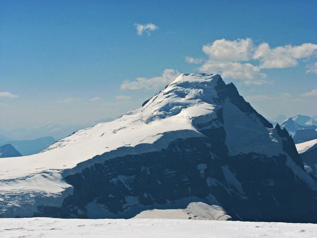
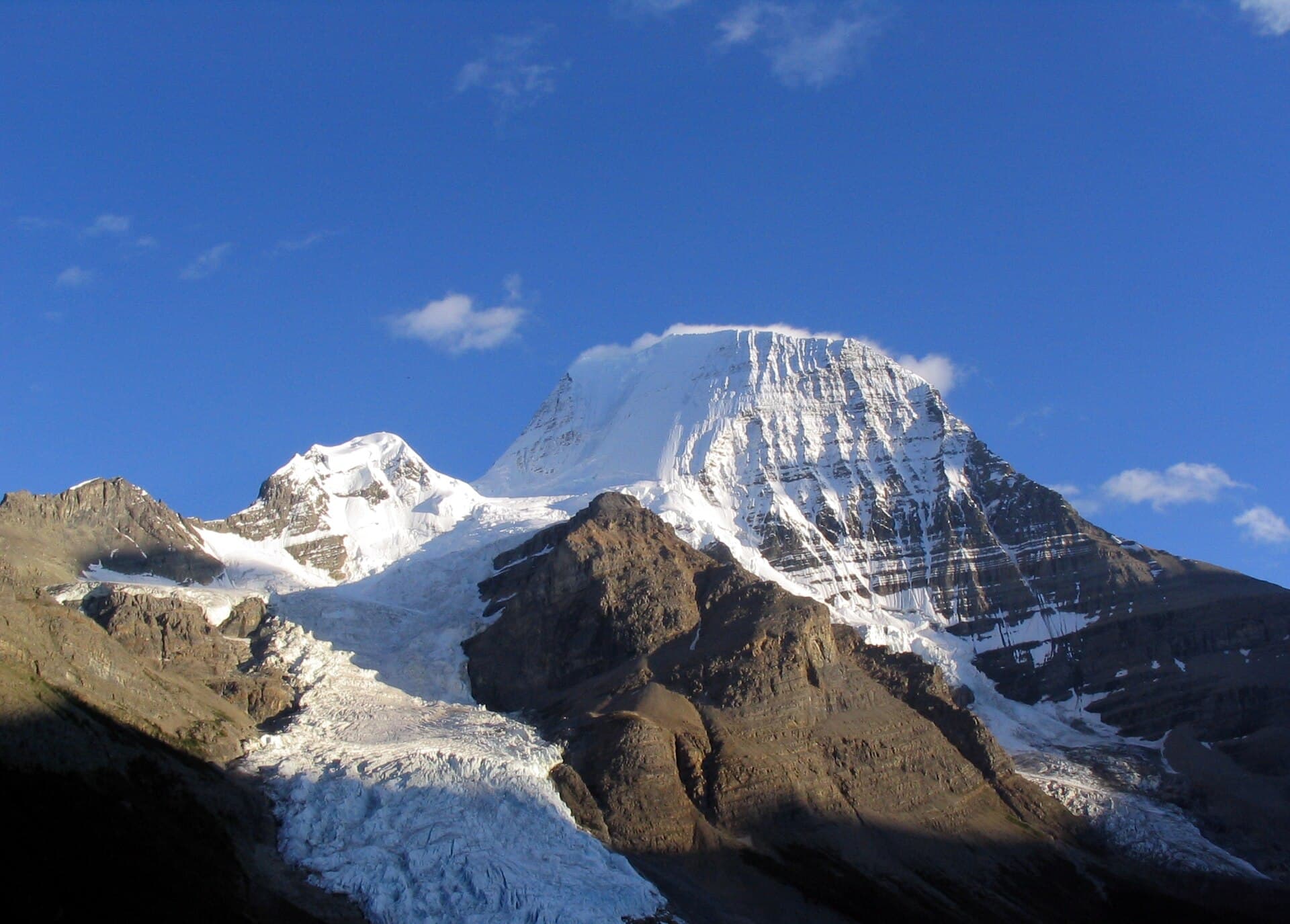
Mount Robson rises to 3,954 metres as the tallest summit in the Canadian Rockies, dominating the skyline of Mount Robson Provincial Park. Its sheer north face and hanging glaciers create one of the most photographed scenes along the Yellowhead Highway, drawing visitors who seek both roadside vistas and multi-day wilderness adventures.
Signature Experiences
The Berg Lake Trail
The premier route leads 22 kilometres one way from the trailhead near the park visitor centre to Berg Lake at the mountain’s base. Hikers pass through old-growth forest, cross the Robson River, and gain steady elevation before reaching the milky waters of the lake with Robson’s icefall looming above. Side trails reach Emperor Falls and the Robson Glacier viewpoint.
Scenic Drives and Viewpoints
The Trans-Canada Yellowhead Highway (Highway 16) offers continuous panoramas of the peak without leaving pavement. Key pullouts include the Mount Robson Viewpoint west of the park entrance and the Overlander Falls area, where the Fraser River cuts through narrow canyons.
Wildlife and Photography
Early morning and late evening light often reveal mountain goats on cliffs and grizzly bears foraging in valley meadows. Photographers favour the reflective surface of Berg Lake at sunrise when the peak catches alpenglow.
How to Get There
The mountain sits along Highway 16 between Jasper, Alberta, and Prince George, British Columbia. Most travellers fly into Edmonton International Airport (five hours’ drive) or Vancouver (seven hours). The nearest town with services is Valemount, 45 minutes west. No public transit reaches the trailhead, so a vehicle is essential.
Best Time to Visit
July through September offers snow-free trails and stable weather for hiking and camping. June and October bring fewer crowds but lingering snow or early storms. Winter access is limited to snowshoeing or ski touring near the highway corridor.
Nearby Attractions
- Jasper National Park lies 80 kilometres east, featuring Maligne Lake and the Columbia Icefield.
- The Fraser River offers rafting and fishing opportunities downstream from Valemount.
- Smaller provincial parks such as Rearguard Falls provide short interpretive walks along the Fraser.
Visitor tips
- Reserve backcountry campsites on the Berg Lake Trail well in advance through BC Parks reservations, especially for July and August.
- Carry bear spray, know how to use it, and make noise on the trail; grizzlies frequent the valley bottoms.
- Check avalanche and weather forecasts before any off-trail travel; sudden storms can drop temperatures and visibility rapidly even in summer.
Frequently asked questions
How difficult is the Berg Lake Trail?
The trail is rated moderate to strenuous with 800 metres of elevation gain over 22 kilometres; most fit hikers complete it in two days with an overnight at one of the designated campgrounds.
Do I need a permit to hike Mount Robson?
Day hikes require no permit, but overnight stays on the Berg Lake Trail need a backcountry camping reservation from BC Parks.
Can beginners climb to the summit of Mount Robson?
The standard route involves technical glacier travel and rock climbing rated 5.4 or harder; it is suitable only for experienced, guided parties.
Are there shorter hikes near Mount Robson?
Yes, the 1.2-kilometre Overlander Falls Trail and the 4.8-kilometre Kinney Lake Trail both offer excellent views with far less effort.
What wildlife might I encounter?
Grizzly and black bears, mountain goats, hoary marmots, and woodland caribou are regularly seen; proper food storage is mandatory at all campsites.