
San Antonio Volcano: Hiking La Palma’s Striking Volcanic Crater
Explore the rugged cinder cone and sweeping Atlantic views at San Antonio in Fuencaliente de La Palma.
Why San Antonio Stands Out
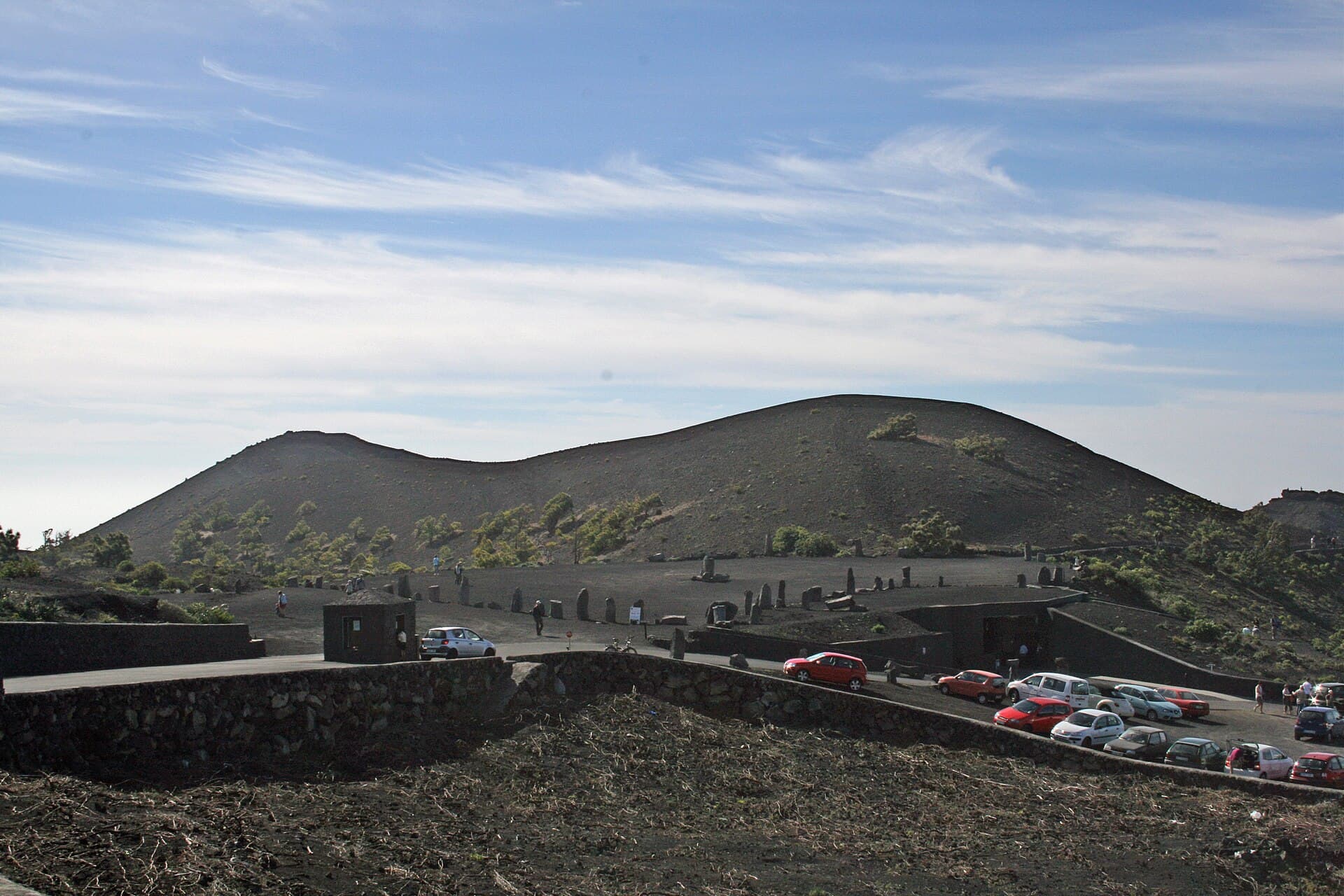
San Antonio is a classic Canary Islands cinder cone rising above the southern tip of La Palma. Its dark slopes and wide crater offer an immediate sense of the island’s volcanic origins, with clear sightlines across the ocean to neighboring islands on good days. The site sits within the Fuencaliente municipality, surrounded by recent lava fields and the famous salt pans of Las Salinas.
Getting There and Practical Access
Most visitors reach San Antonio by car along the LP-2 road that runs through Fuencaliente. A signed turnout leads to a small parking area at the base of the cone. From there a well-defined path climbs steadily to the crater rim. The route is short yet steep, gaining roughly 200 meters in elevation over less than a kilometer. Public buses stop in the village of Fuencaliente, but the final approach is easiest by taxi or rental car.
Best Time to Visit
The southern coast enjoys mild temperatures year-round, yet winter months bring stronger winds and occasional showers. Spring and autumn offer the clearest skies and most comfortable hiking conditions. Summer visits are possible but start early to avoid midday heat on the exposed black rock.
Hiking the Crater Rim
The trail circles the entire rim, revealing layered volcanic deposits and the deep, funnel-shaped crater floor. Short spurs drop to viewpoints overlooking the 1971 Teneguía lava flows that stretch toward the sea. The surface is loose scoria in places, so sturdy footwear is essential. Allow 45 to 90 minutes for a relaxed circuit that includes photo stops.
Extending Your Walk
Combine the crater hike with the coastal path that links San Antonio to the Teneguía lighthouse and black-sand beaches. The route passes through vineyards planted in volcanic soil, producing the island’s distinctive malvasia wines. Carry plenty of water; there are no facilities on the mountain itself.
Nearby Attractions Worth Adding
- The working salt evaporation ponds of Las Salinas, visible from the crater rim and reachable by a short drive.
- The Teneguía volcano viewpoint and its surrounding lava tubes.
- The small harbor at Puerto Naos for a swim after the hike.
These sites together give a complete picture of how volcanic activity has shaped both the landscape and local livelihoods in southern La Palma.
Visitor tips
- Wear sturdy shoes with good grip; the crater path crosses loose volcanic gravel.
- Start early in the day to avoid strong midday winds and heat on the exposed slopes.
- Bring at least two liters of water per person; no services exist on the mountain.
- Combine the visit with a stop at the nearby salt pans for a full picture of the volcanic coast.
Frequently asked questions
How difficult is the hike to San Antonio crater?
The trail is short but steep, gaining about 200 meters over less than a kilometer. Most reasonably fit visitors manage the round trip in under two hours.
Is San Antonio safe to visit after recent volcanic activity on La Palma?
San Antonio itself has been quiet for decades. The 2021 eruption occurred farther north; the site remains open and monitored by local authorities.
Can I reach San Antonio without a car?
Buses run to Fuencaliente village, but the final stretch to the trailhead requires a taxi or a walk along the main road. Most visitors rent a car for flexibility.
Are there any facilities at the volcano?
No. There are no restrooms, water, or food vendors at the parking area or on the crater rim. Plan accordingly.
What should I wear for the hike?
Sturdy closed shoes, sun protection, and a windproof layer are recommended. The black rock absorbs heat quickly and the rim is often windy.
Can I see the ocean from the crater?
Yes. On clear days the rim offers panoramic views across the Atlantic and toward the neighboring islands of El Hierro and La Gomera.