
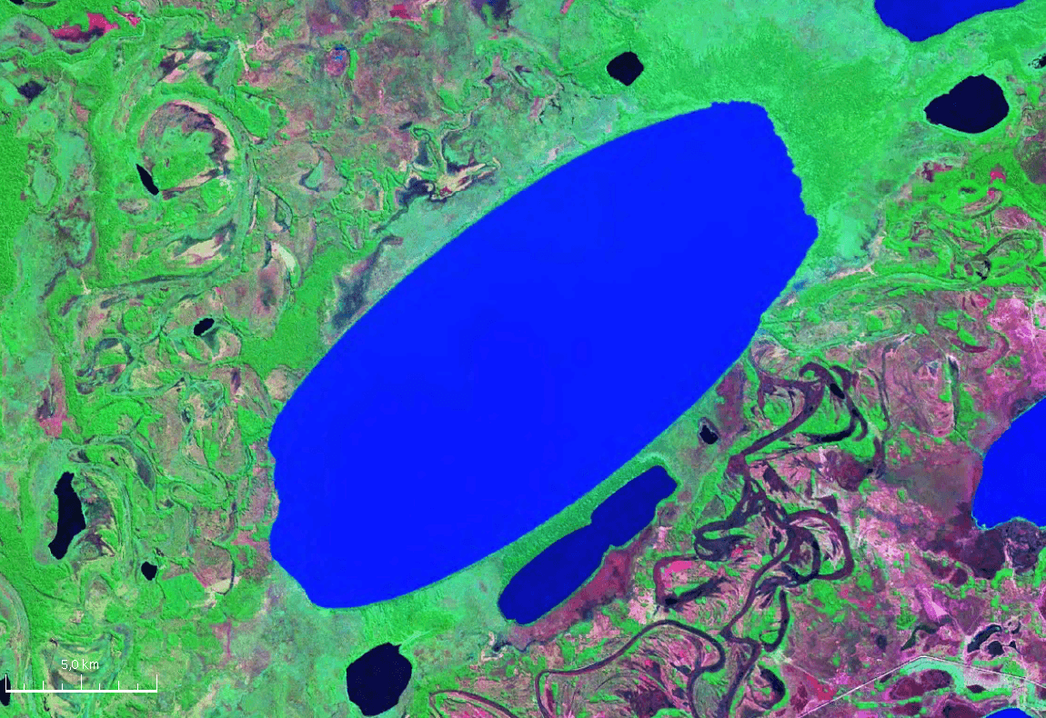
Rogagua Lake: Bolivia’s Remote Amazonian Wetland Escape
A vast, wildlife-rich lake in José Ballivián Province offering authentic lowlands wilderness far from tourist crowds.
Why Rogagua Lake Stands Out
Rogagua Lake sits in the flat savanna and gallery-forest landscape of Bolivia’s Beni lowlands, forming part of the vast Llanos de Moxos wetland system. Its open waters and surrounding palm swamps support large populations of waterbirds, caimans, and fish that sustain local indigenous communities. The lake’s size and seasonal water-level changes create an ever-shifting mosaic of islands and channels that reward patient observers.
Getting There
Most visitors reach the lake from Rurrenabaque or Reyes by 4×4 vehicle or light aircraft to nearby strips, followed by a boat transfer arranged with local communities. Roads are unpaved and can become impassable after heavy rain, so travel is best planned with experienced drivers familiar with the area. The nearest reliable fuel and supplies are in San Borja or Reyes.
Best Time to Visit
The dry season from May through October offers the most reliable access and clearer boat routes. During the wet months the lake expands dramatically, submerging trails and limiting overland travel, although bird concentrations can be spectacular at the edges of flooded forest.
What to See and Do
- Boat excursions across the open lake to observe sunbathing caimans and flocks of herons and ibis.
- Early-morning or late-afternoon visits to gallery forest for howler monkeys and colorful parrots.
- Guided fishing trips targeting species such as pacú and sábalo, practiced sustainably with local fishers.
- Stargazing from simple campsites on the lake’s eastern shore, where light pollution is minimal.
Nearby Attractions
Travelers often combine a Rogagua visit with Laguna Rogaguado to the north or the forested hills near the Beni River. Both sites lie within the same wetland corridor and share similar ecosystems and community-based guiding services.
Visitor tips
- Hire local boatmen through community tourism associations rather than arriving independently; they know shifting sandbars and nesting zones.
- Pack lightweight long sleeves, strong insect repellent, and a good hatu2014mosquitoes are active year-round near the water.
- Carry cash in small denominations; there are no ATMs or card facilities near the lake.
Frequently asked questions
How large is Rogagua Lake?
It stretches roughly 20 kilometers long and up to 8 kilometers wide at peak dry-season levels, making it one of the larger permanent water bodies in the Beni savannas.
Can I swim in Rogagua Lake?
Swimming is possible but not recommended because of caimans and occasional stingrays; most visitors stay in boats.
Are there lodges at the lake?
There are no formal hotels; simple community-run campsites and basic shelters are available by prior arrangement.
Is Rogagua Lake suitable for families with children?
The remote setting and lack of medical facilities make it better suited to adults and older children comfortable with basic conditions.
What permits or fees apply?
Access is arranged through local communities; modest contributions support conservation and village projects rather than formal park fees.