Skip to content
Plan & Tour
DestinationsItinerariesTravel BlogAboutContact
0Sign inPlan a trip
Plan & TourPlan & Tour

Travel guides, destination inspiration and curated itineraries for Canada, the USA and beyond, plus a free tool to plan your own day-by-day trip.

Get travel inspiration

Explore

  • All Destinations
  • Curated Itineraries
  • Travel Blog
  • Plan a Trip

Topics

  • Hiking & Nature
  • Food & Drink
  • City Breaks
  • Budget Travel

Company

  • About Us
  • Contact
  • Privacy Policy
  • Terms of Service

© 2026 Plan & Tour. Built for travellers.

Discover the world, one trip at a time.

Q’asiri: Trekking Bolivia’s Remote Andean Peak in Larecaja
  1. Home
  2. Destinations
  3. La Paz Department
  4. Q’asiri: Trekking Bolivia’s Remote Andean Peak in Larecaja
Mountain

Q’asiri: Trekking Bolivia’s Remote Andean Peak in Larecaja

Ascend the dramatic slopes of Q'asiri for high-altitude adventure amid the Cordillera Real's jagged summits.

La Paz DepartmentUpdated 12 October 2026

Why Q’asiri Stands Out

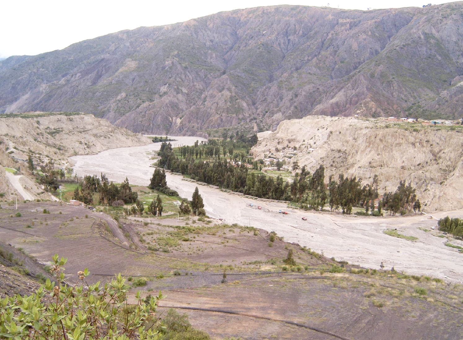
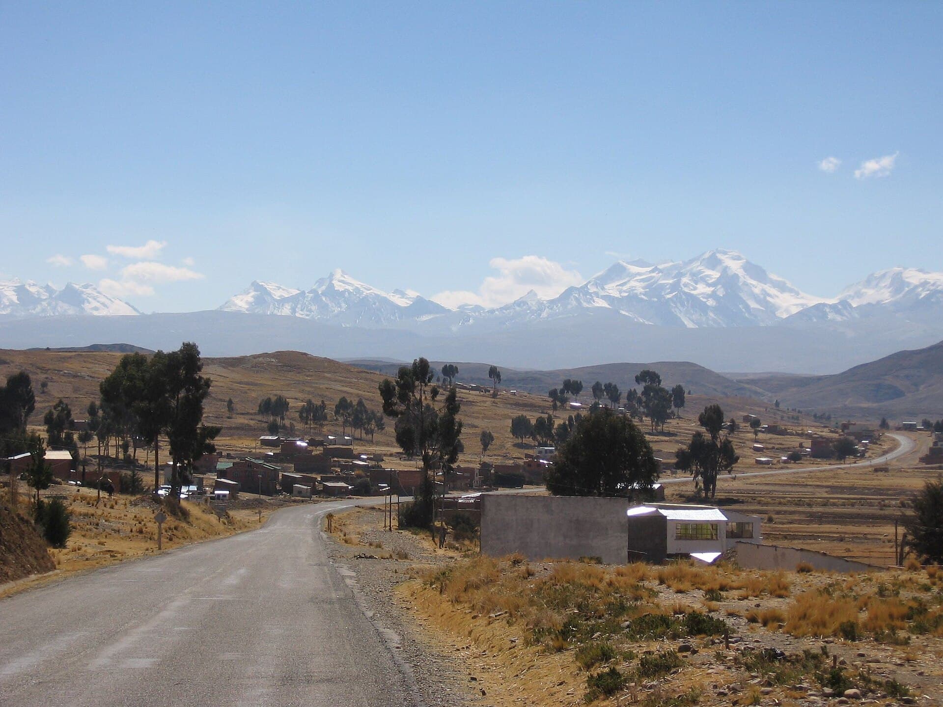
Q’asiri rises as a striking peak in Bolivia’s Cordillera Real, offering climbers and trekkers an accessible yet demanding route through high Andean terrain. Its position in Larecaja province delivers sweeping views of neighboring giants like Illampu and Ancohuma without the crowds found on more famous Bolivian summits. The mountain’s rocky ridges and glacial remnants create a stark, beautiful landscape shaped by centuries of wind and ice.

Getting There

Travel begins in La Paz, where visitors arrange transport north through the Yungas road toward Sorata. From Sorata, local vehicles or hired drivers reach trailheads near the village of Ancohuma or higher base camps. The approach crosses high plateaus and passes through small Aymara communities, providing cultural context alongside the natural scenery. Four-wheel-drive vehicles handle the rough roads best; the final stretches often require walking or mule support.

Best Time to Visit

The clearest weather and most stable conditions occur during the dry season from May through September. These months minimize snow and rain, improving visibility and trail safety on steep sections. Shoulder months like April and October can still work for experienced visitors willing to carry extra gear for variable conditions.

Activities and Routes

Most visitors combine trekking with a summit attempt. Popular routes start from camps at 4,800 meters and ascend via southwest ridges, passing through moraine fields and occasional snow patches. The climb rewards with panoramic views across Lake Titicaca to the west and the Amazon basin lowlands to the east. Non-climbers enjoy multi-day hikes around the base, spotting vicuñas and Andean condors along the way.

Nearby Attractions

After time on Q’asiri, many extend their trip to Sorata for its colonial architecture and fruit markets, or continue to the shores of Lake Titicaca for cultural visits to Isla del Sol. The surrounding valleys also offer shorter day hikes to glacial lakes and traditional weaving villages.

Preparation Essentials

Altitude above 5,000 meters demands careful pacing and prior acclimatization in La Paz. Basic mountaineering skills, including crampon use on icy patches, help on the upper slopes. Local operators in Sorata supply mules for gear transport and can arrange porters familiar with the terrain.

Visitor tips

  • Spend at least three nights in La Paz or Sorata to acclimatize before heading to high camps.
  • Hire a local guide or join an organized group for route-finding and emergency support on technical sections.
  • Carry layers for rapid weather changes and bring sufficient water purification supplies for multi-day trips.

Frequently asked questions

How high is Q'asiri mountain?+

Q'asiri reaches approximately 5,829 meters, placing it among the notable summits of the Cordillera Real.

Do I need technical climbing experience for Q'asiri?+

Basic mountaineering skills help on the upper ridges, but many trekkers complete the route with a qualified local guide and proper equipment.

What is the best way to reach the trailhead from La Paz?+

Most travelers take a bus or private transfer to Sorata, then arrange a four-wheel-drive vehicle or mules for the final approach to base camps.

Are there shorter hikes around Q'asiri for non-climbers?+

Yes, several multi-day circuits circle the mountain's base, passing glacial lakes and offering views without requiring a summit push.

What wildlife might I see near Q'asiri?+

Visitors often spot vicuu00f1as on the high plains and Andean condors soaring above the ridges, especially during the dry season.

Share
Google Maps Apple Maps Directions

Image: Bgabel · Public domain · via Wikimedia Commons

Keep reading

Nearby & related

All stories
La Paz River: Rafting and Canyon Adventures in Bolivia
La Paz Department

La Paz River: Rafting and Canyon Adventures in Bolivia

Follow the La Paz River through Andean canyons from the highlands into the Yungas for rafting, scenery, and cultural…

13 October 2026
L
La Paz Department

Leque River: Bolivia’s Andean Waterway in La Paz Department

Follow the clear waters of the Leque River through rugged valleys and quiet Aymara communities in Bolivia’s La Paz…

13 October 2026
B
La Paz Department

Boopi River: Bolivia’s Wild Waterway in La Paz Department

A biodiverse river valley offering jungle hikes, wildlife viewing, and authentic Amazonian experiences near La Paz.

13 October 2026