Skip to content
Plan & Tour
DestinationsItinerariesTravel BlogAboutContact
0Sign inPlan a trip
Plan & TourPlan & Tour

Travel guides, destination inspiration and curated itineraries for Canada, the USA and beyond, plus a free tool to plan your own day-by-day trip.

Get travel inspiration

Explore

  • All Destinations
  • Curated Itineraries
  • Travel Blog
  • Plan a Trip

Topics

  • Hiking & Nature
  • Food & Drink
  • City Breaks
  • Budget Travel

Company

  • About Us
  • Contact
  • Privacy Policy
  • Terms of Service

© 2026 Plan & Tour. Built for travellers.

Discover the world, one trip at a time.

Puig de Garrafa: Hiking Mallorca’s Quiet Southwestern Summit
  1. Home
  2. Destinations
  3. Balearic Islands
  4. Puig de Garrafa: Hiking Mallorca’s Quiet Southwestern Summit
Mountain

Puig de Garrafa: Hiking Mallorca’s Quiet Southwestern Summit

A rewarding, uncrowded hike through pine forest to panoramic views over Sa Dragonera and the Tramuntana coast.

Balearic IslandsUpdated 21 September 2026

Why Puig de Garrafa Stands Out

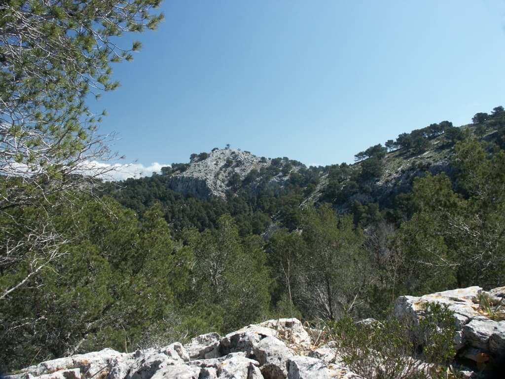
Puig de Garrafa rises above the southwestern corner of Mallorca, offering hikers a quieter alternative to the busier trails of the central Tramuntana. The mountain’s modest height and position deliver sweeping coastal vistas that stretch from the rugged cliffs near Sant Elm to the islet of Sa Dragonera and the open Mediterranean beyond. Because it sits slightly apart from the main ridge, the summit often feels more solitary even on weekends.

Reaching the Trailhead

Drivers approach from the Ma-10 road that links Andratx with the western coast. A signed turnoff near S’Arracó leads to a small, unpaved parking area at the edge of the pine woods. From there a clear path climbs steadily through Aleppo pines and low scrub. Public transport is limited; most visitors rent a car or join a guided walk from nearby Port d’Andratx.

The Ascent and Summit Experience

The route follows a well-trodden GR-style trail marked with occasional cairns. After an initial steep section the gradient eases into a pleasant traverse across rocky terraces dotted with rosemary and wild thyme. Near the top the vegetation thins, revealing limestone slabs that provide natural viewpoints. On clear days the panorama includes the entire western coastline, the silhouette of Sa Dragonera, and, to the north, the higher peaks of the Serra de Tramuntana.

Best Time to Visit

Spring and autumn bring the most comfortable temperatures and the chance to see wildflowers or migrating birds. Summer hikes start early to avoid heat; winter days can be mild but carry the risk of sudden showers and slippery rock. The trail remains open year-round, yet the shoulder seasons offer the best balance of solitude and stable weather.

Nearby Attractions Worth Combining

After descending, many hikers continue to Sant Elm for a meal overlooking the sea or take the short boat trip to Sa Dragonera Natural Park. The historic village of Andratx and its Saturday market lie only a few minutes’ drive inland, while the dramatic coastal road toward Estellencs rewards with further scenic stops.

Visitor tips

  • Start early to secure the limited parking spaces at the trailhead and to enjoy cooler temperatures on the exposed upper slopes.
  • Carry at least two liters of water per person; there are no reliable springs along the route.
  • Wear sturdy footwear with good gripu2014the final approach involves loose limestone scree that becomes treacherous when wet.

Frequently asked questions

How long does the hike to Puig de Garrafa take?+

Most fit walkers complete the round trip in three to four hours, including time at the summit for photos and rest.

Is the trail suitable for beginners?+

The route is moderate rather than easy; good fitness and sure footing are required, though no technical climbing is involved.

Are dogs allowed on the mountain?+

Dogs are permitted provided they remain under control and owners remove any waste; the rocky terrain can be tough on paws in summer.

What should I bring besides water?+

Sun protection, a light windproof layer, a basic first-aid kit, and a printed or downloaded map are recommended as mobile coverage can be patchy.

Can I combine the hike with a visit to Sa Dragonera?+

Yes; the trailhead lies only ten minutesu2019 drive from the Sant Elm ferry jetty, making a combined day trip straightforward.

Share
Google Maps Apple Maps Directions

Image: Antoni Sureda · CC BY-SA 3.0 · via Wikimedia Commons

Keep reading

Nearby & related

All stories
T
Balearic Islands

The Statue of James I of Aragon in Palma de Mallorca

Stand before the bronze monument to the king who conquered Mallorca and shaped the island’s medieval identity.

26 September 2026
M
Balearic Islands

Mirador del Centenari del Foment: Panoramic Views Over Mallorca’s Tramuntana Mountains

This secluded viewpoint delivers sweeping vistas of rugged peaks, olive terraces, and the Mediterranean from the heart…

26 September 2026
M
Balearic Islands

Mirador des Salt de la Bella Dona: Dramatic Cliffside Views in Mallorca’s Tramuntana

This secluded viewpoint reveals plunging gorges, terraced valleys, and distant sea horizons in the heart of the Serra de…

26 September 2026