
Mount Manengouba: Hiking Cameroon’s Volcanic Twin Crater Lakes
Explore the dramatic calderas, endemic wildlife, and highland trails of Mount Manengouba in Cameroon’s Moungo region.
Why Mount Manengouba Stands Out
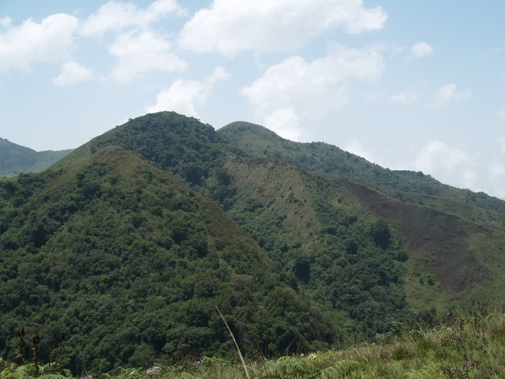
Mount Manengouba rises as a broad stratovolcano in the Cameroon Highlands, its twin summit calderas holding two striking crater lakes surrounded by montane forest and grassland. The larger lake sits in a steep-walled basin while the smaller one reflects changing sky colors; together they create a rare highland landscape that draws hikers and naturalists seeking quieter alternatives to Mount Cameroon.
Reaching the Summit and Lakes
Most visitors start from the village of Bangem or nearby settlements in the Moungo division. The standard route follows a well-defined footpath that climbs through farmland into bamboo and Podocarpus forest before emerging onto open ridges. The ascent typically takes four to six hours one way, passing through zones where the vegetation changes from lowland trees to giant heathers and then to short alpine grasses near the rims.
The Crater Lakes
Both lakes lie inside the main caldera and can be visited on the same day from a high camp. The water is cold and clear; local guides point out the abrupt color difference between the two bodies, one often appearing turquoise while the other stays darker. Swimming is possible but the altitude and sudden winds make it brief.
Flora, Fauna and Cultural Context
The mountain supports several Cameroon-endemic amphibians and birds, including the Mount Manengouba frog found only in the surrounding wetlands. On clear days the views stretch across the fertile plains toward the coast and, to the north, the outlines of other highland peaks. Bakossi communities living on the lower slopes maintain traditional trails and can share knowledge of medicinal plants still gathered on the mountain.
Best Time to Visit
The drier months from November through February offer the most reliable weather for camping on the ridges and for photography of the lakes. Rain can fall any month at this altitude, so expect mist even in the dry season and pack accordingly. The wetter months bring lush growth but also slippery paths and reduced visibility.
Nearby Places Worth Combining
After descending, travelers often continue to Nkongsamba for its market and colonial-era architecture or head toward the Kupe Manengouba area to visit other volcanic features and waterfalls. Douala’s international airport lies roughly four hours away by road, making the mountain a feasible weekend or three-day extension from the coast.
Visitor tips
- Hire a local guide from Bangem or the trailhead villages; paths above the forest belt are faint and weather changes quickly.
- Carry enough water for the full day plus a lightweight tent or bivouac if planning to stay near the lakes overnight.
- Respect community rules about camping sites and avoid leaving waste; the crater area has limited soil for natural decomposition.
Frequently asked questions
How difficult is the hike to the crater lakes?
The route is strenuous because of steady elevation gain and variable footing, but it does not require technical climbing; most fit hikers manage it with a guide.
Do I need a permit to visit Mount Manengouba?
No formal permit is required, but registering with the local chief or guide association at the trailhead is standard practice and helps support the community.
What wildlife might I see?
Birds such as francolins and turacos are common; with luck you may spot monkeys in the lower forest or endemic amphibians near the lake edges at dusk.
Is camping allowed at the summit?
Simple campsites exist on the grassy ridges above the lakes; always check current conditions with guides and pack out all waste.
Can I visit in the rainy season?
Yes, but trails become muddy and visibility drops; many travelers prefer the drier months for clearer views and safer footing.