
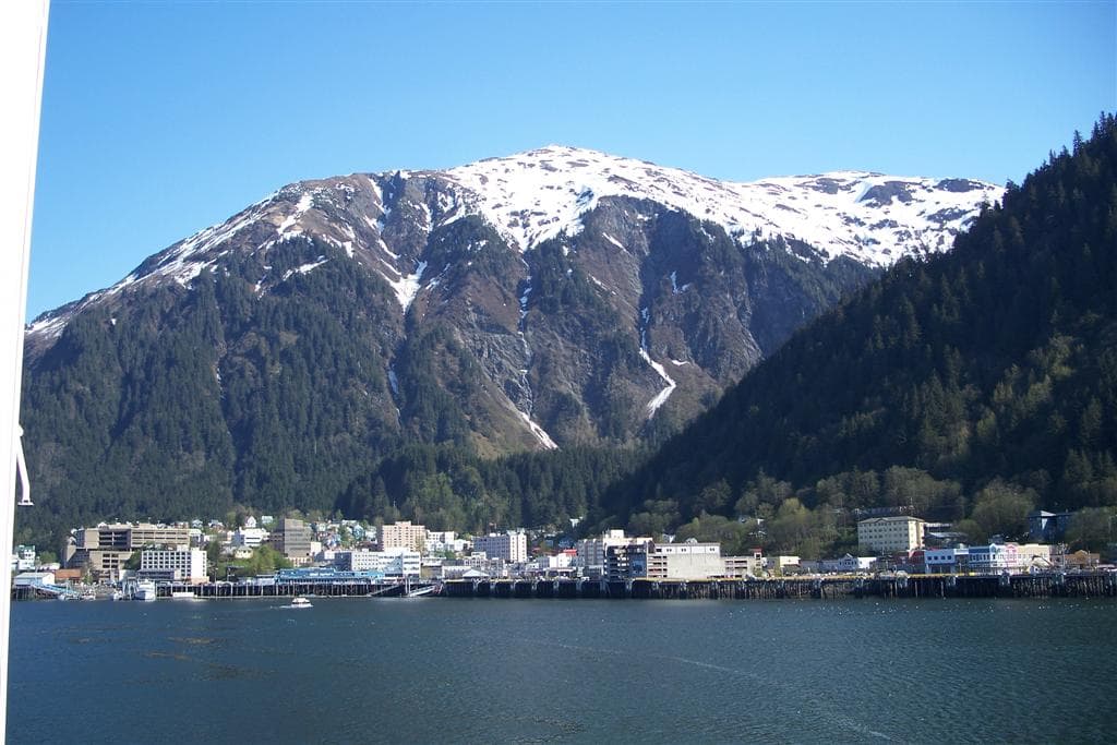
Mount Juneau: Hiking Juneau’s Signature Peak for Panoramic Alaska Views
A rewarding climb from downtown to sweeping vistas over the capital city, channel, and coastal mountains.
Why Climb Mount Juneau
Mount Juneau rises directly behind Alaska’s capital, offering hikers a steep but straightforward route to 3,500-foot summits with unobstructed views of Gastineau Channel, Douglas Island, and the icefields beyond. The mountain’s proximity to town makes it an accessible introduction to Southeast Alaska’s rugged terrain without requiring a boat or plane.
Reaching the Trailhead
The main trail begins near downtown Juneau and can be reached on foot from the cruise-ship docks or by short bus or car ride to the residential neighborhood at its base. Parking is limited, so many visitors walk or use local transit to start the hike. The route follows an old mining road before turning into a single-track path that climbs steadily through dense rainforest.
The Climb Itself
Expect a strenuous ascent marked by switchbacks, occasional boardwalks over muddy sections, and a final exposed ridge. The trail passes through hemlock and spruce forest before opening to alpine meadows dotted with wildflowers in summer. At the summit, a small shelter and communications equipment share space with wide-open rock slabs ideal for lunch and photography. On clear days the panorama includes the Mendenhall Glacier to the north and distant peaks of the Coast Range.
Best Time to Visit
July and August deliver the longest daylight, driest trails, and peak wildflower displays, though rain remains possible any day. Early September offers fewer crowds and colorful berry patches but shorter days. Winter travel is discouraged unless you have avalanche training and proper gear, as the upper slopes hold deep snow.
Wildlife and Safety
Black bears frequent the lower forest; make noise on blind corners and carry bear spray. Mountain goats sometimes appear on the upper ridges. Always check the marine forecast before starting, as sudden wind or fog can obscure the route on the final ridge.
Nearby Attractions
After descending, many hikers continue to the Mount Roberts Tramway for an aerial return or explore the historic buildings and museums along Juneau’s waterfront. The Perseverance Trail offers a gentler alternative in the same valley if legs are tired.
Visitor tips
- Start early to finish before typical afternoon rain and to secure parking near the trailhead.
- Wear sturdy waterproof boots and carry layers; temperatures drop quickly above treeline.
- Pack at least two liters of water, snacks, and a headlamp in case daylight fades sooner than expected.
Frequently asked questions
How difficult is the hike to Mount Juneau?
It is a strenuous climb with consistent elevation gain and some exposed sections near the top; most fit hikers complete it in four to six hours round-trip.
Can beginners or children attempt Mount Juneau?
The trail is best suited for those with prior hiking experience; families with older children who are comfortable on steep grades often succeed with an early start and frequent breaks.
Is there cell service on the mountain?
Service is spotty in the forest but improves on the upper ridge and summit where you may connect to Juneau-area towers.
What should I do if the weather turns bad?
Turn around immediately if fog, high winds, or heavy rain arrives; the upper ridge can become disorienting and slippery.
Are there any fees or permits required?
No permits or fees are needed for the standard trail; simply respect private property near the lower trailhead and pack out all trash.