Skip to content
Plan & Tour
DestinationsItinerariesTravel BlogAboutContact
0Sign inPlan a trip
Plan & TourPlan & Tour

Travel guides, destination inspiration and curated itineraries for Canada, the USA and beyond, plus a free tool to plan your own day-by-day trip.

Get travel inspiration

Explore

  • All Destinations
  • Curated Itineraries
  • Travel Blog
  • Plan a Trip

Topics

  • Hiking & Nature
  • Food & Drink
  • City Breaks
  • Budget Travel

Company

  • About Us
  • Contact
  • Privacy Policy
  • Terms of Service

© 2026 Plan & Tour. Built for travellers.

Discover the world, one trip at a time.

Mount Amagoi: Hiking Tahara’s Quiet Coastal Peak
  1. Home
  2. Destinations
  3. Tahara
  4. Mount Amagoi: Hiking Tahara’s Quiet Coastal Peak
Mountain

Mount Amagoi: Hiking Tahara’s Quiet Coastal Peak

A rewarding half-day climb on the Atsumi Peninsula offering sweeping ocean views and peaceful forest trails.

TaharaUpdated 14 August 2026

Why Visit Mount Amagoi

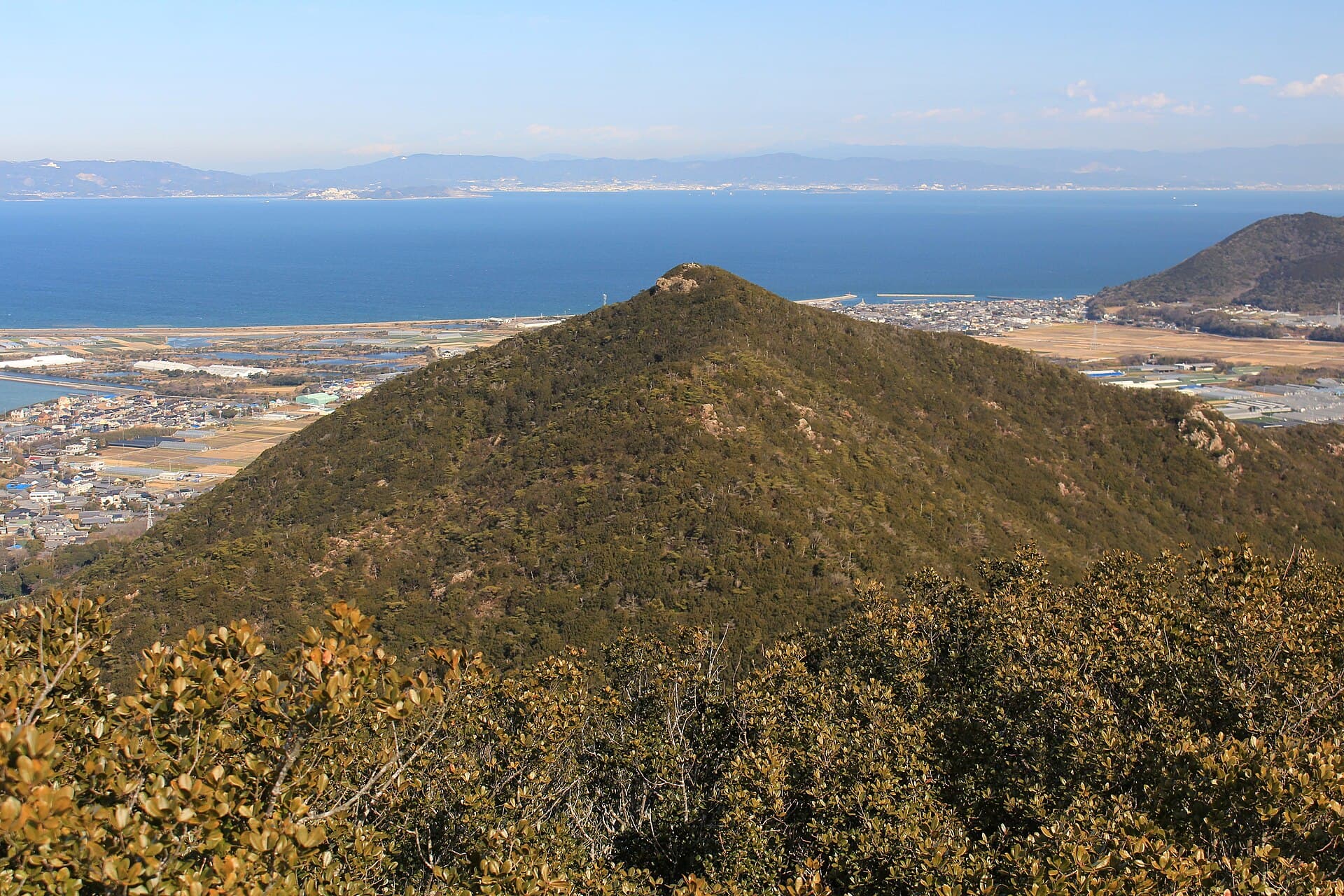
Mount Amagoi rises gently above the flat farmlands of Tahara in southern Aichi Prefecture, offering hikers a compact yet satisfying outing with panoramic views over the Pacific Ocean and Mikawa Bay. The mountain’s modest elevation makes it accessible while still delivering the sense of escape that draws visitors to the Atsumi Peninsula.

Trails and What to Expect

Two main routes lead to the summit. The most popular starts near the Irago Wind Farm area and climbs steadily through mixed cedar and broadleaf forest. The path is well-trodden but never crowded, passing small clearings where wild azaleas bloom in spring. The final stretch opens onto a grassy ridge with unobstructed sightlines toward Cape Irago and the distant Chita Peninsula on clear days. The loop option via the eastern ridge adds variety without extending the total distance beyond a comfortable half-day outing.

Flora and Seasonal Highlights

Early spring brings clusters of pink and white azaleas along the lower slopes. Autumn transforms the forest into a palette of red and gold maples, while winter offers crisp air and occasional light snow dusting the summit rocks. Summer hikers should start early to avoid midday heat and humidity.

How to Get There

Most visitors reach the trailhead by car from central Tahara or Toyohashi. Limited roadside parking is available near the wind turbines; arrive before mid-morning on weekends. Public transport is possible but requires a bus to the southern edge of Tahara followed by a longer walk or taxi to the trail entrance. Once on the mountain, all routes are clearly signed and do not require technical navigation.

Best Time to Visit

March through May and October through November provide the most comfortable temperatures and clearest views. Avoid the Obon holiday period in mid-August and the peak of typhoon season in September when trails can become muddy and slippery.

Nearby Attractions

Combine the hike with a visit to Cape Irago’s lighthouse and rugged coastline just 15 minutes south by car. Tahara’s coastal windmills and the historic Irago Lighthouse offer photogenic stops on the way back. The area’s fresh seafood restaurants in Tahara port provide a satisfying end to the day.

Visitor tips

  • Wear sturdy trail shoes; the upper sections can be rocky and root-covered even in dry weather.
  • Carry at least one liter of water per personu2014there are no reliable springs on the main routes.
  • Check the weather forecast the evening before; strong winds from the Pacific can make the exposed ridge uncomfortable.

Frequently asked questions

How long does the hike to the summit take?+

Most hikers complete the round-trip on the main trail in three to four hours, including time at the viewpoint.

Is Mount Amagoi suitable for beginners or children?+

The moderate grade and short distance make it appropriate for fit beginners and older children, though the final ridge requires sure footing.

Are there toilets or shelters on the mountain?+

A basic toilet is located at the main trailhead; no facilities exist on the trails themselves.

Can I see the ocean from the summit?+

Yes, clear days provide wide views across the Pacific and toward the Irago Peninsula and Chita hills.

Is parking available at the trailhead?+

Limited free roadside parking exists near the wind farm; spaces fill quickly on weekends and holidays.

Share
Google Maps Apple Maps Directions

Image: Alpsdake · CC BY-SA 4.0 · via Wikimedia Commons

Keep reading

Nearby & related

All stories
Ikenohara Park: A Peaceful Pondside Retreat in Tahara
Tahara

Ikenohara Park: A Peaceful Pondside Retreat in Tahara

Discover the quiet natural beauty and local rhythms of this Aichi Prefecture park on the Atsumi Peninsula.

18 August 2026
H
Tahara

Himeshima: A Peaceful Island Escape in Tahara, Aichi

Discover the quiet coastal beauty, local seafood, and nature trails of this small island off Japan’s Atsumi Peninsula.

15 August 2026
Mount Kinugasa: Hiking Tahara’s Quiet Coastal Peak
Tahara

Mount Kinugasa: Hiking Tahara’s Quiet Coastal Peak

Explore the gentle trails, ocean vistas, and seasonal foliage of Mount Kinugasa on Japan’s Atsumi Peninsula.

14 August 2026