
Keep reading
Nearby & related
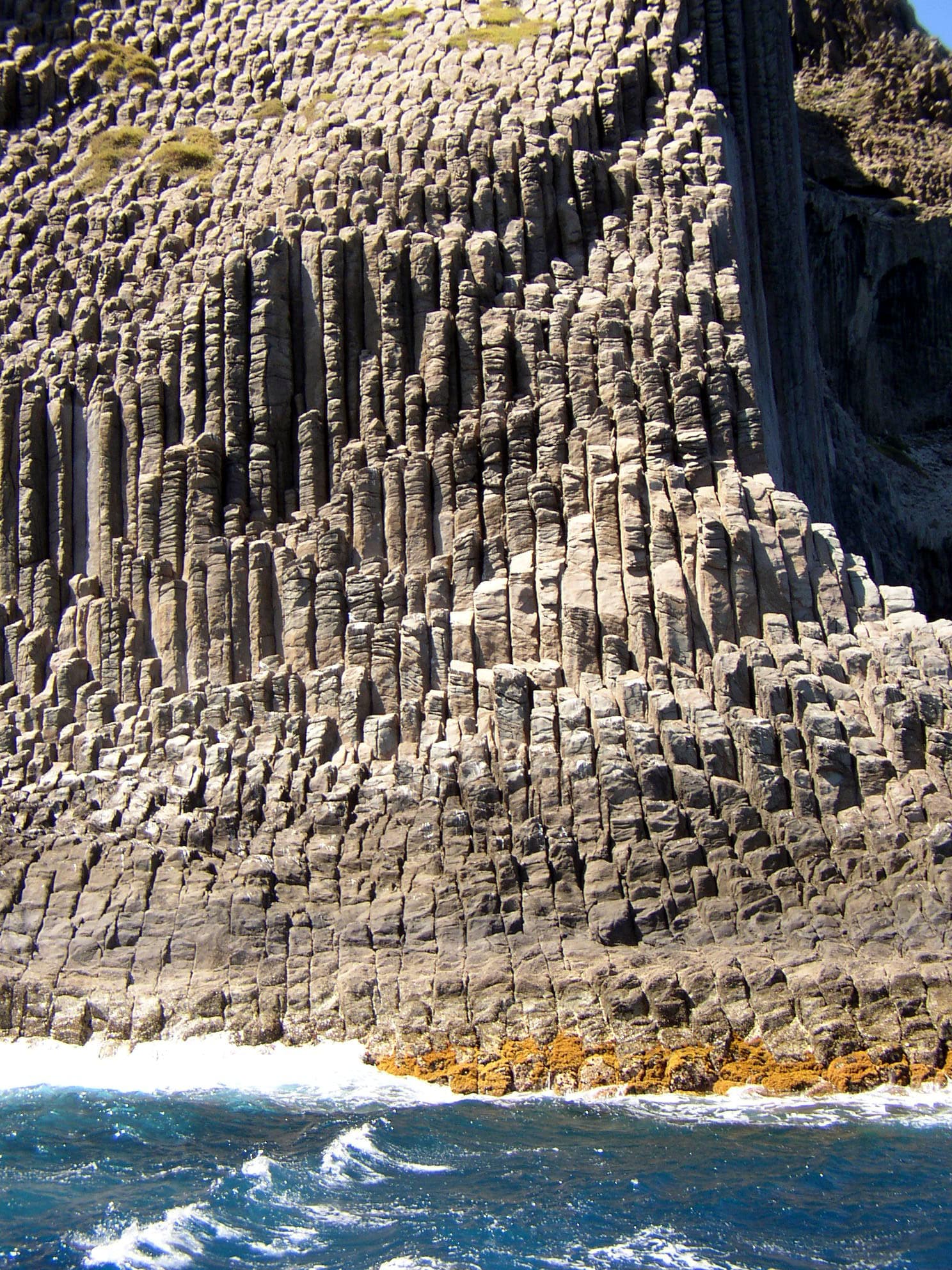
Los Órganos: La Gomera’s Striking Basalt Cliffs
A protected coastal monument showcasing dramatic volcanic rock formations best seen from the sea.
12 November 2026
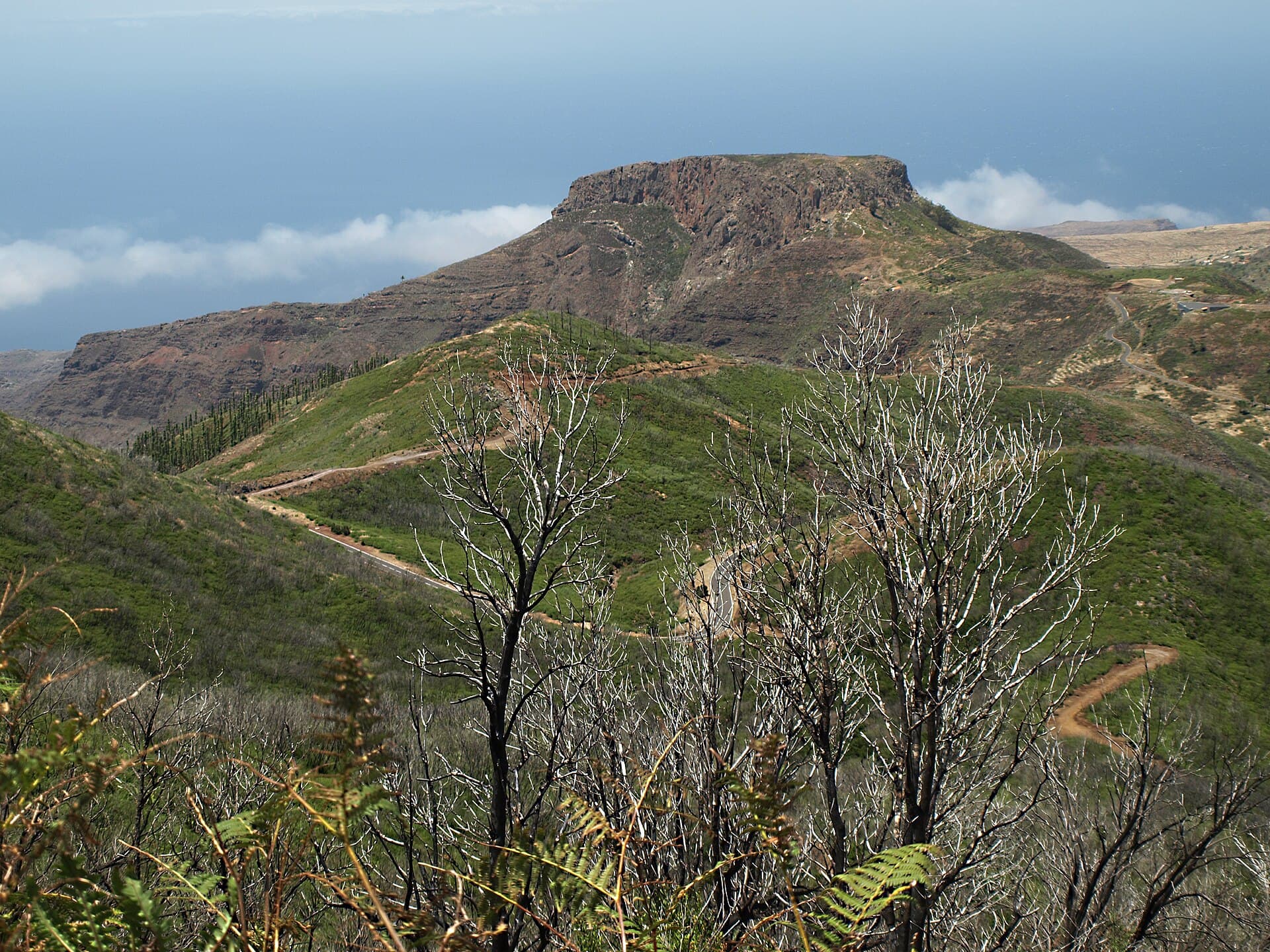
This striking basalt formation in Vallehermoso rewards visitors with panoramic views, unique geology, and quiet trails across La Gomera’s northwest.
Monumento Natural de La Fortaleza protects a dramatic volcanic neck that rises sharply above the Vallehermoso valley on La Gomera. Its sheer cliffs and flat summit resemble an ancient fortress, formed by erosion-resistant basalt that withstood millions of years of weathering. The site showcases the island’s volcanic origins while preserving rare endemic plants that thrive on its slopes.
Reach the monument from Vallehermoso village by following the paved road toward the Ermita de Los Santos and then a short unpaved track to the trailhead. Most visitors arrive by rental car; the drive from San Sebastián de La Gomera takes about 45 minutes along winding roads. Buses run infrequently to Vallehermoso, so plan transfers carefully if relying on public transport. Ferries from Tenerife land at San Sebastián, where car rental is available.
The main loop trail climbs steadily through pine forest and open scrub to viewpoints overlooking the Atlantic and the island’s terraced valleys. Along the way, look for Canary Island palms, tabaiba shrubs, and the occasional Barbary falcon soaring overhead. The summit plateau offers 360-degree vistas that stretch to Tenerife’s Mount Teide on clear days. Shorter paths branch off to rock formations and seasonal waterfalls after heavy rain.
Mild temperatures and lower rainfall make February through May and September through November ideal. Summer brings stronger sun and occasional haze from the Sahara; winter can deliver strong winds on exposed ridges. Early morning starts avoid midday heat and give the best light for photography.
Combine a visit with the lush forests of Garajonay National Park, the coastal hamlets of Agulo and Hermigua, or the black-sand beach at Playa de Vallehermoso. The area’s terraced banana plantations and traditional hamlets provide insight into rural Canarian life.
The main trail is moderate, with steady elevation gain over roughly 4 km round-trip; good fitness is needed but no technical climbing is required.
Dogs are permitted if kept on a leash at all times to protect wildlife and prevent disturbance to ground-nesting birds.
No reliable water sources exist along the paths, so bring all you need and a bit extra for the return.
Overnight camping is prohibited to preserve the protected habitat; picnicking is allowed only at the designated trailhead area.
Descend immediately if visibility drops; the summit and ridges can become disorienting, and sudden wind gusts are common.
Keep reading
A protected coastal monument showcasing dramatic volcanic rock formations best seen from the sea.