Skip to content
Plan & Tour
DestinationsItinerariesTravel BlogAboutContact
0Sign inPlan a trip
Plan & TourPlan & Tour

Travel guides, destination inspiration and curated itineraries for Canada, the USA and beyond, plus a free tool to plan your own day-by-day trip.

Get travel inspiration

Explore

  • All Destinations
  • Curated Itineraries
  • Travel Blog
  • Plan a Trip

Topics

  • Hiking & Nature
  • Food & Drink
  • City Breaks
  • Budget Travel

Company

  • About Us
  • Contact
  • Privacy Policy
  • Terms of Service

© 2026 Plan & Tour. Built for travellers.

Discover the world, one trip at a time.

Monte Volpintesta: Hiking Calabria’s Quiet Sila Summit
  1. Home
  2. Destinations
  3. Calabria
  4. Monte Volpintesta: Hiking Calabria’s Quiet Sila Summit
Mountain

Monte Volpintesta: Hiking Calabria’s Quiet Sila Summit

Traverse beech forests and open ridges on this 1,727-metre peak inside Sila National Park.

CalabriaUpdated 17 October 2026

Why Monte Volpintesta Stands Out

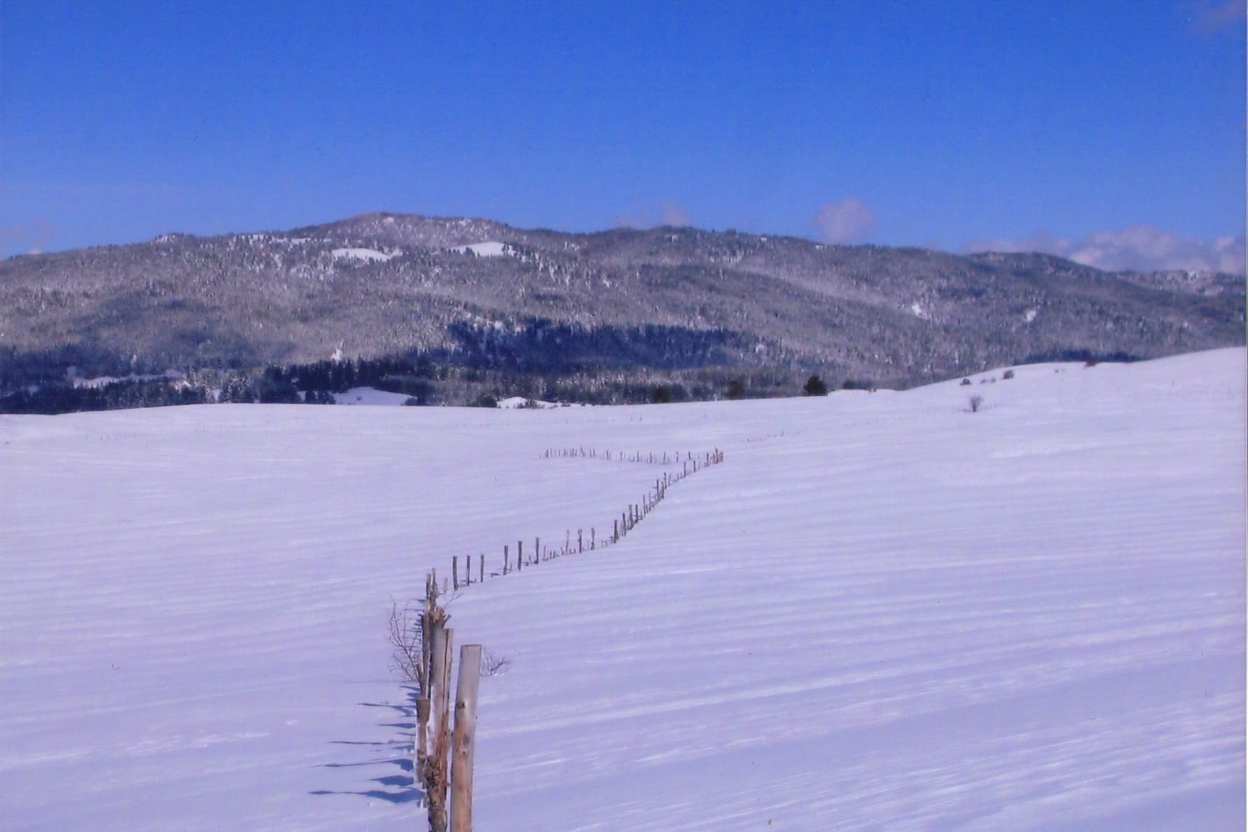
Monte Volpintesta rises in the northern Sila plateau, offering hikers wide views across the Pollino massif to the north and the Ionian Sea on clear days. Unlike the busier trails around Monte Botte Donato, this summit keeps a wild character with fewer visitors and intact old-growth beech stands.

Getting There

Base yourself in Camigliatello Silano or Spezzano della Sila. From Camigliatello follow the SP60 toward Fossiata, then take the unpaved forest road signposted for Monte Volpintesta. The last 4 km require a high-clearance vehicle or a 45-minute walk. Public transport is limited; most visitors rent a car or join a guided hike from the national park visitor centre.

Best Time to Visit

Late May through early October brings snow-free trails and comfortable daytime temperatures between 15–22 °C. July and August can be warm on south-facing slopes; carry extra water. In spring, snow patches linger above 1,500 m and require micro-spikes.

Recommended Routes

  • Forest road ascent from Fossiata (8 km round trip, 450 m elevation gain) – steady gradient, suitable for most walkers.
  • Ridge loop via Colle del Telegrafo (12 km, 600 m gain) – adds panoramic views and passes a former military lookout.
  • Winter snowshoe variant from the same trailhead when conditions allow.

What to See and Do

Look for red deer at dawn near the upper clearings and listen for the call of the black woodpecker in the beech woods. The summit itself is a broad meadow with a trig point and a simple wooden cross; on the clearest days you can see both Etna and the Pollino’s Serra Dolcedorme. Bring binoculars for raptors riding the thermals.

Nearby Attractions

Combine the hike with a visit to the nearby Lago Cecita or the arboretum at the Sila National Park headquarters in Lorica. The historic centre of San Giovanni in Fiore, 25 km south, offers Byzantine-rite monasteries and traditional silkworm museums.

Visitor tips

  • Carry at least 1.5 litres of water per person; no reliable springs on the upper slopes after June.
  • Download offline mapsu2014mobile coverage drops beyond the first kilometre of forest road.
  • Park only in designated clearings; the forest service issues fines for vehicles blocking fire roads.

Frequently asked questions

How difficult is the hike to Monte Volpintesta?+

The standard forest-road route is moderate and achievable for anyone with average fitness; the ridge loop adds steeper sections and loose scree near the summit.

Do I need a permit or guide?+

No permit is required for day hikes, but joining a park-authorised guide is recommended in winter or if you plan the longer ridge loop.

Is Monte Volpintesta suitable for children?+

The shorter forest-road route works well for older children; the ridge loop is better for teenagers with hiking experience.

Where can I stay near the trailhead?+

Camigliatello Silano has hotels, B&Bs and agriturismi within a 15-minute drive; several open year-round.

Are there any facilities on the mountain?+

There are no huts or toilets above the trailhead; plan to return to Camigliatello for meals and services.

Share
Google Maps Apple Maps Directions

Image: Beppeveltri · CC BY-SA 3.0 · via Wikimedia Commons

Keep reading

Nearby & related

All stories
S
Calabria

Silos Archaeological Site: Ancient Ruins in Coastal Calabria

Explore the layered history and quiet coastal setting of Silos, an archaeological site near Crotone that preserves…

18 October 2026
C
Calabria

Cannoni Archaeological Site: Ancient Ruins in Calabria’s Heartland

Wander the weathered remains of Cannoni, an evocative archaeological site near Crotone revealing layers of ancient…

18 October 2026
T
Calabria

Torrionetto Archaeological Site: Calabria’s Quiet Window into Ancient Magna Graecia

Trace layers of Greek and Roman history at this compact, coastal ruin near Crotone.

18 October 2026