Skip to content
Plan & Tour
DestinationsItinerariesTravel BlogAboutContact
0Sign inPlan a trip
Plan & TourPlan & Tour

Travel guides, destination inspiration and curated itineraries for Canada, the USA and beyond, plus a free tool to plan your own day-by-day trip.

Get travel inspiration

Explore

  • All Destinations
  • Curated Itineraries
  • Travel Blog
  • Plan a Trip

Topics

  • Hiking & Nature
  • Food & Drink
  • City Breaks
  • Budget Travel

Company

  • About Us
  • Contact
  • Privacy Policy
  • Terms of Service

© 2026 Plan & Tour. Built for travellers.

Discover the world, one trip at a time.

Monte Petroso: Hiking Abruzzo’s Quiet Apennine Summit
  1. Home
  2. Destinations
  3. Abruzzo
  4. Monte Petroso: Hiking Abruzzo’s Quiet Apennine Summit
Mountain

Monte Petroso: Hiking Abruzzo’s Quiet Apennine Summit

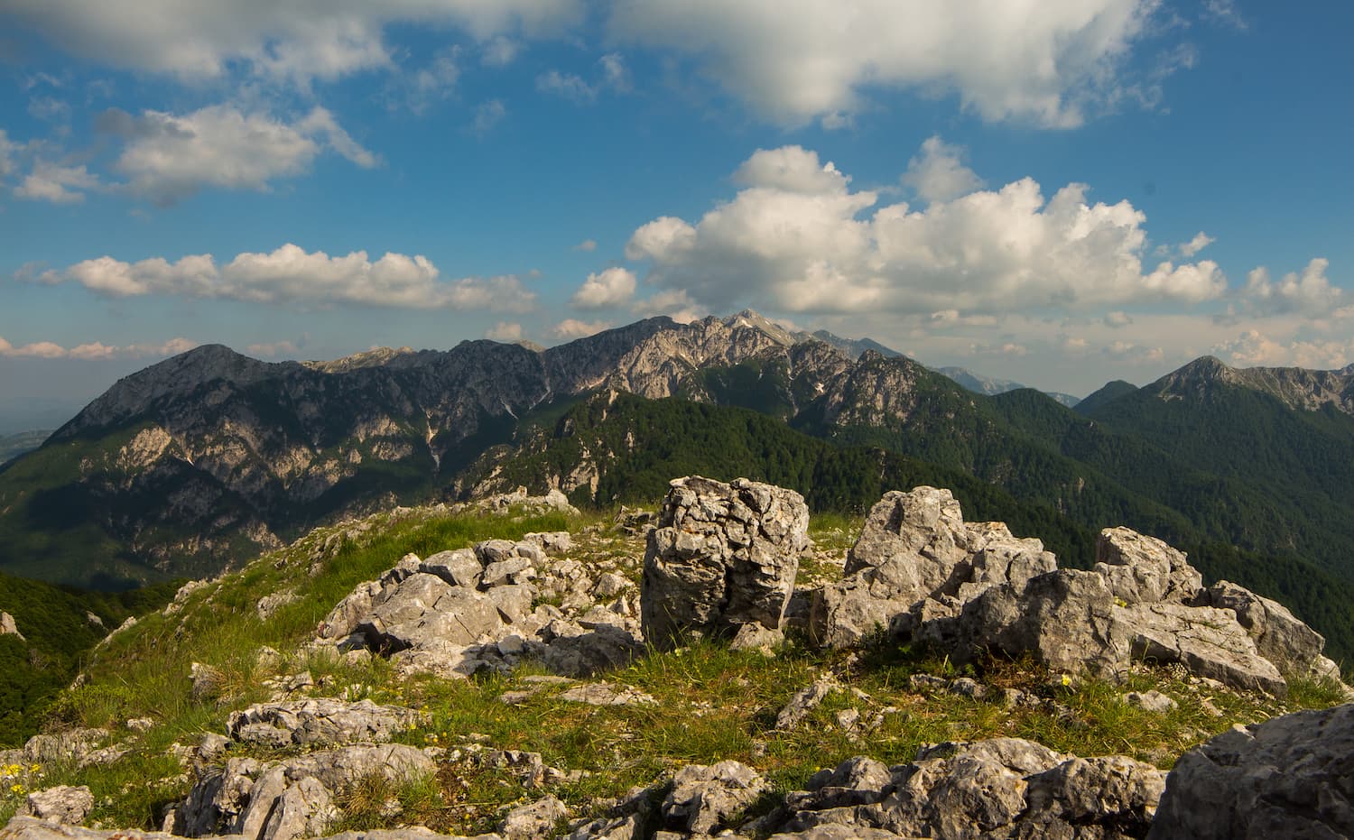
A rewarding, lesser-known peak offering sweeping views across the Maiella massif and Marsicani range.

AbruzzoUpdated 14 August 2026

Why Monte Petroso Stands Out

Monte Petroso rises to 1,905 metres in the heart of Abruzzo’s Apennines, offering hikers a compact yet satisfying climb with uninterrupted views over the Maiella National Park and the remote valleys of the Monti Marsicani. Unlike busier summits such as Monte Amaro, Petroso sees few visitors, preserving a sense of solitude amid beech forests, limestone ridges and occasional sightings of Apennine chamois.

Getting There

The nearest reliable access point is the village of Anversa degli Abruzzi, roughly 20 minutes by car from the A25 motorway exit at Cocullo. From Anversa a narrow road climbs to the trailhead at Fonte della Chiusa (1,050 m). Public transport reaches Anversa via the Rome–Pescara railway; a local taxi or pre-arranged lift is then needed for the final ascent. Drivers coming from Rome should allow two-and-a-half hours; from Pescara the journey is just over one hour.

Best Time to Visit

Late May through early October provides the most stable conditions. Snow can linger on north-facing slopes into June, while summer thunderstorms are common in the afternoon. Early autumn brings clear air and turning beech leaves, making September and early October ideal for photography. Winter ascents require crampons and ice-axe experience.

Trails and Activities

The standard route follows the marked path CAI 332 from Fonte della Chiusa. It ascends steadily through mixed woodland for 90 minutes before emerging onto open pasture and the final rocky scramble to the summit cross. Allow four to five hours round-trip with time for photos. Strong hikers can combine the peak with the neighbouring ridge walk toward Monte Capraro for a full-day outing. Bring a map or GPS track; mobile coverage is patchy above the treeline.

Wildlife and Landscape

The slopes support one of the last beech forests in the central Apennines. Look for signs of Marsican brown bears (never approach) and listen for the distinctive call of the rock partridge. From the summit the eye takes in the entire Maiella plateau to the east and the Fucino basin to the west, a dramatic contrast between wild highlands and reclaimed farmland.

Nearby Places Worth Exploring

  • Scanno and its glacial lake, 25 minutes by car, for lakeside walks and traditional woollen goods.
  • The ancient village of Sulmona, famous for confetti almonds and its medieval aqueduct.
  • The remote hamlet of Villalago and the Sagittario gorge, offering short via ferrata routes for experienced climbers.

Visitor tips

  • Carry at least two litres of water per person; there are no reliable springs above the trailhead.
  • Check the regional weather forecast the evening before; afternoon storms can develop quickly above 1,500 m.
  • Park only in designated lay-bys at Fonte della Chiusa to avoid blocking forestry access roads.

Frequently asked questions

How difficult is the hike to Monte Petroso?+

It is a moderate outing with 850 m of elevation gain on a well-marked path; the final 15 minutes involve easy scrambling over loose limestone.

Is Monte Petroso suitable for children?+

Older children with hiking experience can manage the route, but the rocky upper section and lack of shade make it less ideal for younger kids.

Are there any facilities on the mountain?+

No. There are no huts, toilets or water sources above the car park; plan accordingly and take all rubbish with you.

Can I reach the summit in winter?+

Only with mountaineering equipment and experience; the route is not maintained and avalanche risk exists on steeper slopes.

What wildlife might I see?+

Apennine wolves, chamois and golden eagles are occasionally spotted; bears are present but sightings are rare and should be reported to park authorities.

Share
Google Maps Apple Maps Directions

Image: Alex Amariei · CC BY-SA 4.0 · via Wikimedia Commons

Keep reading

Nearby & related

All stories
M
Abruzzo

Monte Rotella: Hiking Abruzzo’s Majestic Maiella Peak

Tackle the rewarding trails and panoramic views of Monte Rotella in Italy’s wild Apennine heartland.

14 August 2026
M
Abruzzo

Monte Foltrone: Hiking Abruzzo’s Quiet Apennine Summit

A rewarding climb through beech woods and open ridges to panoramic views over the Gran Sasso and the Adriatic.

14 August 2026
Caldora-Cantelmo Castle: Medieval Fortress Above Pacentro
Pacentro

Caldora-Cantelmo Castle: Medieval Fortress Above Pacentro

Perched on a rocky spur in Abruzzo’s mountains, this 14th-century castle offers sweeping valley views and a tangible…

14 August 2026