Skip to content
Plan & Tour
DestinationsItinerariesTravel BlogAboutContact
0Sign inPlan a trip
Plan & TourPlan & Tour

Travel guides, destination inspiration and curated itineraries for Canada, the USA and beyond, plus a free tool to plan your own day-by-day trip.

Get travel inspiration

Explore

  • All Destinations
  • Curated Itineraries
  • Travel Blog
  • Plan a Trip

Topics

  • Hiking & Nature
  • Food & Drink
  • City Breaks
  • Budget Travel

Company

  • About Us
  • Contact
  • Privacy Policy
  • Terms of Service

© 2026 Plan & Tour. Built for travellers.

Discover the world, one trip at a time.

Monte Midia: Hiking Abruzzo’s Quiet Apennine Summit
  1. Home
  2. Destinations
  3. Abruzzo
  4. Monte Midia: Hiking Abruzzo’s Quiet Apennine Summit
Mountain

Monte Midia: Hiking Abruzzo’s Quiet Apennine Summit

A rewarding day hike in central Italy offering sweeping views across the Abruzzo highlands with minimal crowds.

AbruzzoUpdated 13 August 2026

Why Monte Midia Stands Out

Monte Midia rises in the western part of Abruzzo, forming part of the ridge that separates the Fucino basin from the higher central Apennines. At just over 1,700 metres it is not the tallest peak in the region, yet its isolated position delivers broad horizons that take in the Gran Sasso massif to the north-east and the Simbruini range to the south-west.

Getting There and Trail Access

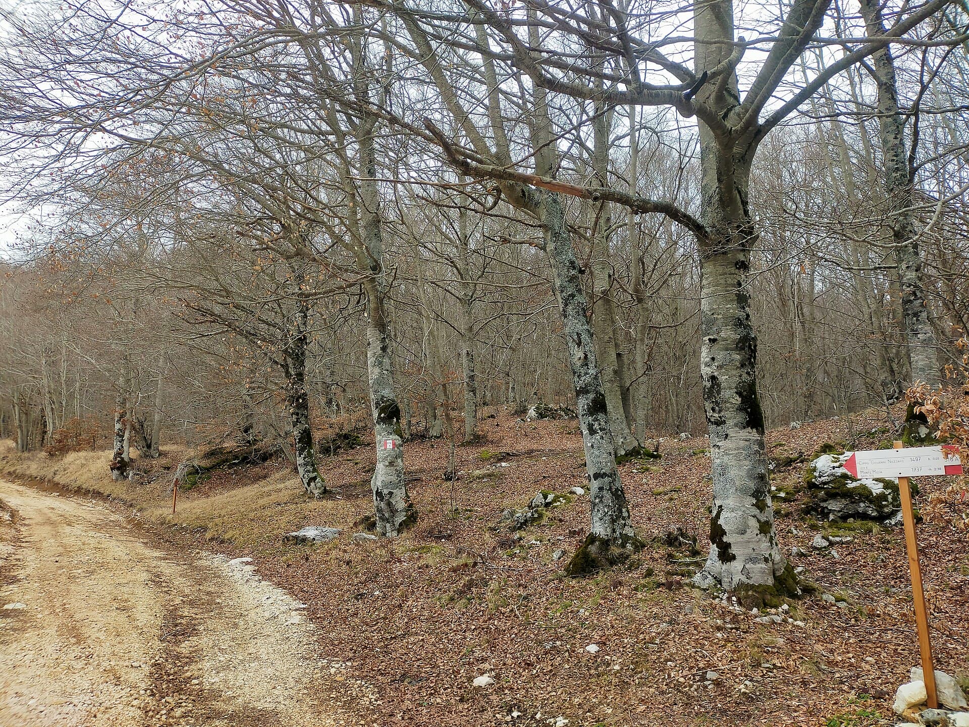
The most practical approach begins from the village of Cappelle dei Marsi or the higher hamlets above Tagliacozzo. A narrow paved road climbs through beech woods to a small parking area near Fonte Canale. From here a clear footpath ascends steadily through open pasture and scattered juniper before reaching the broad summit ridge. The route is marked with red-and-white paint but carries no numbered trail designation; hikers should carry a 1:25 000 map or GPS track. Total walking time from the upper car park is roughly two hours each way with 450 metres of ascent.

What the Summit Offers

The top is a gentle grassy dome marked by a modest cairn and a metal cross. On clear days the panorama extends from the snow-streaked Gran Sasso peaks to the flat, cultivated Fucino plain below. In spring the slopes are carpeted with wild narcissus and gentians; in autumn the beech woods below turn gold and red. There is no refuge or water on the summit, so carry all supplies.

Flora, Fauna and Seasonal Changes

Monte Midia lies within a quiet pocket of the Apennines where wolves still roam the higher beech forests. Golden eagles and peregrine falcons are regularly seen circling the ridges. The lower slopes support mixed deciduous woodland that gives way to sub-alpine grassland near the top. Snow lingers into May on north-facing slopes, while July and August bring hot, dry conditions and occasional thunderstorms.

Combining the Visit with Nearby Sites

Many visitors pair the hike with a stop at the medieval hill town of Tagliacozzo, whose arcaded square and fountain make a pleasant lunch stop. The shores of Lake Fucino, now reclaimed farmland, lie only twenty minutes by car and offer a contrasting flat landscape dotted with artichoke fields and small villages.

Visitor tips

  • Start early to avoid afternoon thunderstorms common in summer and to enjoy cooler temperatures on the exposed ridge.
  • Wear sturdy boots; the final section crosses loose limestone scree that can be slippery when wet.
  • Download an offline map before leaving mobile coverage; signposts are minimal once you leave the beech woods.

Frequently asked questions

How difficult is the hike to Monte Midia?+

The trail is moderate for fit walkers; the main challenge is the steady climb and lack of shade on the upper slopes.

Is Monte Midia suitable for children?+

Older children accustomed to mountain walking can manage the route, but the lack of facilities and exposed terrain make it less ideal for very young hikers.

Are there any facilities on the mountain?+

No huts, toilets or water sources exist above the trailhead; everything must be carried in and out.

When is the best season for wildflowers?+

Late May through early June offers the richest display of alpine flowers on the upper meadows.

Can I drive closer to the summit?+

A gravel track reaches the upper trailhead, but the final approach is on foot only; private vehicles cannot proceed beyond the marked parking area.

Share
Google Maps Apple Maps Directions

Image: Marica Massaro · CC BY-SA 4.0 · via Wikimedia Commons

Keep reading

Nearby & related

All stories
T
Abruzzo

Toppe Vurgo: Hiking Abruzzo’s Quiet Apennine Summit

A rewarding day hike to sweeping limestone views in Italy’s lesser-visited central highlands.

20 August 2026
M
Abruzzo

Monte del Casale: Hiking Abruzzo’s Quiet Apennine Summit

A rewarding, low-crowd mountain hike in central Abruzzo offering sweeping views across the Majella and Gran Sasso…

20 August 2026
M
Abruzzo

Monte Piselli: Hiking the Quiet Ridges of Abruzzo’s Gran Sasso

Traverse beech forests and limestone ridges on this overlooked peak inside Italy’s largest national park.

20 August 2026