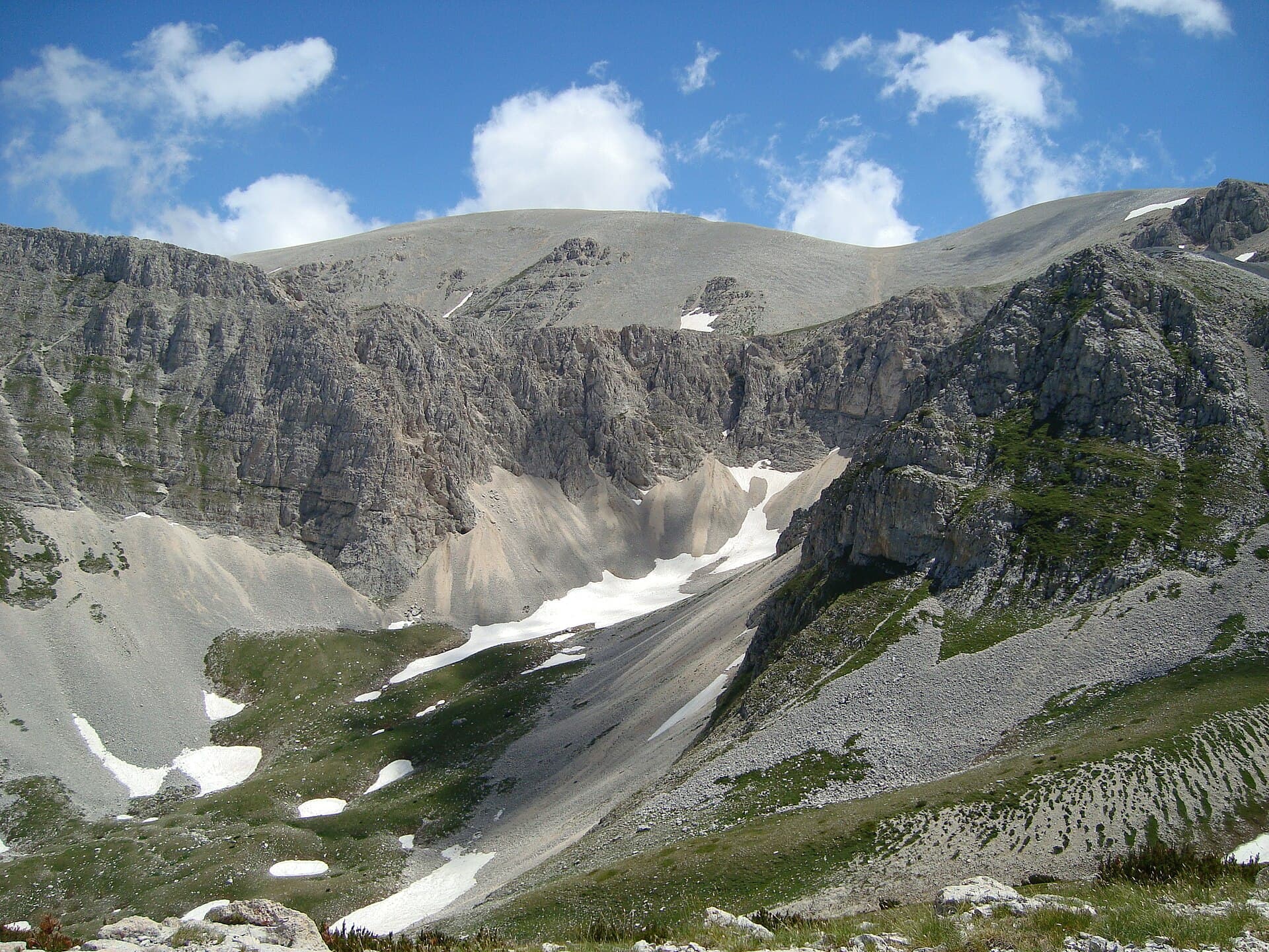
Why Monte Acquaviva Stands Out
At 2,737 meters, Monte Acquaviva is the highest point of the Maiella massif and one of the most prominent summits in the central Apennines. Its broad, karst plateau and sheer southern escarpments rise dramatically above the valleys of Abruzzo, offering hikers a true high-mountain experience within Maiella National Park. The landscape features limestone pavements, seasonal snowfields, and rare alpine flora that bloom briefly in summer.
Getting There
Most visitors approach from the western side of the range. Drive to Campo di Giove or Lama dei Peligni, then follow the unpaved road to the Pian di Valle parking area. From here a well-marked trail climbs steadily through beech forest before emerging onto open slopes. Public transport is limited; a rental car or organized shuttle from Sulmona is the most practical option. The final trailhead sits at roughly 1,600 meters, so allow time for the ascent.
Best Time to Visit
Late June through early October provides the most reliable conditions for summit attempts. Snow can linger into July on north-facing slopes, while sudden afternoon thunderstorms are common in August. Winter visits require mountaineering skills and avalanche awareness. Early autumn brings clear air and fewer visitors, though temperatures drop quickly after sunset.
Trails and What to Expect
The standard route follows the Sentiero Italia variant from Pian di Valle. It gains 1,100 meters over 4–5 hours one way, crossing high pastures where Apennine chamois and golden eagles are frequently sighted. The final ridge walk is exposed; sure footing and a head for heights are essential. Strong hikers can combine the summit with nearby Monte Amaro for a full-day traverse.
Nearby Attractions
After descending, explore the Eremo di Santo Spirito a Maiella, a 13th-century hermitage carved into the rock near Roccamorice. The nearby Orfento Valley offers easier walks through old-growth beech forest. In the town of Sulmona, sample confetti almonds and visit the medieval aqueduct that once supplied the valley.
Practical Considerations
No facilities exist above the trailhead, so carry at least two liters of water per person and a windproof jacket. Mobile coverage is patchy above 2,000 meters. Always check the park’s weather bulletin before setting out, as the plateau offers little shelter once clouds roll in.