
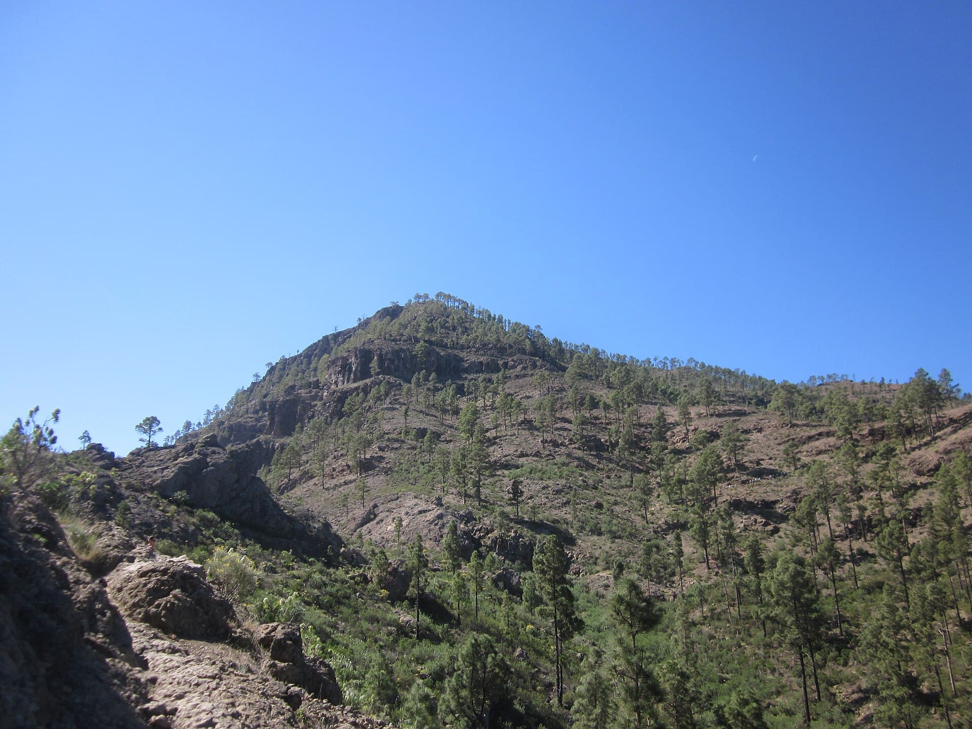
Montaña de Tauro: Hiking the Dramatic Peaks Above Mogán in Gran Canaria
Explore the volcanic trails, sweeping coastal views, and quiet natural beauty of this Mogán mountain.
Why Visit Montaña de Tauro
Montaña de Tauro rises in the rugged interior of Mogán municipality on Gran Canaria, offering hikers an accessible escape into the island’s volcanic highlands. Its slopes reveal layered rock formations, endemic Canary Island flora, and long vistas across the Atlantic and the deep barrancos that carve toward the coast. The mountain rewards visitors who seek uncrowded trails rather than crowded coastal resorts.
Trails and What to See
Several paths ascend from lower valleys toward the summit area. Walkers pass through stands of Canary pine and clusters of tabaiba and cardón, with frequent overlooks into steep ravines. On clear days the panorama stretches from the Mogán coastline to distant ridges of the central massif. The terrain is rocky but generally moderate, suiting those comfortable with uneven paths and moderate elevation gain.
Flora and Geology Highlights
Look for endemic species adapted to the dry, sunny slopes. The dark volcanic rock tells the story of Gran Canaria’s ancient eruptions, visible in the contrasting layers exposed along trail cuts.
Getting There
Most visitors arrive by rental car from the south-coast resorts of Puerto Rico or Playa de Mogán. Roads climb steadily into the municipality; parking is available at trailheads near the village outskirts. Public buses reach Mogán village, after which a taxi or additional walk is needed to reach higher starting points. The drive from Las Palmas takes roughly an hour via the GC-1 and GC-60.
Best Time to Visit
Spring and autumn deliver the mildest temperatures and clearest skies for extended walks. Summer heat can be intense on exposed slopes, while winter brings occasional rain that turns paths slippery. Early morning starts avoid both midday sun and any afternoon cloud build-up typical of the islands.
Nearby Attractions
Combine a morning on Montaña de Tauro with an afternoon at the harbor and fish market in Playa de Mogán or a swim at nearby coves. The dramatic Barranco de Mogán offers further hiking options, while the coastal road leads west to the quieter beaches of Veneguera and Tasarte.
Visitor tips
- Carry at least two liters of water per person; shade is scarce on the upper slopes.
- Wear sturdy hiking boots with good grip and bring a light wind layer for the summit.
- Check local weather and trail conditions the morning of your hike, as fog can reduce visibility quickly.
Frequently asked questions
How difficult is the hike up Montau00f1a de Tauro?
Trails range from moderate to strenuous depending on the route chosen; allow three to five hours round-trip with steady elevation gain on rocky paths.
Is Montau00f1a de Tauro suitable for beginners?
Experienced walkers comfortable with uneven terrain will manage well; novices should choose shorter lower sections and travel with a guide or experienced companion.
Are there any facilities on the mountain?
No services exist above the trailheads; bring all supplies including food, water, and navigation tools.
Can I drive to the summit?
No vehicle access reaches the higher slopes; parking is limited to lower trailheads and the final approach is on foot.
What wildlife might I see?
Keep an eye out for Berthelotu2019s pipit, Canary lizards, and occasional raptors soaring over the ridges.