Skip to content
Plan & Tour
DestinationsItinerariesTravel BlogAboutContact
0Sign inPlan a trip
Plan & TourPlan & Tour

Travel guides, destination inspiration and curated itineraries for Canada, the USA and beyond, plus a free tool to plan your own day-by-day trip.

Get travel inspiration

Explore

  • All Destinations
  • Curated Itineraries
  • Travel Blog
  • Plan a Trip

Topics

  • Hiking & Nature
  • Food & Drink
  • City Breaks
  • Budget Travel

Company

  • About Us
  • Contact
  • Privacy Policy
  • Terms of Service

© 2026 Plan & Tour. Built for travellers.

Discover the world, one trip at a time.

Montaña Blanca: Hiking Tenerife’s Striking White Volcanic Peak
  1. Home
  2. Destinations
  3. Canary Islands
  4. Montaña Blanca: Hiking Tenerife’s Striking White Volcanic Peak
Mountain

Montaña Blanca: Hiking Tenerife’s Striking White Volcanic Peak

A rewarding ascent through pumice fields to panoramic views of Teide National Park.

Canary IslandsUpdated 10 November 2026

Why Montaña Blanca Stands Out

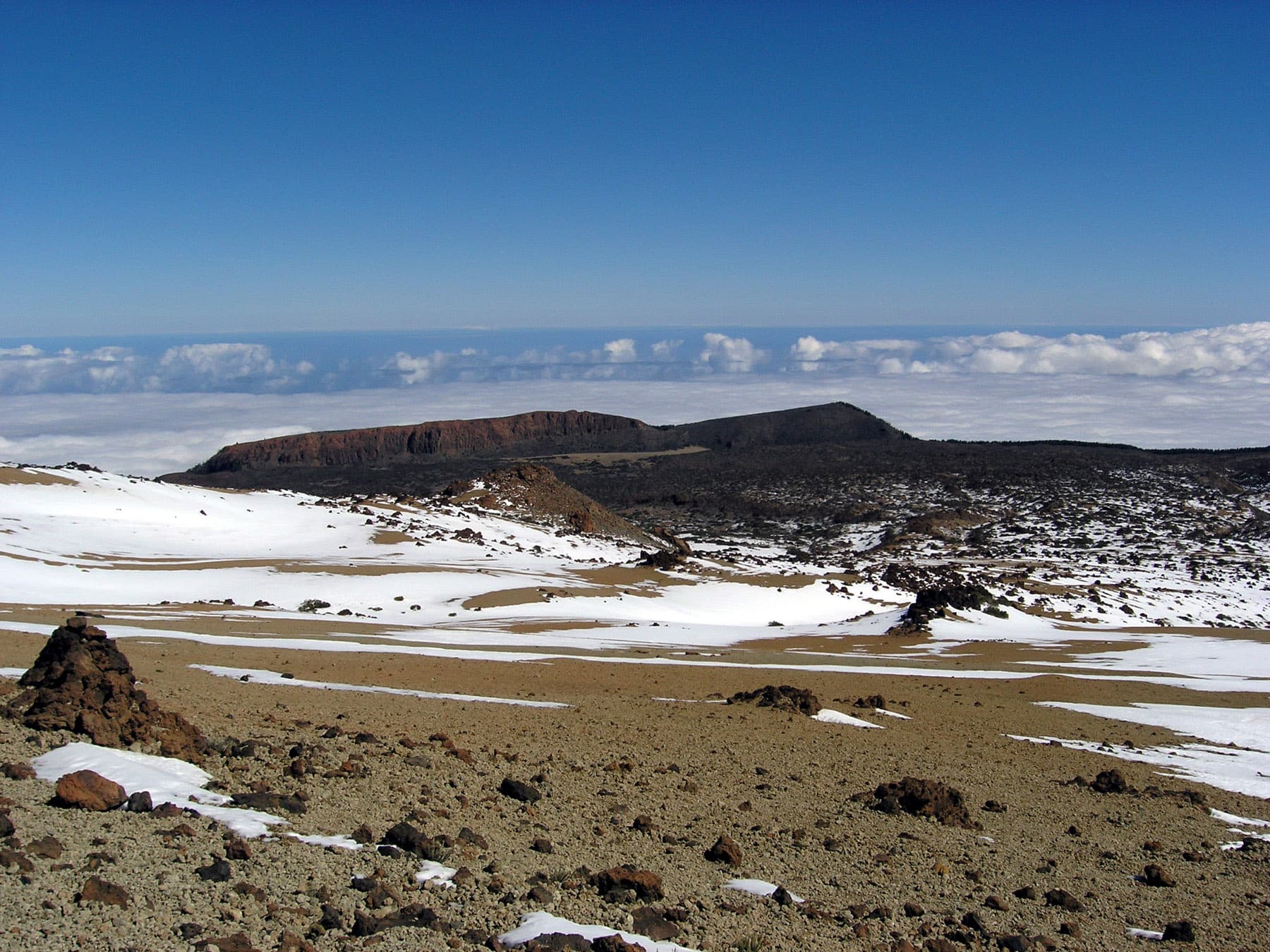
Montaña Blanca rises as a distinctive pale cone of pumice and ash within Teide National Park on Tenerife. Its light-colored slopes contrast sharply with the darker lava flows and black cinder cones that surround it, offering hikers an otherworldly landscape shaped by ancient eruptions. The mountain provides one of the most accessible high-altitude walks in the Canary Islands while delivering sweeping vistas of Mount Teide and the surrounding caldera.

Popular Hiking Routes

The main trail begins at the Montaña Blanca trailhead off the TF-21 road. Hikers ascend gradually through fields of white pumice and scattered volcanic bombs before reaching a saddle with dramatic sightlines toward the Teide summit. Many continue along the same path toward Refugio de Altavista or join the cable-car route for the final push to the crater rim. Shorter loops around the base let visitors experience the stark geology without committing to a full day. The terrain is loose in places, so trekking poles help with stability on the descent.

Flora and Geology Highlights

Above 2,000 meters the only plants that thrive are specialized species such as the Teide broom and the iconic Teide violet. These hardy survivors bloom briefly in late spring, adding splashes of color against the mineral palette. The white surface underfoot is actually fragmented pumice ejected during prehistoric eruptions; walking across it feels like crossing a giant ashtray.

Getting There and Practical Access

Most visitors arrive by rental car and park at the signed trailhead lay-by on the road between Vilaflor and the Teide cable-car station. A few public buses run from Costa Adeje and Playa de las Américas to the nearby Parador hotel, after which a short walk or taxi completes the journey. Parking fills early on weekends, so starting before 9 a.m. is advisable. No permits are required for the standard Montaña Blanca route, though the higher Teide summit does need advance booking.

Best Time to Visit

April through June and September through October offer the most comfortable temperatures and clearest skies. Summer days can exceed 30 °C even at altitude, while winter brings the possibility of snow and ice on the upper slopes. Clear mornings are common year-round, but afternoon clouds often form around the peak, so an early start maximizes visibility.

Nearby Attractions

After descending, many travelers continue to the Teide cable car for closer views of the crater or explore the Roques de García rock formations just a short drive away. The visitor center at El Portillo provides excellent context on the park’s volcanic history before heading back down the mountain.

Visitor tips

  • Carry at least two liters of water per person; there are no refill points on the trail.
  • Wear sturdy boots with good ankle support because the pumice surface shifts underfoot.
  • Check the daily weather forecast and wind conditions before setting out, as exposed ridges can become hazardous quickly.

Frequently asked questions

How long does the hike to the top of Montau00f1a Blanca take?+

The round-trip from the trailhead to the main saddle and back usually takes three to four hours for fit walkers.

Is Montau00f1a Blanca suitable for beginners?+

The lower sections are manageable for reasonably fit beginners, but the loose volcanic gravel and steady elevation gain make it moderately challenging.

Can I reach Montau00f1a Blanca without a car?+

Buses serve the Parador area, but the final stretch to the trailhead requires a taxi or an additional walk of about 30 minutes.

Are there toilets or facilities at the trailhead?+

There are no services directly at the Montau00f1a Blanca parking area; the nearest facilities are at the Parador hotel or the El Portillo visitor center.

What should I do if the weather turns bad?+

Descend immediately if clouds descend or winds pick up; the mountain offers little shelter once you leave the lower slopes.

Share
Google Maps Apple Maps Directions

Image: Jens Steckert · CC BY-SA 3.0 · via Wikimedia Commons

Keep reading

Nearby & related

All stories
B
Canary Islands

Blas Cabrera Felipe Monument: Honoring a Canary Islands Physics Pioneer

Visit the monument to Blas Cabrera Felipe, the influential Spanish physicist born in the Canary Islands, set amid…

15 November 2026
M
Canary Islands

Mirador de Gomera: Tenerife’s Iconic Viewpoint Over La Gomera

Experience sweeping Atlantic vistas of La Gomera island from this elevated Tenerife lookout point.

15 November 2026
M
Canary Islands

Mirador Somada Alta: Sweeping Vistas Across La Palma’s Rugged Heart

This elevated viewpoint on La Palma offers unobstructed panoramas of volcanic ridges, deep barrancos, and the Atlantic…

15 November 2026