Skip to content
Plan & Tour
DestinationsItinerariesTravel BlogAboutContact
0Sign inPlan a trip
Plan & TourPlan & Tour

Travel guides, destination inspiration and curated itineraries for Canada, the USA and beyond, plus a free tool to plan your own day-by-day trip.

Get travel inspiration

Explore

  • All Destinations
  • Curated Itineraries
  • Travel Blog
  • Plan a Trip

Topics

  • Hiking & Nature
  • Food & Drink
  • City Breaks
  • Budget Travel

Company

  • About Us
  • Contact
  • Privacy Policy
  • Terms of Service

© 2026 Plan & Tour. Built for travellers.

Discover the world, one trip at a time.

Kunturiri: Trekking Bolivia’s Remote High-Andean Peak
  1. Home
  2. Destinations
  3. La Paz Department
  4. Kunturiri: Trekking Bolivia’s Remote High-Andean Peak
Mountain

Kunturiri: Trekking Bolivia’s Remote High-Andean Peak

A practical guide to reaching, climbing, and experiencing Kunturiri, one of La Paz Department’s striking yet uncrowded Andean summits.

La Paz DepartmentUpdated 12 October 2026

Why Kunturiri Stands Out

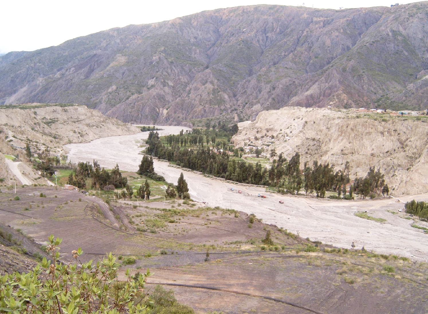
Kunturiri rises from the arid western cordillera of La Paz Department, offering trekkers and climbers a genuine high-altitude adventure without the crowds that gather on more famous Bolivian peaks. Its position on the edge of the Altiplano delivers sweeping views across volcanic landscapes, salt flats, and distant snow-capped ranges. The mountain’s isolation rewards visitors with a sense of wilderness rarely found near La Paz.

Best Time to Visit

The dry season from May through October provides the most reliable weather for travel and climbing. Clear skies and stable conditions prevail, although nights remain freezing. The wet season brings muddy access roads and higher avalanche risk, so most visitors plan trips between June and September when daylight is longest and trails are firm.

Getting There from La Paz

Most travelers start in La Paz and take a private transfer or shared jeep southwest along the road toward the Chilean border. The journey passes through Patacamaya and continues on unpaved tracks toward the mountain’s base. Allow a full day for the approach; many groups overnight at a simple camp or estancia before beginning the ascent. Hiring a local driver familiar with the route is strongly recommended, as signage is minimal and four-wheel-drive is essential.

Acclimatization and Permits

Because Kunturiri sits well above 5,000 meters, spend at least two nights in La Paz or at intermediate altiplano villages before attempting the summit. No formal permit is required for the mountain itself, yet local communities may request a small contribution for passage across their land. Arrange this through your guide or driver in advance.

What to See and Do

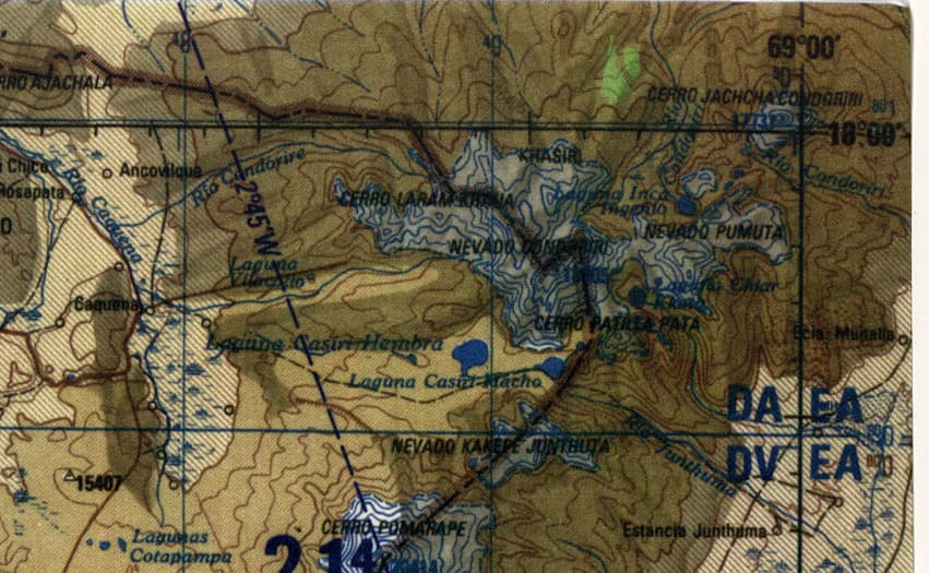
The standard route follows a broad ridge that leads to the main summit pyramid. The terrain mixes loose scree with occasional rock bands, demanding steady pacing and good route-finding. On clear days the panorama includes the Sajama volcano to the south and the shimmering expanse of the Altiplano stretching westward. Photographers should aim for sunrise from a high camp to capture the first light striking the peak’s eastern face.

Those not seeking the summit can enjoy multi-day treks around the mountain’s lower slopes, visiting small lakes and traditional llama pastures. Birders often spot Andean flamingos and condors in the surrounding wetlands.

Nearby Attractions

Combine a Kunturiri trip with a visit to Sajama National Park for hot springs and vicuña viewing, or continue west to the Uyuni salt flats. The town of Patacamaya offers basic supplies and a last chance to top up fuel before entering the remote cordillera.

Visitor tips

  • Acclimatize properly in La Paz for at least 48 hours and carry extra water, as streams are scarce on the mountain.
  • Hire a local guide or join an organized group; the route above 5,500 meters is unmarked and weather can change rapidly.
  • Pack layers for extreme temperature swings and bring a reliable headlamp for pre-dawn starts.

Frequently asked questions

How difficult is the climb to Kuntuririu2019s summit?+

The route is non-technical but demanding due to altitude and loose rock; most fit hikers with prior high-mountain experience can reach the top in a long day from a high camp.

Do I need a guide or can I go independently?+

Independent travel is possible with good navigation skills and a 4x4 vehicle, but most visitors hire a local driver or guide for safety and to arrange community access fees.

What is the elevation of Kunturiri?+

The summit sits above 5,500 meters, making acclimatization essential before any attempt.

Are there facilities or huts on the mountain?+

No huts or services exist; visitors must be fully self-sufficient with tents, food, and fuel.

Can I combine Kunturiri with other Bolivian highlights?+

Yes. Many travelers visit Sajama National Park or continue to the Uyuni salt flats after descending from the mountain.

Share
Google Maps Apple Maps Directions

Image: This work is in the public domain in the United States because it is a work of the United States Federal Government under the terms of 17 U.S.C. § 105. See Copyright. · Public domain · via Wikimedia Commons

Keep reading

Nearby & related

All stories
La Paz River: Rafting and Canyon Adventures in Bolivia
La Paz Department

La Paz River: Rafting and Canyon Adventures in Bolivia

Follow the La Paz River through Andean canyons from the highlands into the Yungas for rafting, scenery, and cultural…

13 October 2026
L
La Paz Department

Leque River: Bolivia’s Andean Waterway in La Paz Department

Follow the clear waters of the Leque River through rugged valleys and quiet Aymara communities in Bolivia’s La Paz…

13 October 2026
B
La Paz Department

Boopi River: Bolivia’s Wild Waterway in La Paz Department

A biodiverse river valley offering jungle hikes, wildlife viewing, and authentic Amazonian experiences near La Paz.

13 October 2026