
Keep reading
Nearby & related
Aichi Prefecture
Morizo & Kikkoro Statue: Aichi’s Enduring World Expo Mascots
Discover the whimsical Morizo and Kikkoro statues in Aichi Prefecture, lasting symbols of the 2005 Expo’s celebration of…
19 August 2026
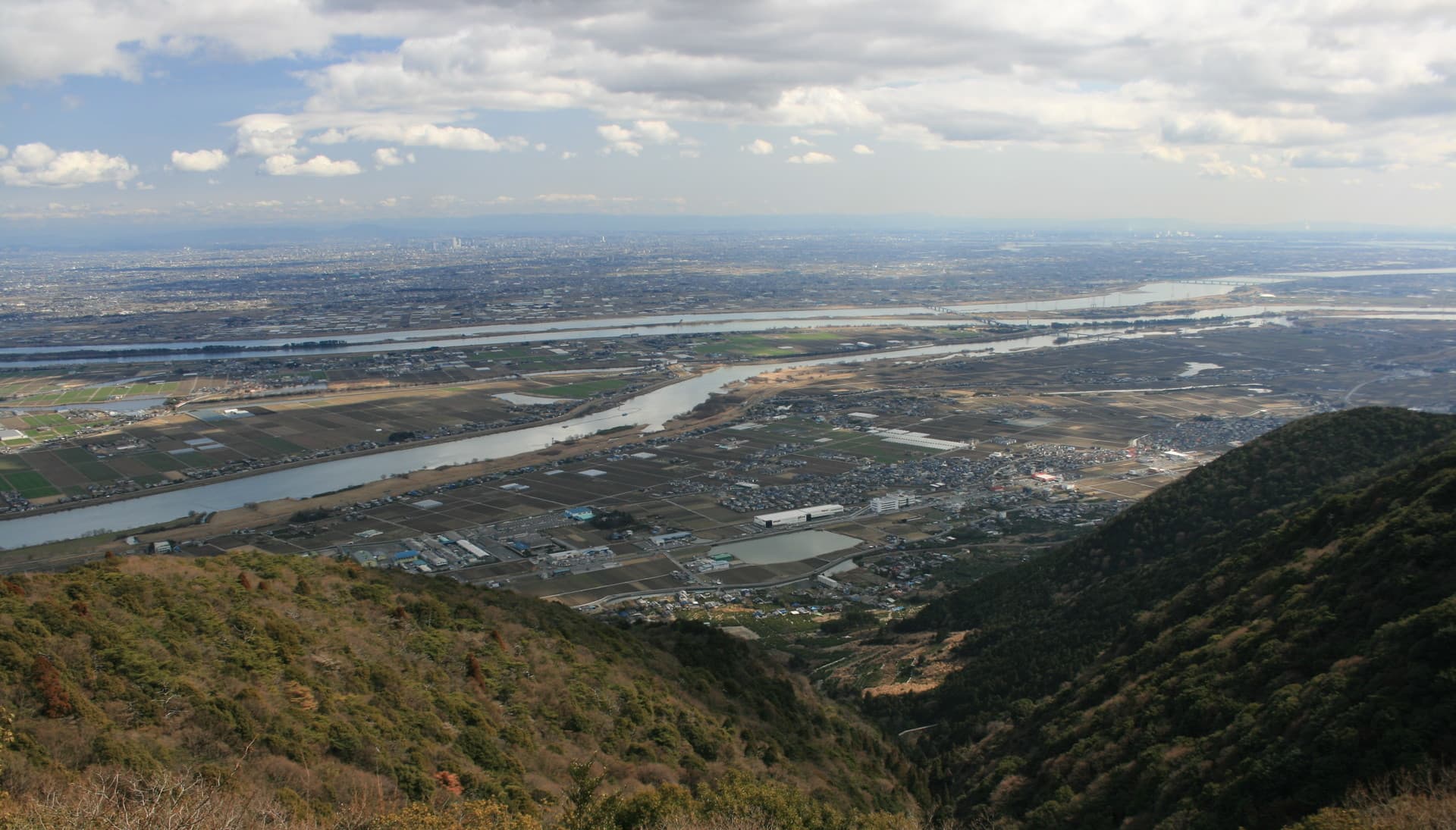
Discover the Kiso, Nagara, and Ibi Rivers where they converge in Aichi Prefecture for quiet landscapes, seasonal festivals, and easy day trips from Nagoya.
The Kiso Three Rivers form a striking confluence where the Kiso, Nagara, and Ibi meet near the borders of Aichi, Gifu, and Mie. This flat, fertile basin offers wide river views framed by distant mountains, traditional fishing villages, and quiet parks. The waterways have shaped local life for centuries through rice farming, timber transport, and cormorant fishing that continues today on the Nagara River.
Walk or cycle the river embankments for unobstructed panoramas, especially at sunrise when mist lingers over the water. In spring, cherry trees line sections of the banks; in autumn, maple and ginkgo foliage create colorful reflections. Local parks near the confluence provide spots for picnics and birdwatching, with herons and migratory ducks common year-round.
Cormorant fishing demonstrations on the Nagara offer a glimpse of an 1,300-year-old technique using trained birds and traditional boats. Several observation decks along the Ibi River let visitors watch the slow flow toward Ise Bay. Small museums in nearby towns display historical flood-control engineering that tamed these once-wild rivers.
From Nagoya Station, local trains reach stations along the rivers in under an hour. Buses connect to riverside parks, and rental bicycles are available at several trailheads. The area is compact enough for a relaxed day trip, with easy connections back to central Aichi.
Late March through early April brings cherry blossoms and mild weather ideal for walking. June and July feature firefly viewing along quieter tributaries. October and November deliver peak autumn color and comfortable temperatures for cycling. Winter offers clear views of snow-capped peaks on clear days, though river levels can rise after heavy rain.
Combine a river visit with the historic castle town of Inuyama to the north or the port city of Kuwana to the south. The nearby Atsuta Shrine in Nagoya provides cultural contrast after a day outdoors. The river basin also serves as a gateway to the mountains of the Kiso Valley for those extending their stay.
Keep reading
Discover the whimsical Morizo and Kikkoro statues in Aichi Prefecture, lasting symbols of the 2005 Expo’s celebration of…
They are the Kiso, Nagara, and Ibi Rivers, which flow together in a broad alluvial plain straddling Aichi, Gifu, and Mie prefectures.
Yes, traditional ukai cormorant fishing continues on the Nagara River from May through October, with public viewing areas available.
Yes. Trains from Nagoya reach riverside stations in 30 to 60 minutes, making it an easy half-day or full-day outing.
Flat embankment paths and cycling routes run for several kilometers, suitable for relaxed walking or biking rather than strenuous hikes.
Comfortable walking shoes, water, a hat, and binoculars for wildlife. Insect repellent is useful in summer near the water.
Stand above the massive swirling pothole formed by centuries of river erosion in the mountains of Aichi Prefecture.
Climb to this hilltop viewpoint in Aichi Prefecture for uninterrupted panoramas of mountains, valleys, and distant city…