
Keep reading
Nearby & related
Aichi Prefecture
Morizo & Kikkoro Statue: Aichi’s Enduring World Expo Mascots
Discover the whimsical Morizo and Kikkoro statues in Aichi Prefecture, lasting symbols of the 2005 Expo’s celebration of…
19 August 2026
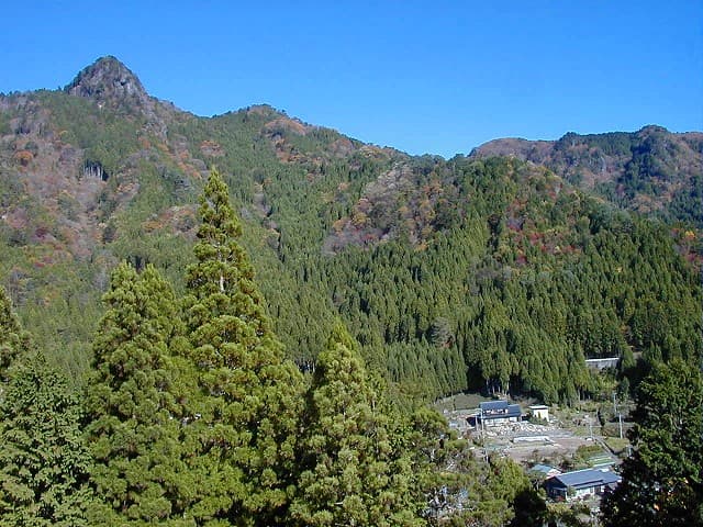
Trek the gentle slopes of this shrine-topped peak for forest paths and sweeping views across eastern Aichi Prefecture.
Hirayama Myojin-yama rises modestly above the hills of eastern Aichi, offering hikers a peaceful alternative to busier peaks in the Japanese Alps. The mountain’s name hints at its Shinto heritage, with a small shrine near the summit that rewards climbers with a moment of quiet reflection amid cedar and oak woods.
Two main routes approach the 800-meter summit. The eastern trail from the Hirayama trailhead climbs steadily through mixed forest on a well-marked path that takes about 90 minutes one way. The western approach starts near a small farming hamlet and passes seasonal wildflowers in spring and autumn foliage later in the year. Both routes are suitable for fit beginners, though the final section includes some rocky steps.
From the summit clearing you can see the ridgelines of the Tenryu River valley and, on clear days, distant views toward the Southern Alps. The shrine itself is a simple wooden structure surrounded by stone lanterns; many visitors leave a small offering or simply enjoy the breeze. In autumn, the surrounding slopes turn gold and crimson, creating a classic Japanese mountain landscape without the crowds of more famous locations.
The mountain lies in rural eastern Aichi, best reached by car via Route 151 or local roads from Shinshiro city. Limited bus service runs from Toyohashi Station to nearby villages; hikers often arrange a taxi drop-off or join local walking groups. Parking is available at both main trailheads.
Late March through early May brings fresh greenery and mild temperatures. October and November offer the most vivid autumn colors and cooler hiking conditions. Summer visits are possible but expect humidity and occasional afternoon thunderstorms; winter hikes require micro-spikes after snowfall.
Keep reading
Discover the whimsical Morizo and Kikkoro statues in Aichi Prefecture, lasting symbols of the 2005 Expo’s celebration of…
Allow two to three hours round-trip on either main trail for most hikers, including time at the shrine.
The eastern route can be managed by older children with hiking experience, but the rocky upper sections require adult supervision.
Only a basic toilet block exists at the main eastern trailhead; nothing is available higher up.
No permit is required and the trails are clearly marked, but joining a local hiking club is helpful for non-Japanese speakers.
A light rain jacket, snacks, and a small towel for the shrine visit are recommended year-round.
Stand above the massive swirling pothole formed by centuries of river erosion in the mountains of Aichi Prefecture.
Climb to this hilltop viewpoint in Aichi Prefecture for uninterrupted panoramas of mountains, valleys, and distant city…