Skip to content
Plan & Tour
DestinationsItinerariesTravel BlogAboutContact
0Sign inPlan a trip
Plan & TourPlan & Tour

Travel guides, destination inspiration and curated itineraries for Canada, the USA and beyond, plus a free tool to plan your own day-by-day trip.

Get travel inspiration

Explore

  • All Destinations
  • Curated Itineraries
  • Travel Blog
  • Plan a Trip

Topics

  • Hiking & Nature
  • Food & Drink
  • City Breaks
  • Budget Travel

Company

  • About Us
  • Contact
  • Privacy Policy
  • Terms of Service

© 2026 Plan & Tour. Built for travellers.

Discover the world, one trip at a time.

Gojō River: Cherry Blossom Paths and Riverside Walks in Aichi
  1. Home
  2. Destinations
  3. Aichi Prefecture
  4. Gojō River: Cherry Blossom Paths and Riverside Walks in Aichi
River

Gojō River: Cherry Blossom Paths and Riverside Walks in Aichi

Follow the quiet embankments of Gojō River through Aichi Prefecture for seasonal blossoms and easy escapes from Nagoya.

Aichi PrefectureUpdated 14 August 2026

Why Gojō River Stands Out

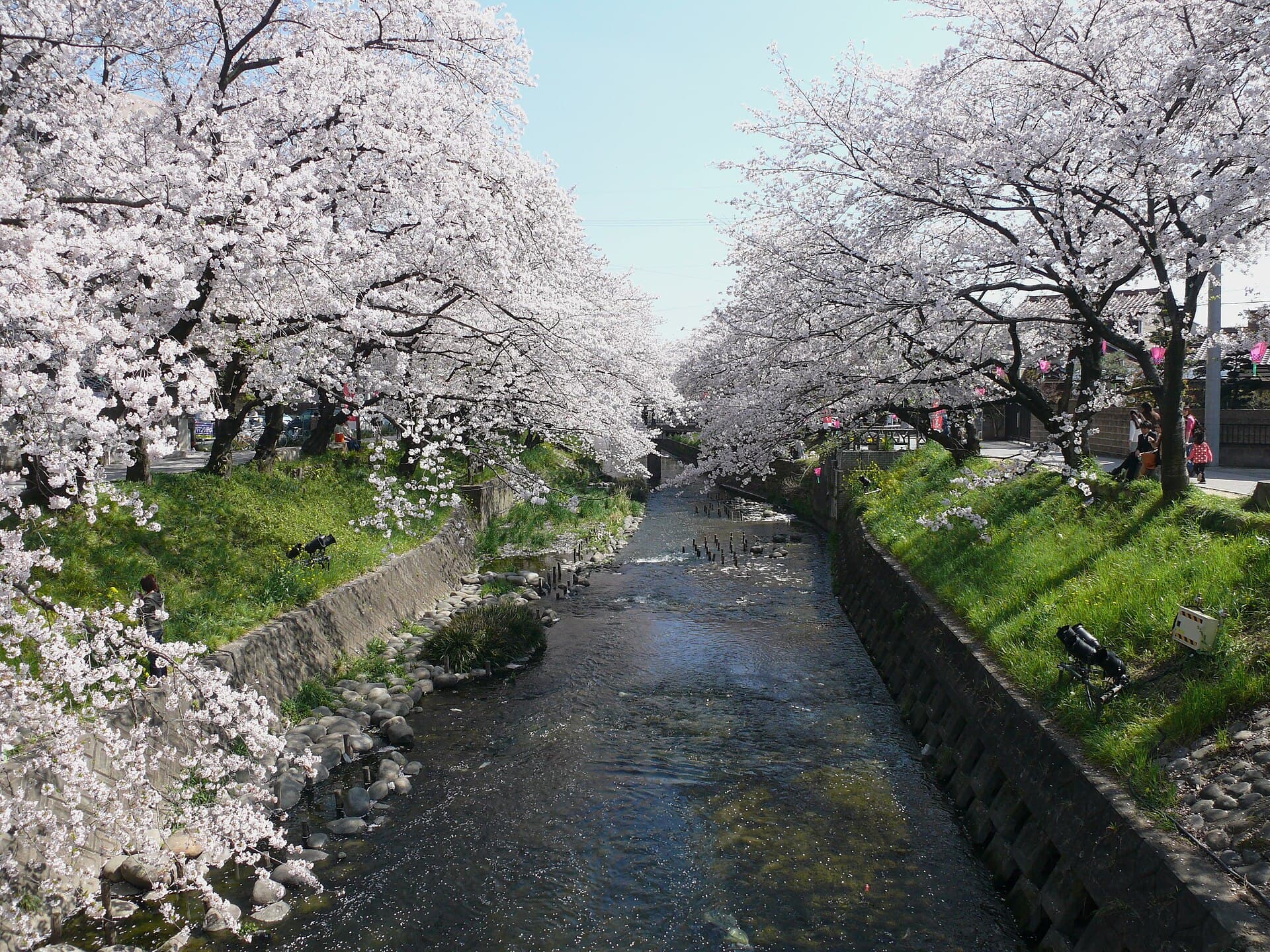
The Gojō River flows through western Aichi Prefecture, offering a flat, accessible corridor of green that contrasts with the urban density of nearby Nagoya. Its tree-lined banks, particularly the long stretches of cherry trees, create one of the region’s most reliable spring displays without the crowds found at larger national parks.

What to See and Do

Walk or cycle the raised paths that run alongside the river. In March and April the sakura canopy forms a continuous tunnel for several kilometers, ideal for hanami picnics on the grass slopes. Outside blossom season the same paths remain pleasant for jogging or photography, with views of distant mountains on clear days.

Seasonal Highlights

  • Spring: Peak cherry blossoms and early-morning mist over the water.
  • Summer: Greenery and occasional local festivals on the riverbanks.
  • Autumn: Yellow and red foliage along the embankments.

Getting There

Reach the river easily from Nagoya by Meitetsu train to stations such as Inazawa or Kiyosu, then a short walk to the water’s edge. Local buses also connect residential areas directly to riverside parks. The flat terrain makes the area suitable for families with strollers or visitors traveling by bicycle.

Best Time to Visit

Plan a visit between late March and mid-April for the most vivid blossoms. Early mornings offer cooler temperatures and fewer people. The river remains enjoyable year-round for quiet walks, though summer humidity and occasional heavy rain require basic preparation.

Nearby Attractions

Combine a river visit with stops at Kiyosu Castle or the historic streets of nearby Inazawa. The Gojō River also sits within easy reach of the larger Kiso River system, allowing extended cycling routes for those wanting more distance.

Visitor tips

  • Wear comfortable shoes for the long, paved embankments and bring water, especially in warmer months.
  • Visit on weekdays to avoid weekend picnickers during cherry blossom season.
  • Check local weather forecasts before heading out, as the open riverbanks offer little shelter during sudden rain.

Frequently asked questions

How long does it take to walk the main cherry blossom section?+

The primary sakura-lined stretch runs about four kilometers and can be covered comfortably in one to two hours at a relaxed pace.

Is the Goju014d River suitable for children?+

Yes. The paths are flat and wide, with grassy areas for picnics, though parents should watch for bicycles and stay away from the wateru2019s edge after heavy rain.

Can I rent bicycles near the river?+

Several stations along the Meitetsu line near Inazawa and Kiyosu offer short-term rentals that allow easy exploration of the riverside paths.

Are there restrooms and vending machines along the banks?+

Basic public toilets and vending machines appear at regular intervals near the main access points and small parks.

What should I bring for a hanami picnic?+

A blanket, simple food, and a small trash bag are sufficient; the embankments provide natural seating but have limited shade once the blossoms fall.

Share
Google Maps Apple Maps Directions

Image: Gnsin · CC BY-SA 3.0 · via Wikimedia Commons

Keep reading

Nearby & related

All stories
M
Aichi Prefecture

Morizo & Kikkoro Statue: Aichi’s Enduring World Expo Mascots

Discover the whimsical Morizo and Kikkoro statues in Aichi Prefecture, lasting symbols of the 2005 Expo’s celebration of…

19 August 2026
預
Aichi Prefecture

預り渕ポットホール: Japan’s Dramatic River-Carved Pothole Viewpoint in Aichi

Stand above the massive swirling pothole formed by centuries of river erosion in the mountains of Aichi Prefecture.

19 August 2026
H
Aichi Prefecture

Hassoyama Panorama Observatory: Sweeping Views Across Aichi’s Countryside

Climb to this hilltop viewpoint in Aichi Prefecture for uninterrupted panoramas of mountains, valleys, and distant city…

19 August 2026