Skip to content
Plan & Tour
DestinationsItinerariesTravel BlogAboutContact
0Sign inPlan a trip
Plan & TourPlan & Tour

Travel guides, destination inspiration and curated itineraries for Canada, the USA and beyond, plus a free tool to plan your own day-by-day trip.

Get travel inspiration

Explore

  • All Destinations
  • Curated Itineraries
  • Travel Blog
  • Plan a Trip

Topics

  • Hiking & Nature
  • Food & Drink
  • City Breaks
  • Budget Travel

Company

  • About Us
  • Contact
  • Privacy Policy
  • Terms of Service

© 2026 Plan & Tour. Built for travellers.

Discover the world, one trip at a time.

El Toro: Hiking Menorca’s Highest Peak in the Balearic Islands
  1. Home
  2. Destinations
  3. Balearic Islands
  4. El Toro: Hiking Menorca’s Highest Peak in the Balearic Islands
Mountain

El Toro: Hiking Menorca’s Highest Peak in the Balearic Islands

Ascend El Toro for sweeping island views, a historic sanctuary, and quiet trails on Menorca’s tallest mountain.

Balearic IslandsUpdated 21 September 2026

Why El Toro Stands Out

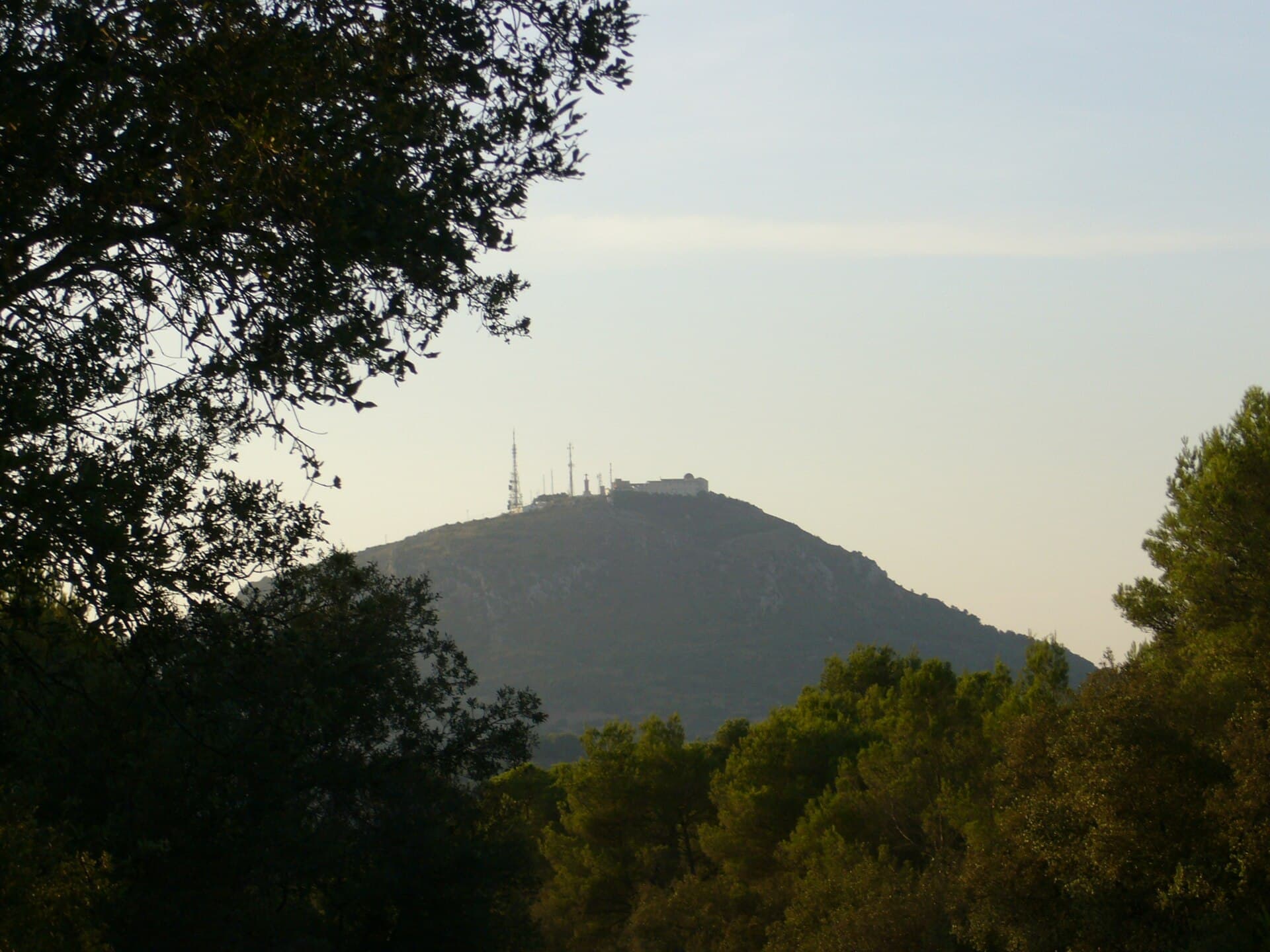
At 358 meters, El Toro is the highest point on Menorca and offers 360-degree views across the island’s rolling countryside, distant coastline, and neighboring islets. The summit’s small sanctuary adds cultural interest, while the surrounding Mediterranean scrub and pine woods provide habitat for resident birds and seasonal wildflowers.

Planning Your Visit

The best months are April to June and September to October, when temperatures are mild and the risk of strong tramontana winds is lower. Summer visits are possible but require an early start to avoid heat. Winter days can be clear but shorter and occasionally windy.

Getting There

El Toro lies roughly in the center of Menorca, about 15 minutes’ drive from both Mahón and Es Mercadal. Follow the signposted road that climbs directly toward the summit; a small parking area sits just below the final section. Public buses reach the nearby village of Es Mercadal, from where a taxi or 45-minute walk completes the journey. No special permits are needed for the standard route.

The Hike to the Summit

From the upper parking area a paved path leads to the sanctuary in under ten minutes. For a longer walk, start lower on the access road or join the GR-223 trail that circles the mountain. The terrain is straightforward but stony; good shoes and a hat are essential. Allow 30–45 minutes for the shortest ascent and an hour or two for a loop that takes in viewpoints on the northern and southern flanks.

What to See and Do

  • Visit the 17th-century sanctuary and its terrace for the classic panorama.
  • Watch for booted eagles and peregrine falcons riding thermals above the slopes.
  • Continue a short distance along the ridge for quieter viewpoints away from the sanctuary.
  • Combine the visit with nearby villages such as Es Mercadal for local cheese and gin tasting.

Nearby Attractions

After descending, head to the prehistoric settlement of Torre d’en Galmés or the coastal coves of Cala Tirant and Binimel·là. The Camí de Cavalls trail passes close by, allowing longer day hikes that link the mountain with Menorca’s dramatic north coast.

Visitor tips

  • Carry at least one liter of water per person; there are no refill points on the upper slopes.
  • Wear sturdy shoes and sun protection even on short visitsu2014the limestone surface is uneven and exposed.
  • Check the wind forecast before setting out; strong gusts are common on the summit ridge.

Frequently asked questions

How high is El Toro and how long does the hike take?+

The summit reaches 358 meters. The shortest route from the upper parking area takes 10u201315 minutes; a circular walk from lower on the access road takes 90u2013120 minutes.

Is El Toro suitable for children or beginners?+

The final paved section is easy for most people, including families. Longer loops on the surrounding trails require moderate fitness and good footwear.

Can I drive all the way to the top?+

A public road climbs most of the way, ending at a parking area just below the sanctuary. The last few minutes are on foot.

Are there facilities at the summit?+

The sanctuary and a small cafu00e9 operate during daylight hours in peak season; outside those months bring your own supplies.

What is the best time of day to visit?+

Early morning or late afternoon provides softer light for photography and fewer visitors; avoid midday in summer.

Share
Google Maps Apple Maps Directions

Image: No machine-readable author provided. Gabriel Vidal assumed (based on copyright claims). · Public domain · via Wikimedia Commons

Keep reading

Nearby & related

All stories
Poblat Pretalaiòtic des Figueral: Exploring Mallorca’s Hidden Bronze Age Village
Balearic Islands

Poblat Pretalaiòtic des Figueral: Exploring Mallorca’s Hidden Bronze Age Village

A quiet prehistoric settlement in northeastern Mallorca revealing early island life long before the Talayotic towers.

21 September 2026
Talaiot de Son Fred: Exploring Mallorca’s Ancient Talayotic Tower
Balearic Islands

Talaiot de Son Fred: Exploring Mallorca’s Ancient Talayotic Tower

Discover this well-preserved prehistoric monument hidden in the quiet countryside of central Mallorca.

21 September 2026
Temple Talaiòtic de Son Corró: Mallorca’s Ancient Talayotic Sanctuary
Balearic Islands

Temple Talaiòtic de Son Corró: Mallorca’s Ancient Talayotic Sanctuary

Step into the Bronze Age at this remarkably intact prehistoric temple set amid Mallorca’s rural heartland.

21 September 2026