Skip to content
Plan & Tour
DestinationsItinerariesTravel BlogAboutContact
0Sign inPlan a trip
Plan & TourPlan & Tour

Travel guides, destination inspiration and curated itineraries for Canada, the USA and beyond, plus a free tool to plan your own day-by-day trip.

Get travel inspiration

Explore

  • All Destinations
  • Curated Itineraries
  • Travel Blog
  • Plan a Trip

Topics

  • Hiking & Nature
  • Food & Drink
  • City Breaks
  • Budget Travel

Company

  • About Us
  • Contact
  • Privacy Policy
  • Terms of Service

© 2026 Plan & Tour. Built for travellers.

Discover the world, one trip at a time.

Bimberi Peak: Hiking the Highest Summit in the Australian Capital Territory
  1. Home
  2. Destinations
  3. Australian Capital Territory
  4. Bimberi Peak: Hiking the Highest Summit in the Australian Capital Territory
Mountain

Bimberi Peak: Hiking the Highest Summit in the Australian Capital Territory

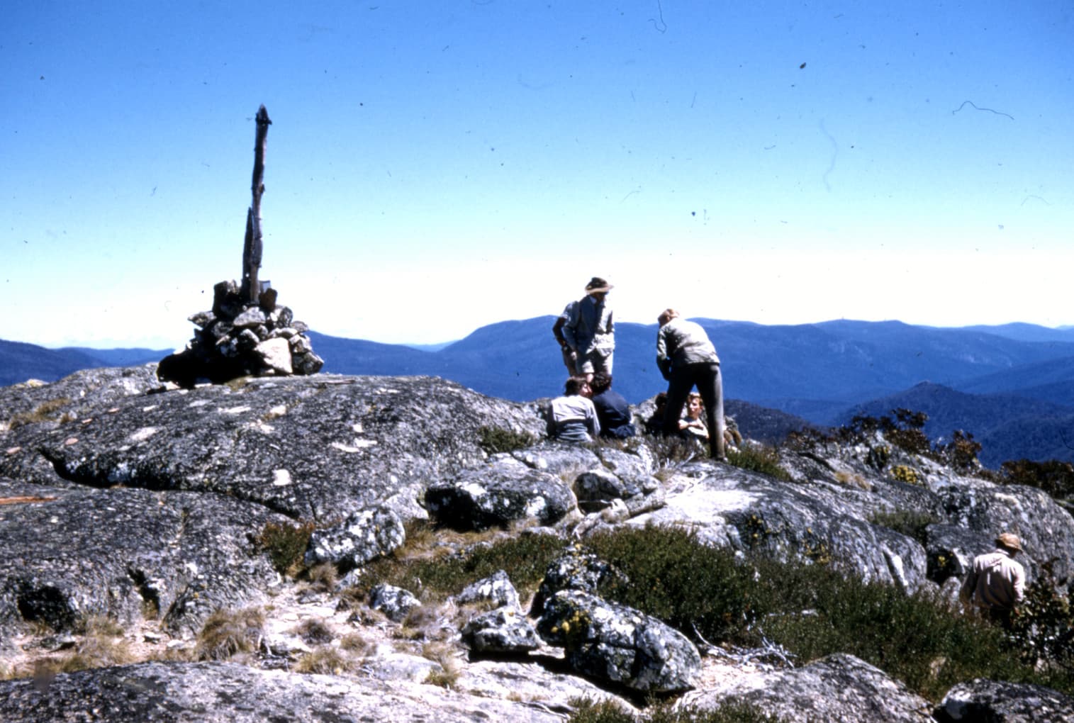
Tackle the remote trail to Bimberi Peak, the ACT’s tallest mountain at 1912 metres, for sweeping views across Namadgi National Park.

Australian Capital TerritoryUpdated 17 September 2026

Why Bimberi Peak Stands Out

Bimberi Peak rises as the highest point in the Australian Capital Territory, offering hikers a genuine wilderness experience within easy reach of Canberra. At 1912 metres it crowns the Brindabella Range inside Namadgi National Park, where subalpine grasslands meet snow-gum woodlands and granite tors. The summit rewards steady walkers with 360-degree vistas that stretch from the Snowy Mountains to the Canberra skyline on clear days.

Planning Your Hike

Most visitors start from the Mount Franklin Road trailhead or combine the walk with nearby Mount Gingera. The route crosses open ridges and descends briefly into sheltered valleys before the final rocky scramble. Expect a full-day return journey on unmarked sections; navigation skills and a topographic map are essential. Carry at least three litres of water per person, as no reliable sources exist on the upper slopes.

Best Time to Visit

Late spring through autumn provides the most stable conditions. Snow can linger into October and return in May, turning the track icy and increasing exposure risk. Summer days are long but can bring thunderstorms; start early to avoid afternoon lightning. Winter ascents require crampons and ice axes for experienced parties only.

Getting There and Nearby Attractions

Drive south from Canberra via the Cotter Road and then Mount Franklin Road, which becomes unsealed and may close after heavy rain. Four-wheel-drive vehicles handle the final kilometres best, though high-clearance two-wheel-drive cars can reach the main trailhead in dry weather. Once at the summit, many extend the day by visiting the nearby Mount Kelly or following the Australian Alps Walking Track toward Mount Murray. Canberra’s national institutions and restaurants lie roughly 90 minutes away for post-hike recovery.

Wildlife and Environment

Watch for eastern grey kangaroos grazing at dawn and the occasional wedge-tailed eagle riding thermals above the ridges. The park protects rare alpine flora including the Namadgi grevillea; stay on formed tracks to avoid damaging fragile soils. Leave no trace principles apply throughout the national park.

Visitor tips

  • Check current road and fire-danger conditions with Namadgi National Park rangers before departure, as unsealed roads close quickly after rain.
  • Pack layers and a headlamp; weather can change rapidly above the treeline even in summer.
  • Carry a printed map and compass in addition to GPS, as mobile coverage is patchy on the upper ridges.

Frequently asked questions

How difficult is the hike to Bimberi Peak?+

The route involves steady climbing on rough tracks with some off-trail navigation; it suits fit walkers comfortable with day-long efforts and basic route-finding.

Can I drive to the summit of Bimberi Peak?+

No vehicle access reaches the top. The final kilometres must be walked from trailheads along Mount Franklin Road.

Is camping allowed near Bimberi Peak?+

Dispersed bush camping is permitted in Namadgi National Park with a permit; choose sites at least 100 metres from watercourses and avoid sensitive alpine zones.

What wildlife might I see on the way?+

Eastern grey kangaroos, crimson rosellas, and wedge-tailed eagles are common; lyrebirds sometimes appear in the lower gullies.

Are there toilets or water on the trail?+

No facilities exist beyond the trailhead. Carry all water required and plan to manage waste according to leave-no-trace guidelines.

Share
Google Maps Apple Maps Directions

Image: Stanley Goodhew (via Miles Goodhew) · CC BY-SA 2.0 · via Wikimedia Commons

Keep reading

Nearby & related

All stories
T
Australian Capital Territory

The Astronomer Statue: Canberra’s Celestial Landmark in the Australian Capital Territory

This compelling public sculpture in Canberra invites contemplation of science, space, and the night sky within the…

21 September 2026
T
Australian Capital Territory

Tribute Sculpture: Canberra’s Striking Public Artwork

A powerful abstract form by Inge King that rewards a close look amid the capital’s planned landscape.

21 September 2026
T
Australian Capital Territory

The Edmund Barton Statue: Australia’s First Prime Minister in Canberra

Stand before the dignified bronze likeness of Sir Edmund Barton and trace the origins of Australian federation in the…

21 September 2026