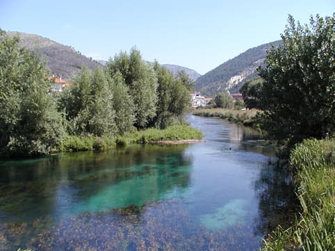
The River’s Course from Mountains to Sea
The Aterno-Pescara begins high in the Apennines near the Gran Sasso massif and flows eastward for roughly 150 kilometres before emptying into the Adriatic at Pescara. Its upper reaches carve through narrow valleys dotted with medieval villages, while the lower section widens into a fertile plain famous for vineyards and olive groves before reaching the coast.
What to See Along the Aterno-Pescara
Start near L’Aquila where the river is still called the Aterno; the dramatic gorge at San Demetrio ne’ Vestini offers striking limestone cliffs and easy riverside walks. Downstream, Sulmona sits in a wide basin framed by snow-capped peaks and is renowned for its confetti almonds and Renaissance architecture. Further east, the river passes Chieti, home to an important archaeological museum showcasing Samnite and Roman finds from the valley. The final stretch enters Pescara, where the river meets the sea beside a long sandy beach and a lively waterfront promenade.
Outdoor Activities
Cyclists enjoy the flat riverside paths that connect Pescara with nearby towns; several sections form part of the Ciclovia dei Parchi long-distance route. Kayakers and stand-up paddleboarders launch from quiet bends near Popoli, while anglers target trout in the upper reaches and sea bass near the estuary. Wine lovers can follow the river through the Montepulciano d’Abruzzo DOC zone for cellar visits and tastings amid rolling hills.
Best Time to Visit
Spring and autumn deliver mild temperatures ideal for hiking and cycling without summer crowds. Early summer brings wildflowers in the mountain valleys and warm enough water for paddling. Winter visits suit those interested in snow-capped peaks above the lower valley or the quieter coastal atmosphere in Pescara.
Getting There and Getting Around
Pescara Abruzzo Airport lies minutes from the river mouth, with direct flights from major Italian and some European cities. Regional trains run along the valley between Pescara and Sulmona, stopping at many riverside villages. A rental car provides the most flexibility for reaching trailheads and small wineries not served by public transport.
Nearby Destinations
From the river valley it is easy to reach the Gran Sasso e Monti della Laga National Park for high-altitude hikes, the hill town of Penne with its well-preserved historic centre, or the Trabocchi Coast south of Pescara for elevated wooden fishing platforms turned into restaurants.