Peace River: Canoeing the Wild Heart of Northern British Columbia
Follow the Peace River through dramatic canyons, boreal forests, and historic fur-trade routes in one of Canada’s most remote and rewarding river systems.
Why the Peace River Matters
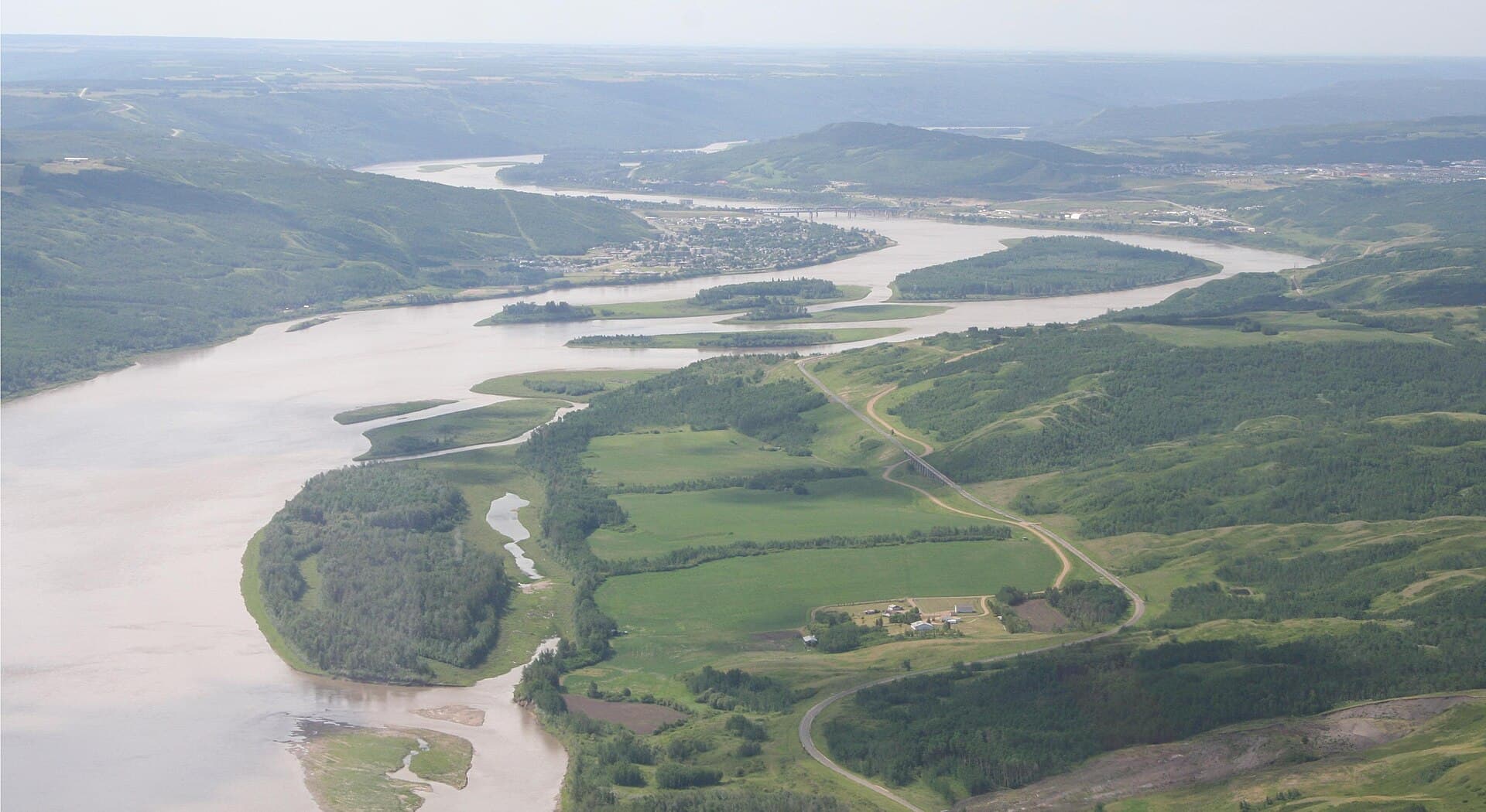
The Peace River carves a broad valley across northeastern British Columbia, beginning in the Rocky Mountains and flowing east toward the Alberta border. Its scale—over 1,900 kilometres long—creates a unique transition zone between mountain, foothills, and prairie ecosystems. Visitors encounter steep shale cliffs, cottonwood islands, and clear side streams that support healthy populations of Arctic grayling, bull trout, and walleye.
Best Time to Visit
June through early September offers the most reliable water levels for paddling and the longest daylight. July and August bring warm afternoons ideal for swimming at gravel bars, while late August often produces spectacular northern lights once darkness returns. Spring runoff can make the river powerful and silty; winter travel is possible by snowmobile but requires local knowledge of ice conditions.
What to See and Do
Paddling and Boating
Multi-day canoe or raft trips between Hudson’s Hope and the Alberta border reveal remote campsites and changing scenery. Shorter outings are possible from boat launches near Taylor and Fort St. John. Jet-boat tours depart from several points and reach sections inaccessible by paddle.
Wildlife and Scenery
Look for elk on the valley slopes, bald eagles along the river, and moose in back channels. The Peace River Canyon above the W.A.C. Bennett Dam provides dramatic hiking on old construction roads now reclaimed by forest.
History and Culture
Visit the remains of Rocky Mountain Fort near Fort St. John and the interpretive centre at Hudson’s Hope to learn about the North West Company’s fur-trade route. Indigenous Dane-zaa and Cree communities maintain strong connections to the river; guided cultural tours are available through local operators.
Getting There
The river is most easily reached via the Alaska Highway. Fly into Fort St. John (YXJ) then drive 30–90 minutes to boat launches at Taylor, Clayhurst, or the Peace Island Park. Rental canoes and shuttles can be arranged in Fort St. John; self-sufficient travellers should carry extra fuel and spare parts.
Nearby Attractions
Combine a river trip with visits to the W.A.C. Bennett Dam visitor centre, the rolling hills of the Peace River Regional District, or the historic Alaska Highway segment toward Dawson Creek. The Muskwa-Kechika Management Area lies to the west for extended wilderness adventures.
Visitor tips
- Book river shuttles and equipment well in advance; northern BC outfitters have limited fleets.
- Carry bear spray and store food properlyu2014black bears and grizzlies frequent the valley.
- Check water levels and weather forecasts with local operators before launching; sudden wind can create large waves on open stretches.
Frequently asked questions
Do I need a guide to paddle the Peace River?
Experienced paddlers can travel independently on marked sections, but first-timers or those planning multi-day trips benefit from local guides familiar with rapids, campsites, and changing water levels.
What fish species can I catch?
The river supports Arctic grayling, bull trout, walleye, and northern pike. A British Columbia fishing licence is required; catch-and-release is encouraged for bull trout.
Are there campgrounds along the river?
Several provincial recreation sites and private campgrounds sit near the river, but many desirable gravel-bar camps are first-come, first-served. Always check for fire bans.
How remote is the Peace River?
Cell service is limited or nonexistent beyond Fort St. John and Taylor; travellers should carry satellite communicators and file trip plans with local authorities.
Can I see the northern lights from the river valley?
Yes, the wide valley and low light pollution make the Peace River an excellent location for aurora viewing from late August through April.