Kootenay Lake: Boating and Mountain Views in British Columbia’s Interior
This vast freshwater lake in the Kootenay region delivers serene paddling, forested shores, and easy access to hot springs and historic towns.
Why Kootenay Lake Stands Out
Kootenay Lake stretches more than 100 kilometres through southeastern British Columbia, framed by the Purcell and Selkirk mountain ranges. Its clear waters support healthy populations of rainbow trout and kokanee salmon, while the surrounding valleys produce cherries and apples in summer. The lake remains largely undeveloped along much of its shoreline, giving visitors a sense of wilderness even when staying near small communities.
Getting There and Getting Around
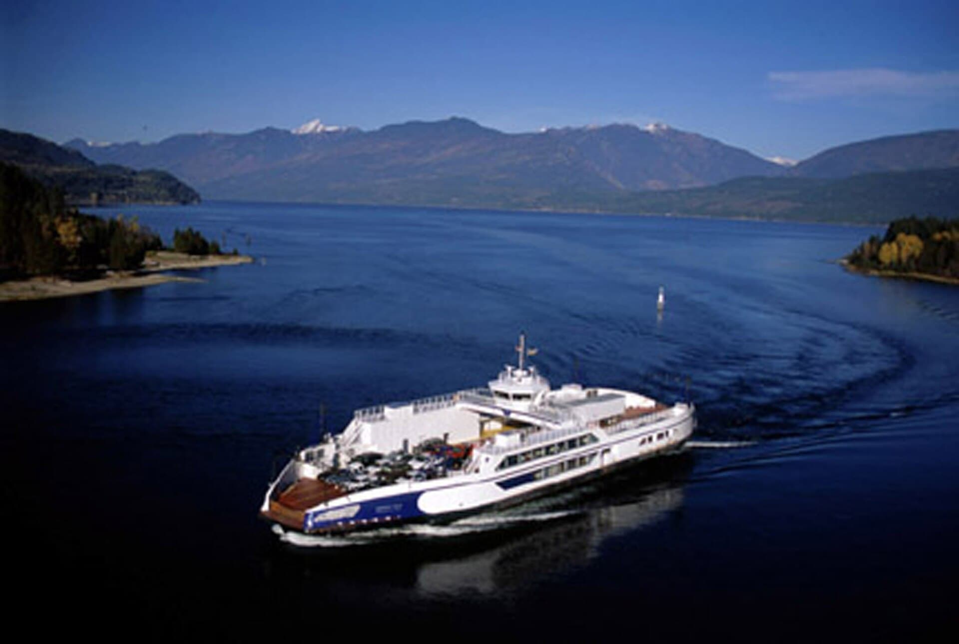
Most travellers reach the lake by driving Highway 3A from the west or Highway 3 from the east. The nearest commercial airports are in Castlegar and Cranbrook; both lie within a two-hour drive. Once on the water, free ferries connect Balfour on the west shore with Kootenay Bay on the east, saving considerable driving time and offering panoramic views. Public boat launches exist at several provincial parks and municipal sites along both shores.
Water Activities
Calm mornings make the lake ideal for kayaking and stand-up paddleboarding, especially in the protected bays near Kaslo and Crawford Bay. Anglers launch early for trout and char; provincial regulations require a valid fishing licence. Motorized boating is popular, yet strict no-wake zones protect sensitive shoreline habitat. Swimming is comfortable from mid-July through August when surface temperatures rise.
Hikes and Shoreline Exploration
Short trails at Kokanee Creek Provincial Park lead to pebble beaches and old-growth cedar groves. Longer options include the gentle ascent to the viewpoint above Pilot Bay Lighthouse or the steeper climb along the Lakeside Trail near Balfour. In autumn, the same paths reveal brilliant larch and cottonwood colour against the deep blue water.
Best Time to Visit
July and August bring the warmest water and driest weather, perfect for multi-day paddling trips. Late spring offers fewer crowds and dramatic mountain runoff views, while early autumn delivers quieter camping and reliable sunshine. Winter visits centre on cross-country skiing in the nearby backcountry and soaking in Ainsworth Hot Springs.
Nearby Towns Worth Exploring
- Nelson, with its well-preserved Victorian architecture and lively arts scene.
- Kaslo, home to the restored sternwheeler SS Moyie and a compact downtown along the water.
- Crawford Bay, known for its blacksmith shop and artisan studios.
Each community provides groceries, fuel, and lodging without overwhelming the lake’s natural setting.
Visitor tips
- Pack layers and rain gear; mountain weather can shift quickly even in summer.
- Launch boats early to avoid afternoon winds that often funnel down the lakeu2019s long axis.
- Carry bear spray and store food properly when camping or hiking in surrounding forests.
Frequently asked questions
Can you swim in Kootenay Lake?
Yes. Designated beaches at provincial parks offer safe, gradual entry; water clarity is excellent but temperatures stay cool until mid-summer.
Are there campgrounds right on the lake?
Several provincial parks maintain lakeside sites with boat launches and picnic areas; reservations are recommended in peak season.
How long does the Balfour ferry take?
The crossing lasts about 35 minutes and runs frequently year-round, weather permitting.
Is fishing good on Kootenay Lake?
The lake supports strong rainbow trout and kokanee fisheries; check current provincial regulations before casting.
What wildlife might visitors see?
Bald eagles, osprey, black bears, and deer are common along the shoreline, especially near creek mouths and quieter bays.